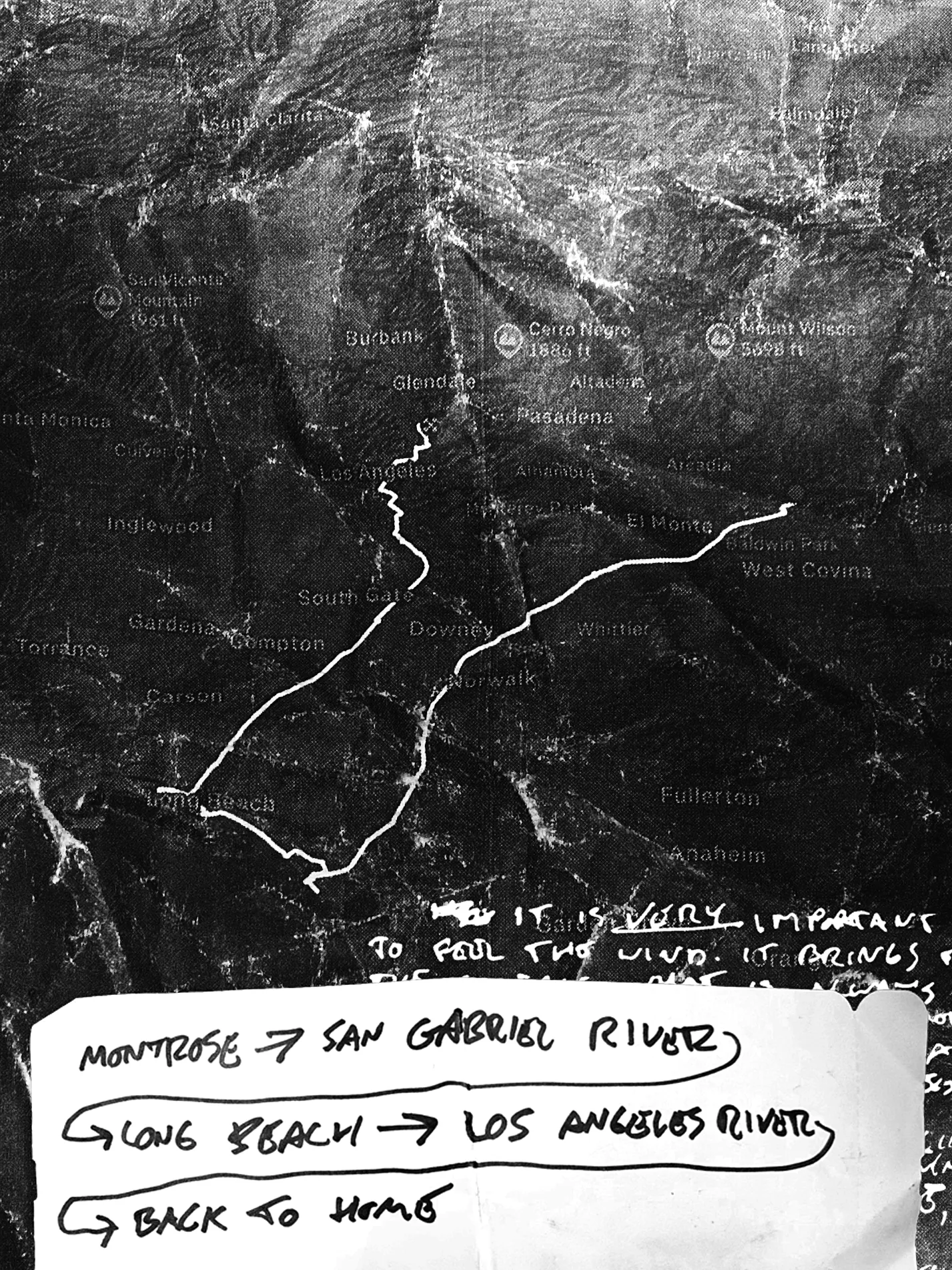
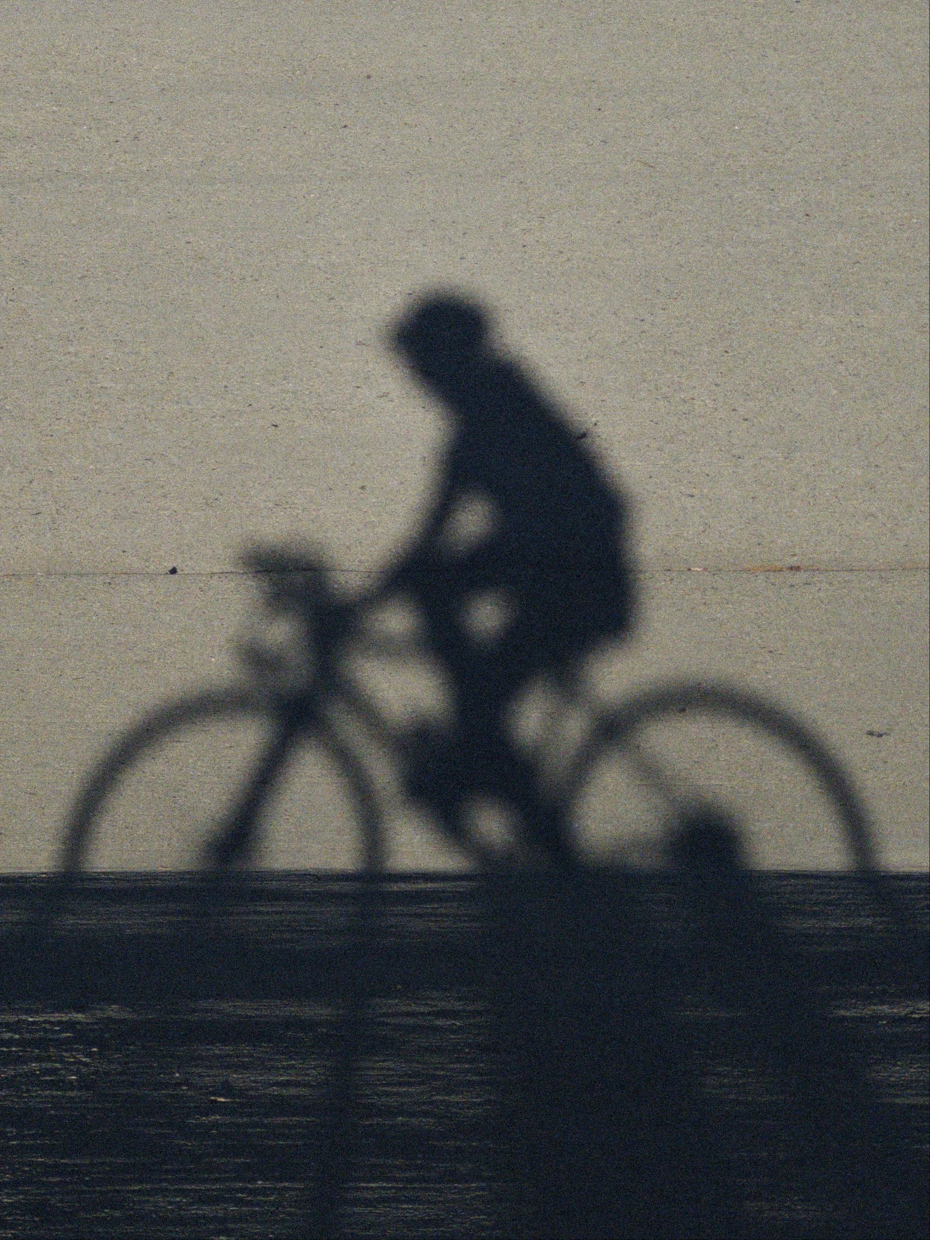
It is VERY IMPORTANT to feel the wind. It brings to the surface what is always true. A medium we all move with and through. Is it a headwind? A tailwind? An absence? A presence? Do you feel the resistance or the push?
Get a bike and you increase a sensitivity to air and wind and body. At first when you’re on the bike, then increasingly when you’re off the bike. A crucial shift in distance and duration uniquely through an exchange between the biological and the mechanical.
Riding as gesture towards not being one to participate in “the forgetting of the air.” Bike as tool for awareness of the air. The wind. The arch-mediator that mixes everything together. “Air never takes place in the mode of entry into presence, except in the wind.” Movement into presence. Thanks, Frank.
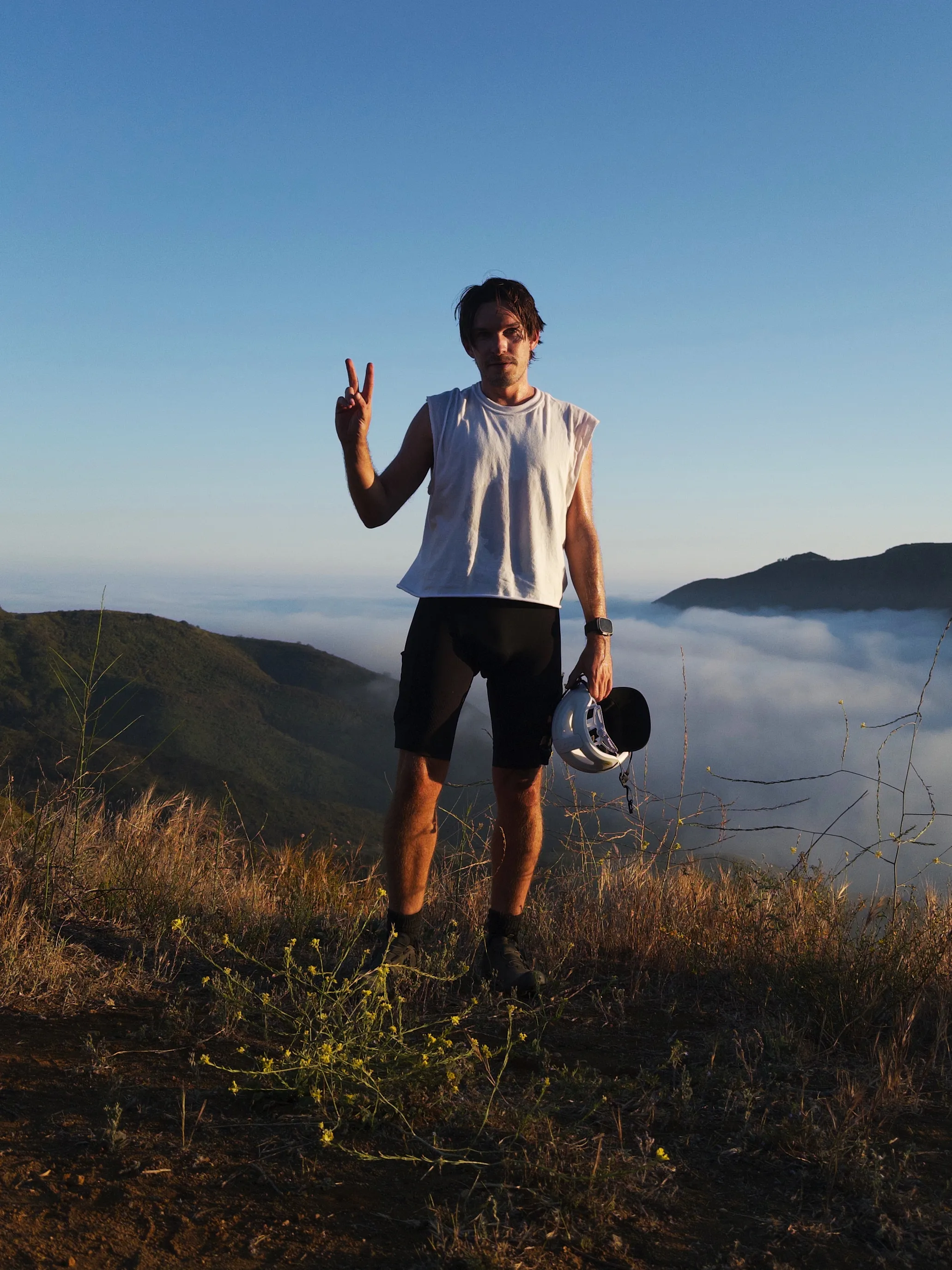
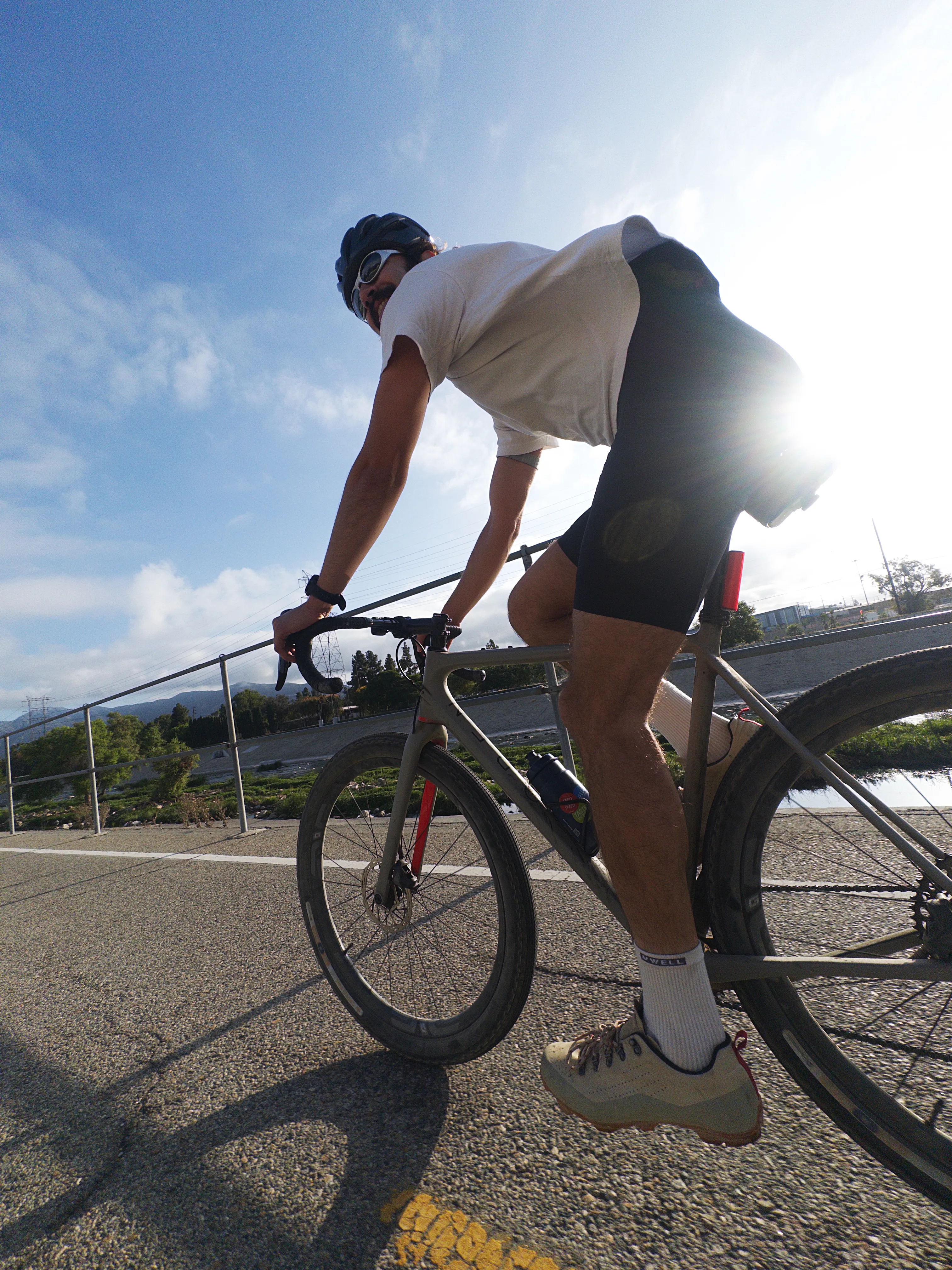
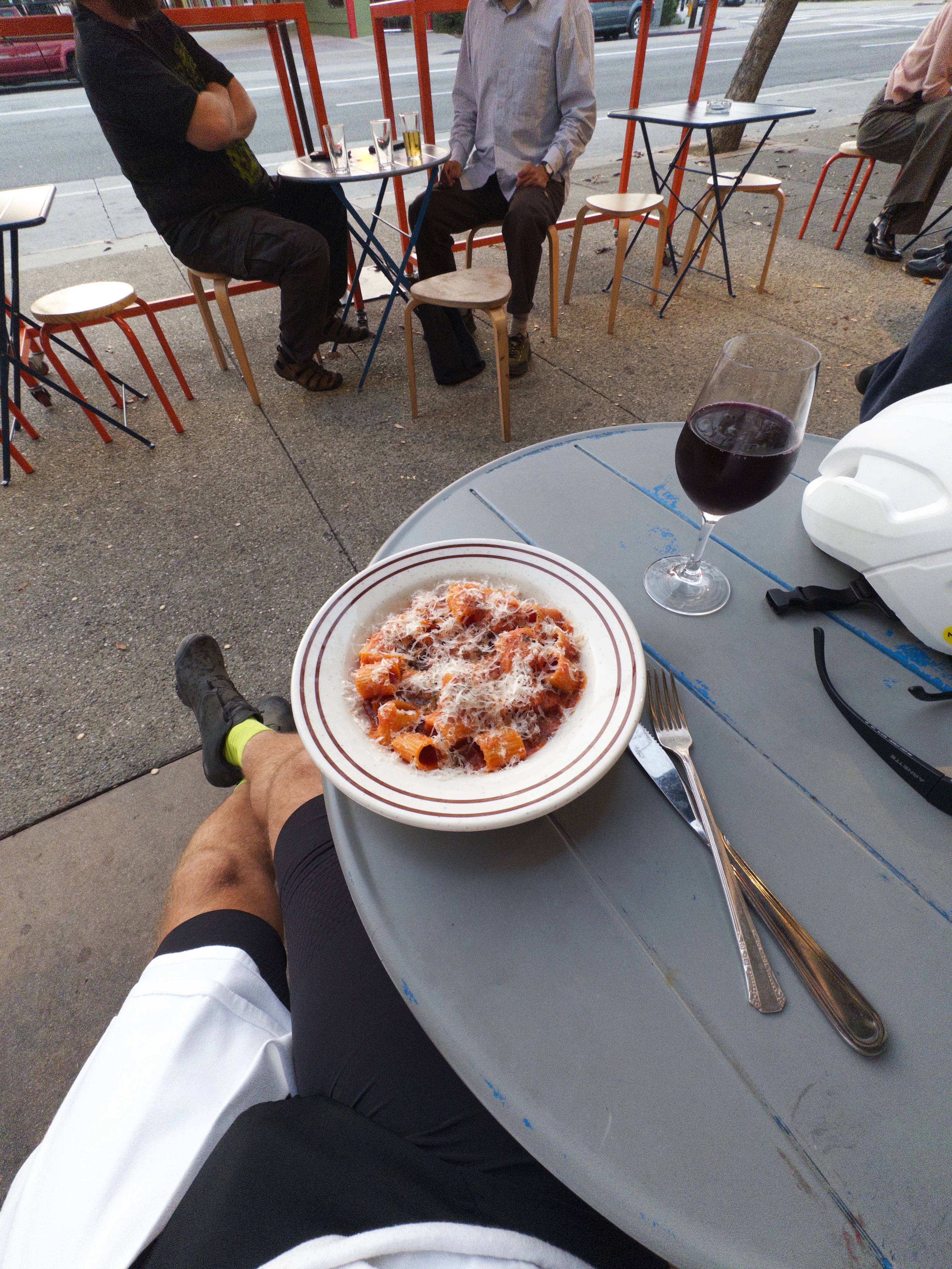
You find yourself in places you have no reason to be, other than the route affords good riding conditions. Less traffic, better surface. You may pass a 7-11 playing very loud classical music through cream-colored speakers mounted streetside. You might stand there listening for some time. A path terminating at the port, the scale leaving an impression of awe like the granite walls of Yosemite.
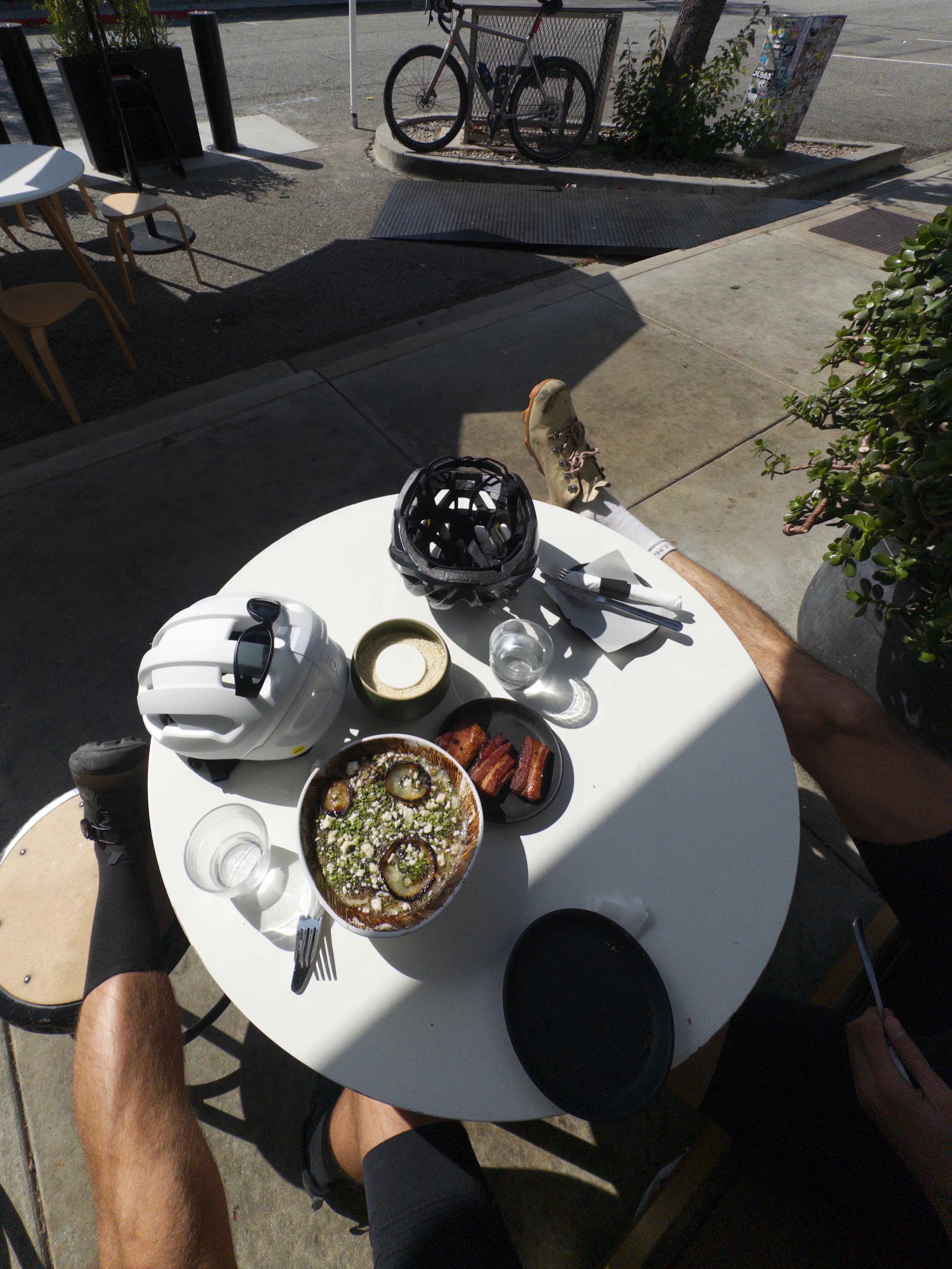
Walls of fragrance. Clouds you’d be shielded from behind the glass of the car. Blooming jacaranda. Water reclamation. It all hits. Want to pick a route? Follow the nose. Bring a friend. Bring two. Bring twenty. What’s another plate of pasta and glass of Boulay?
Sit atop the saddle and let the scene pass by.
Blink and the day has passed by too.
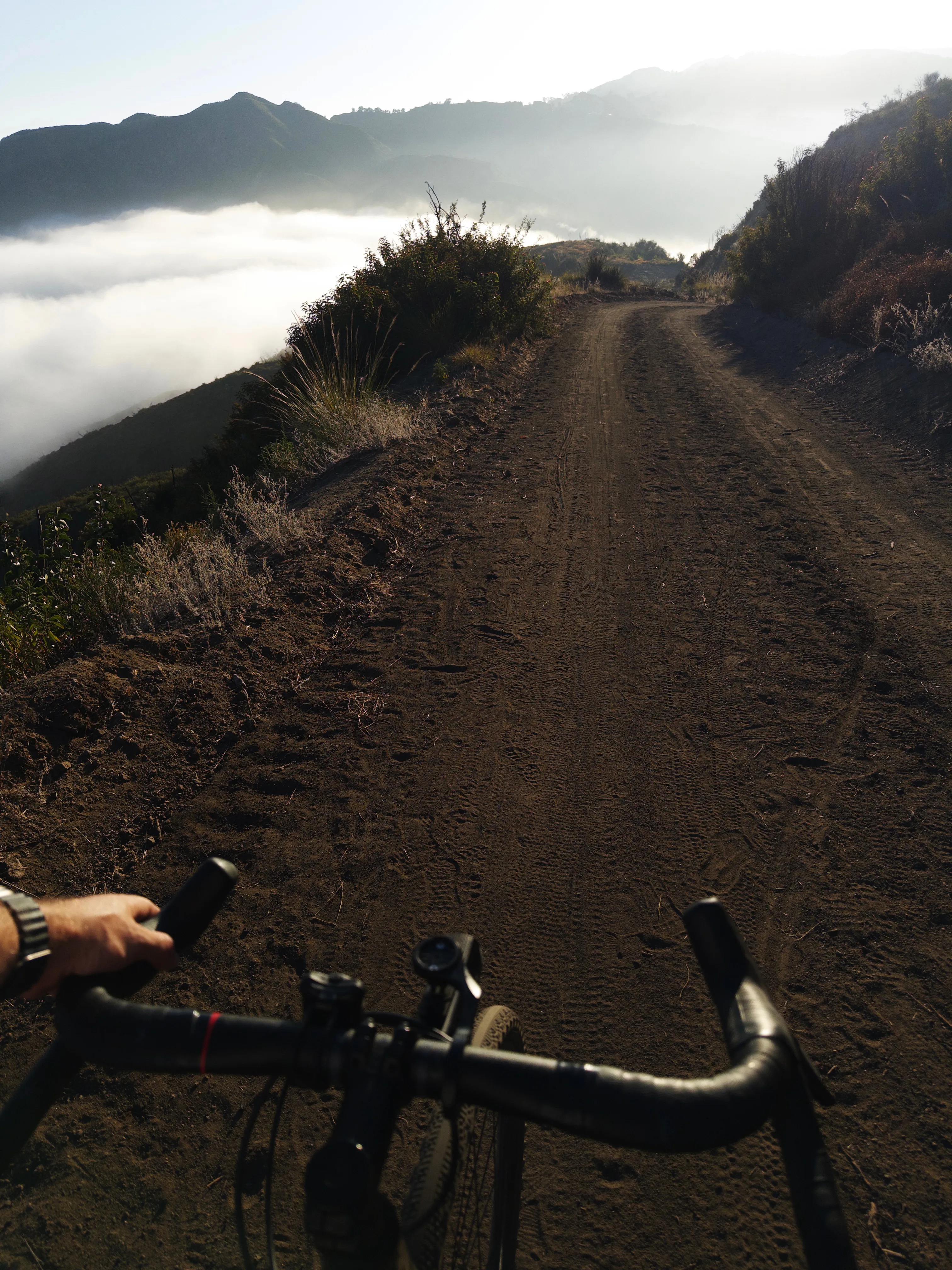
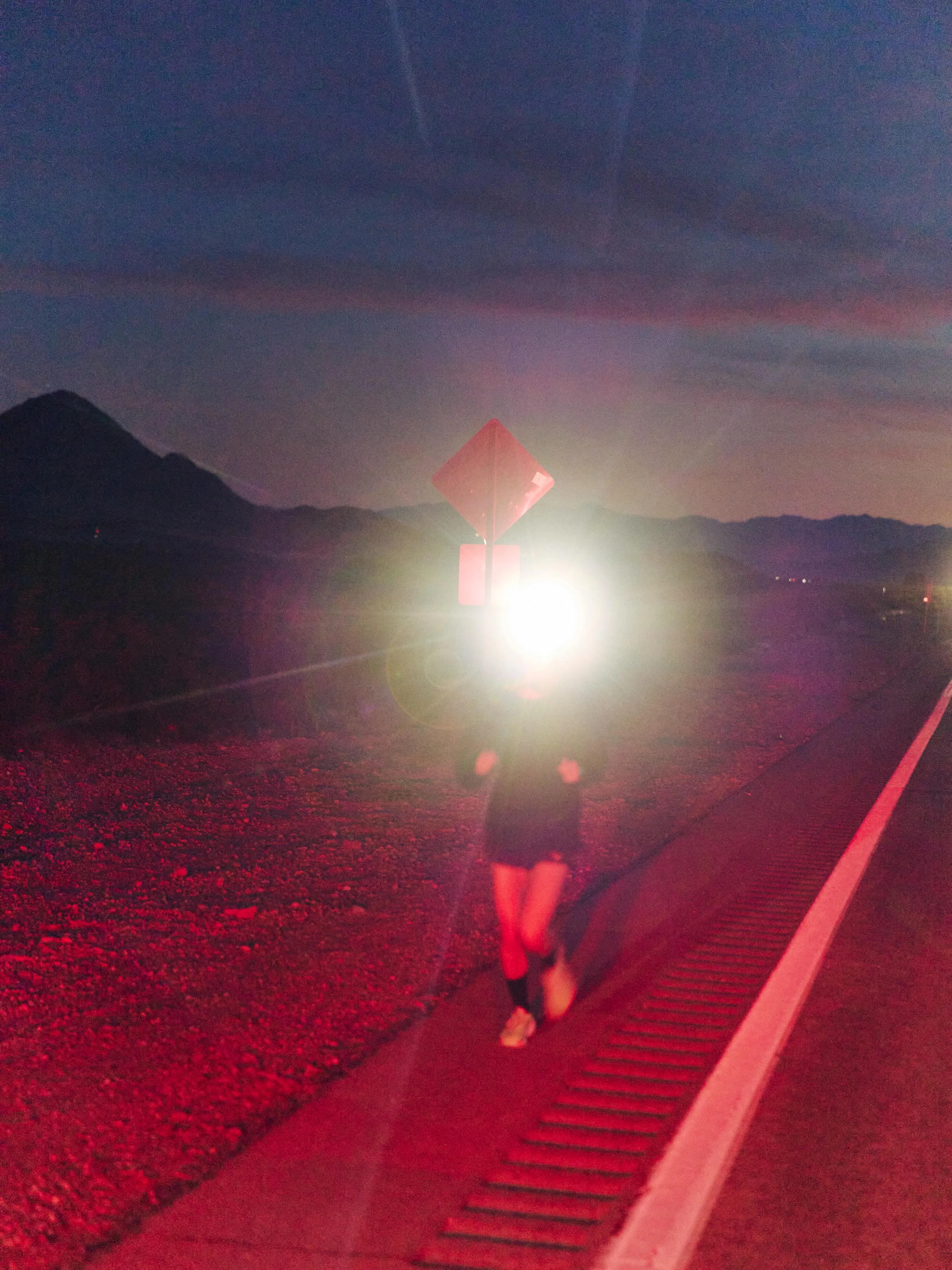
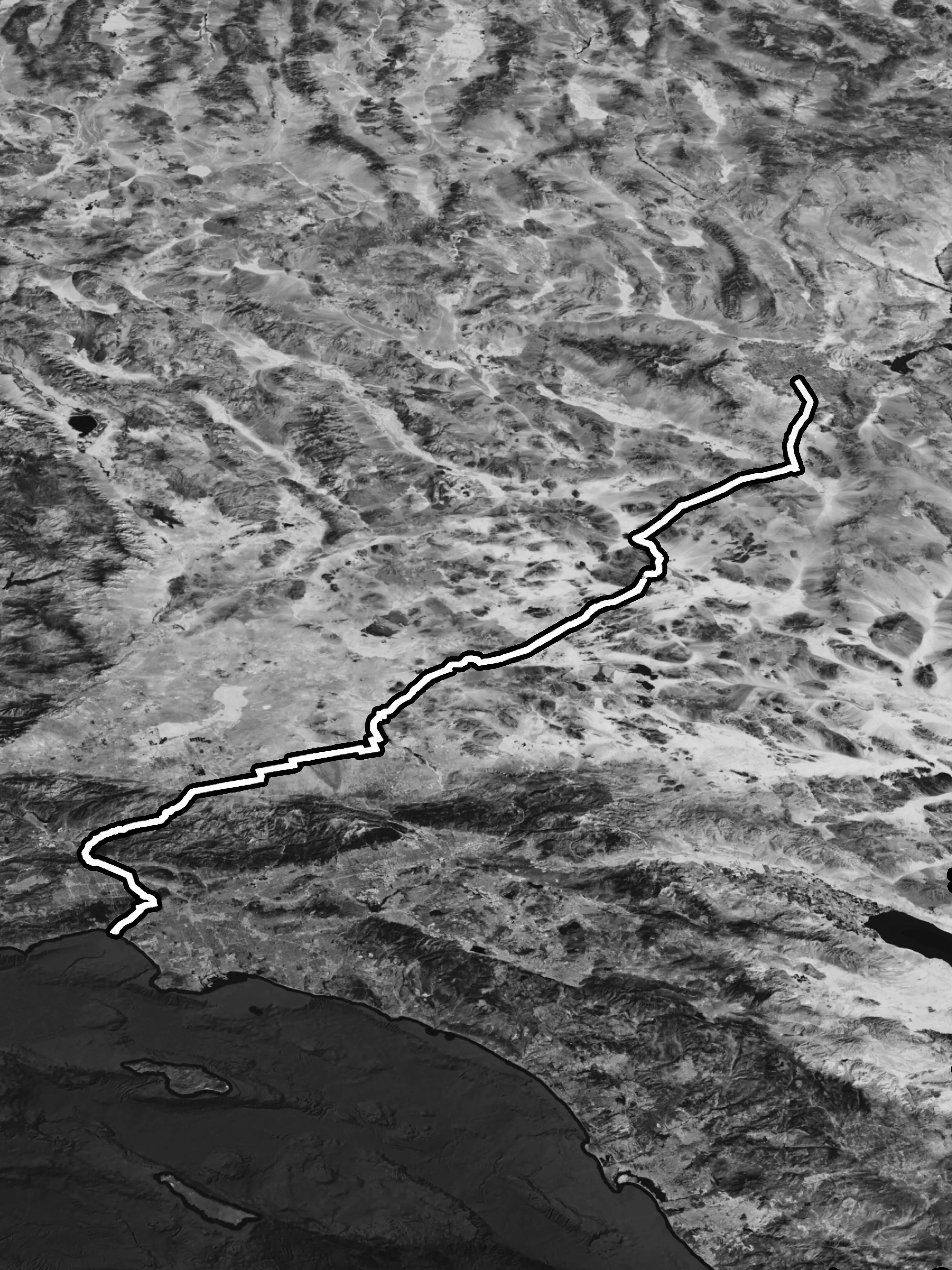
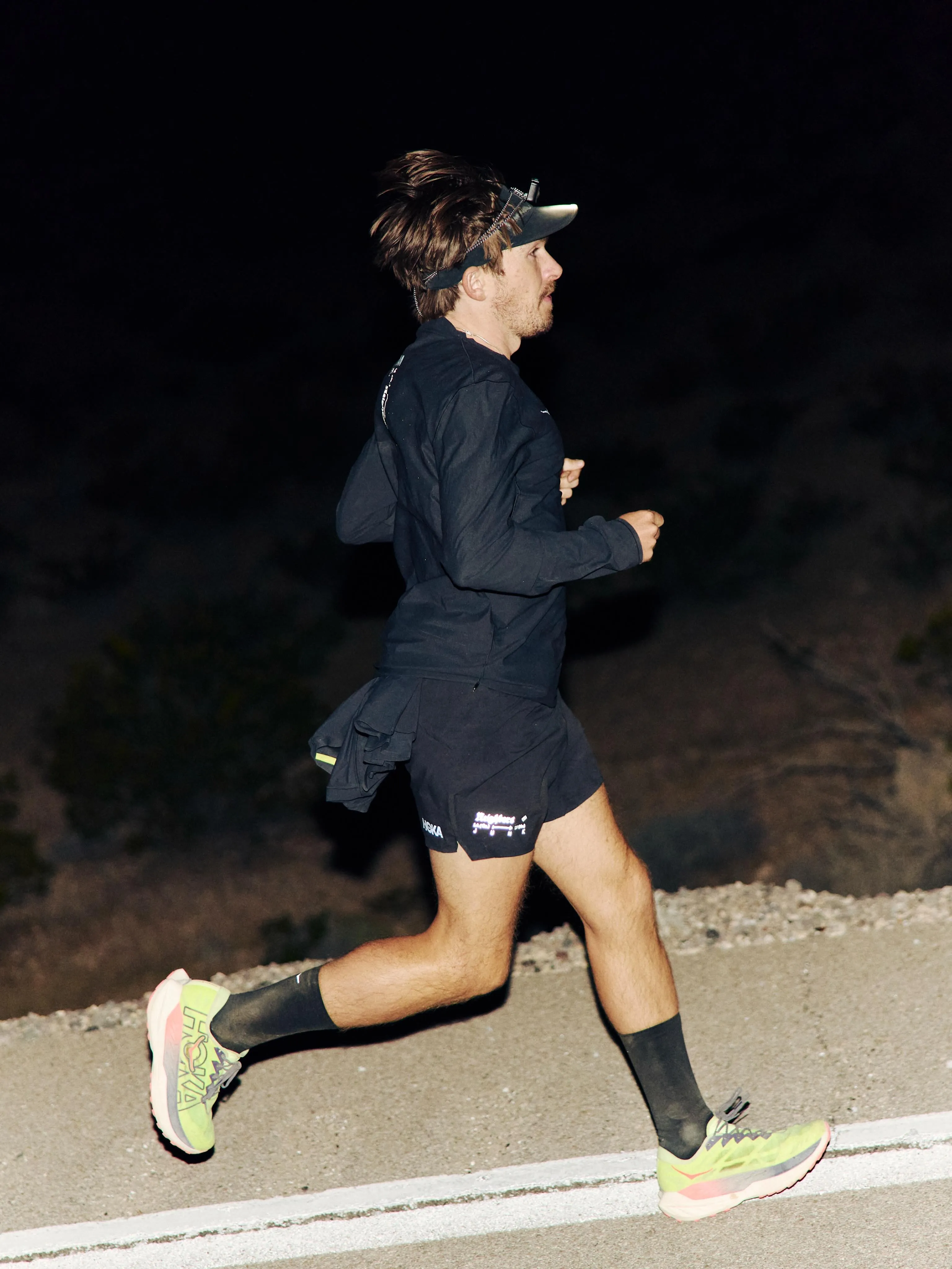
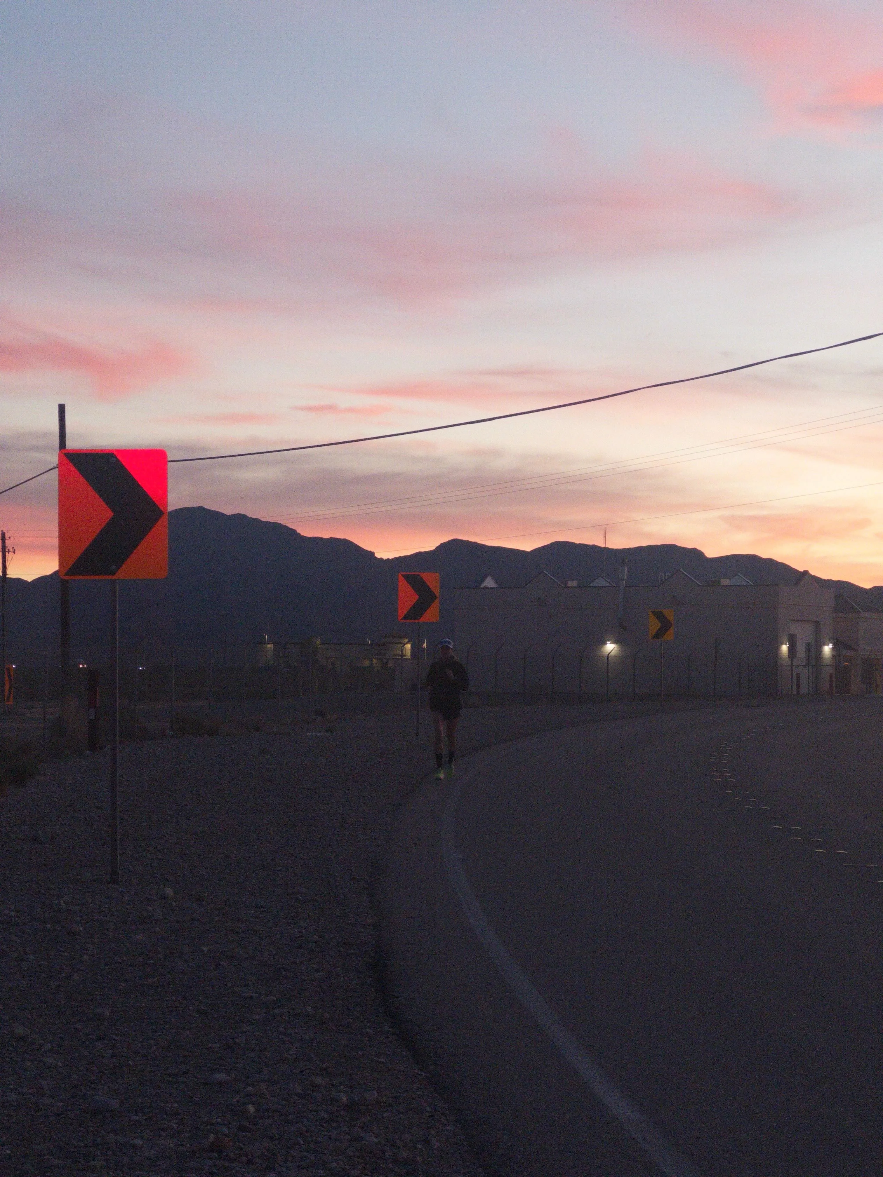
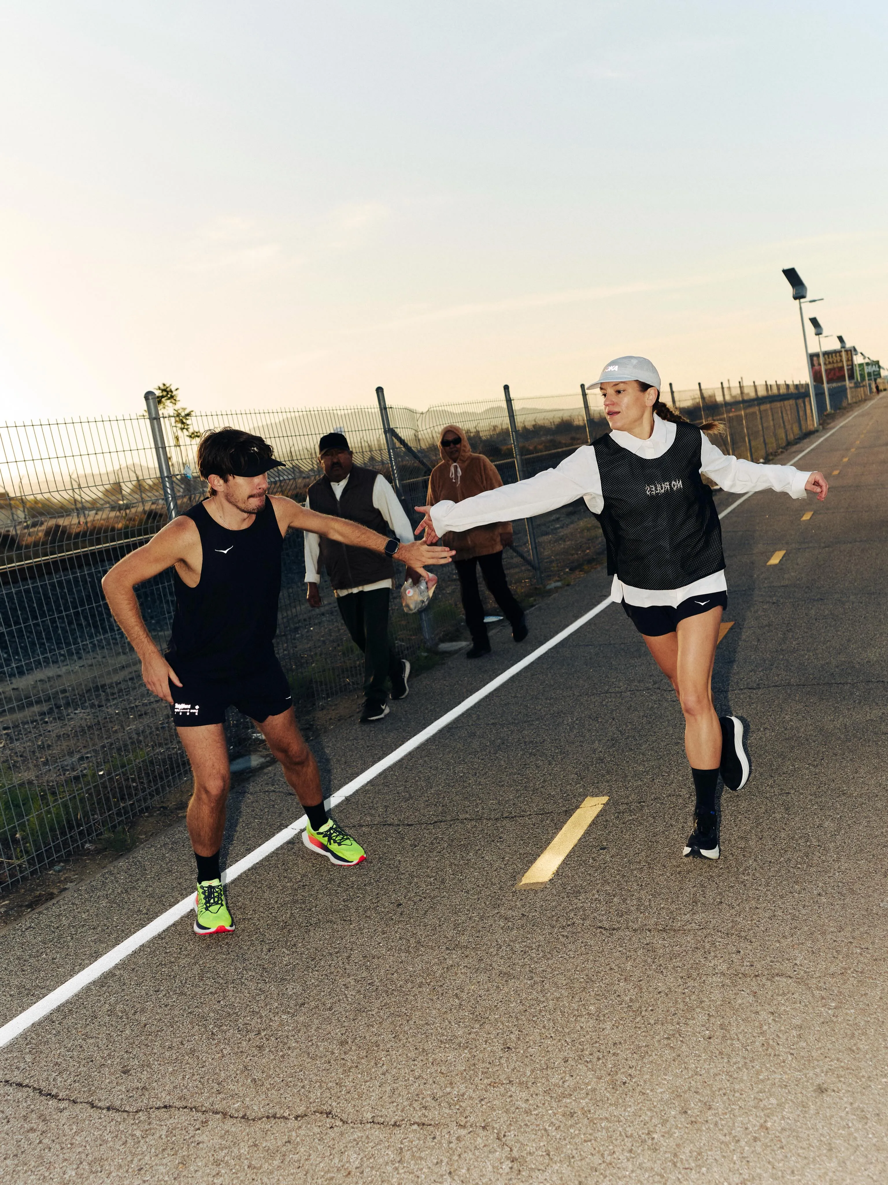
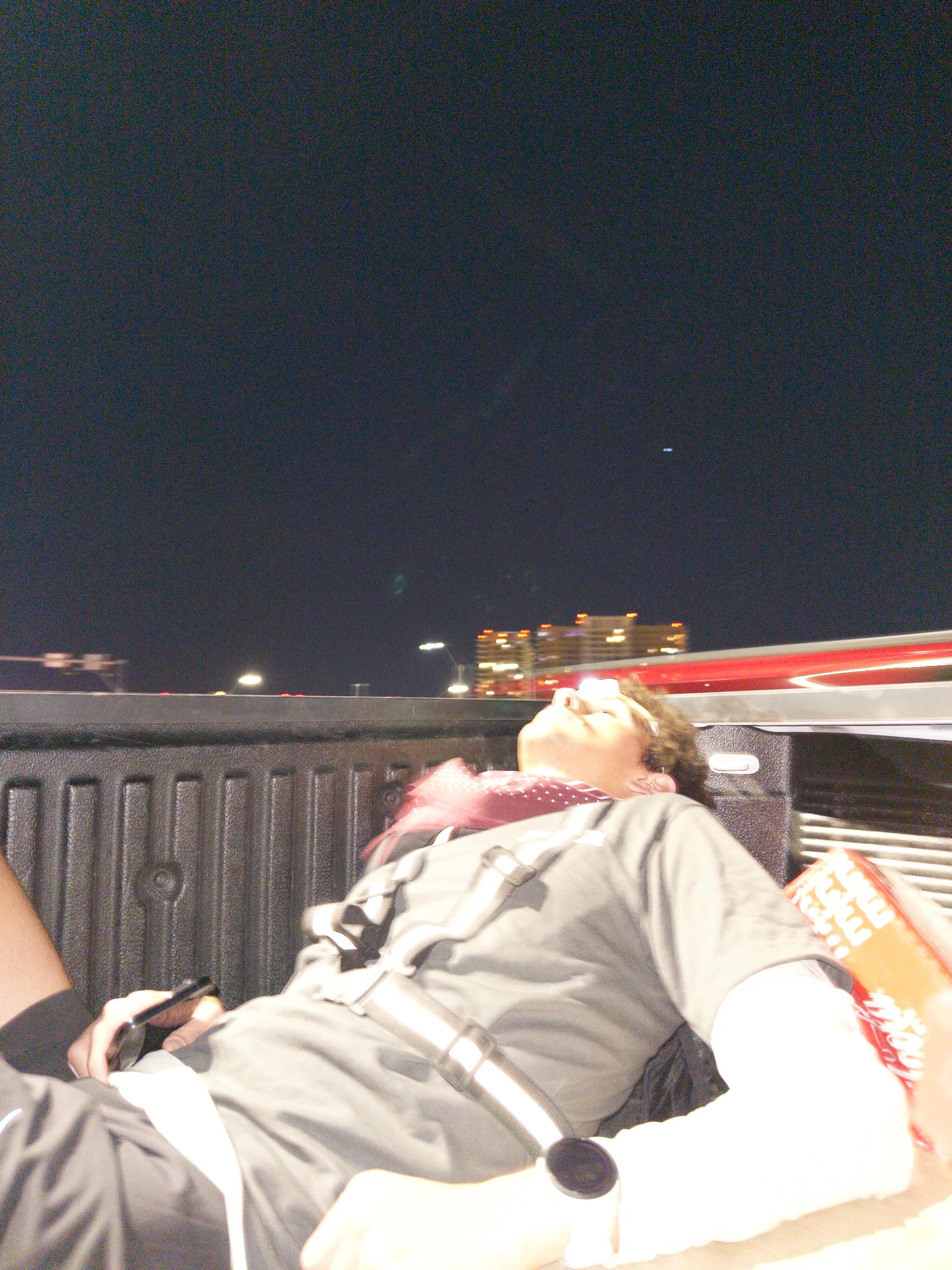
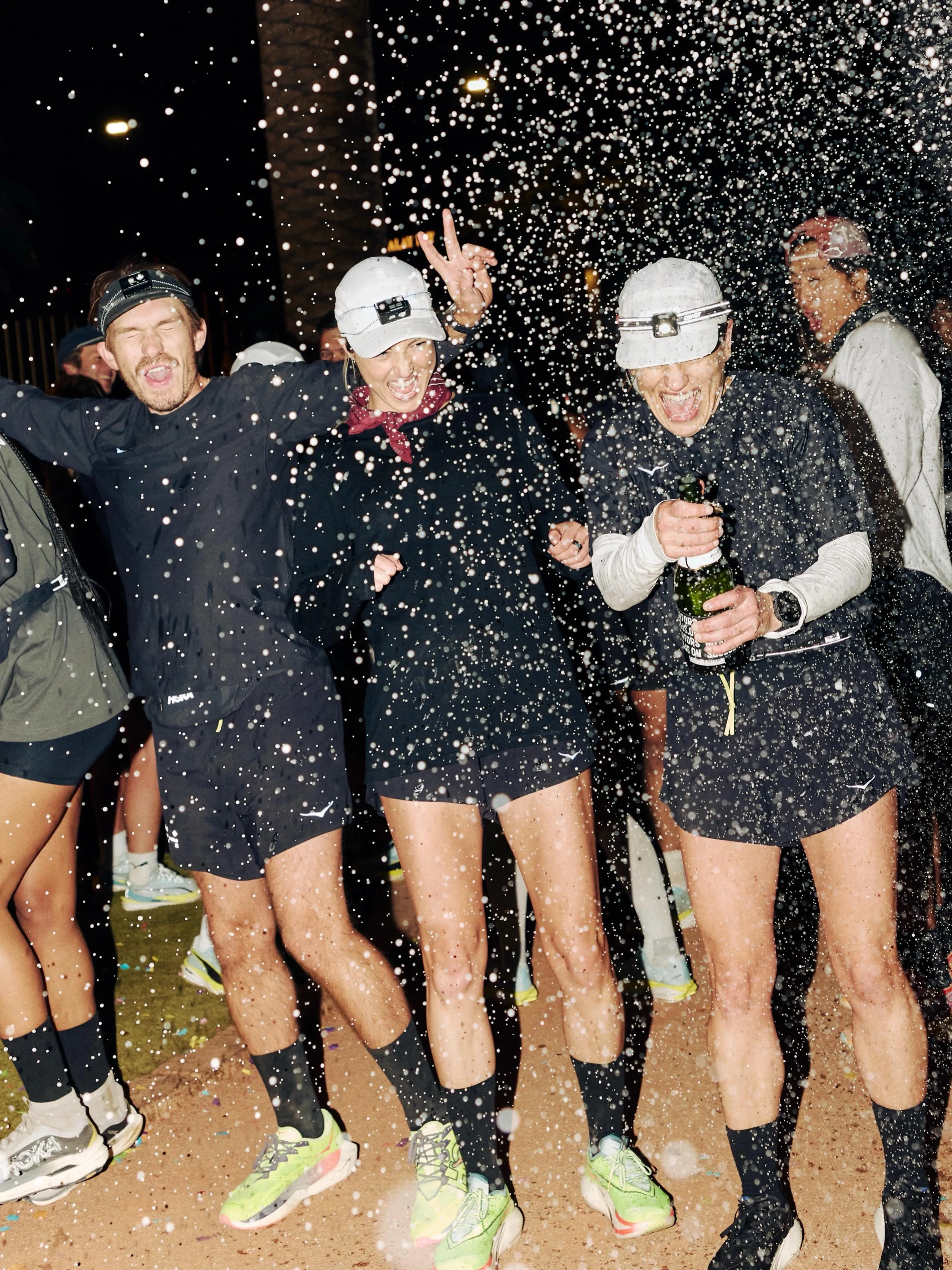
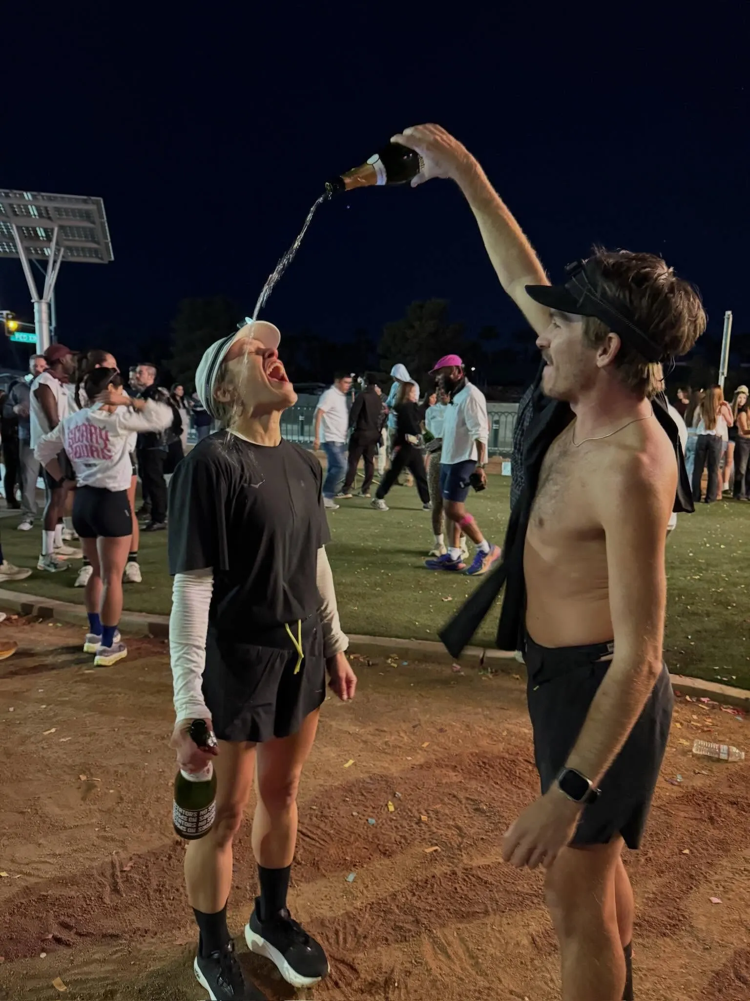
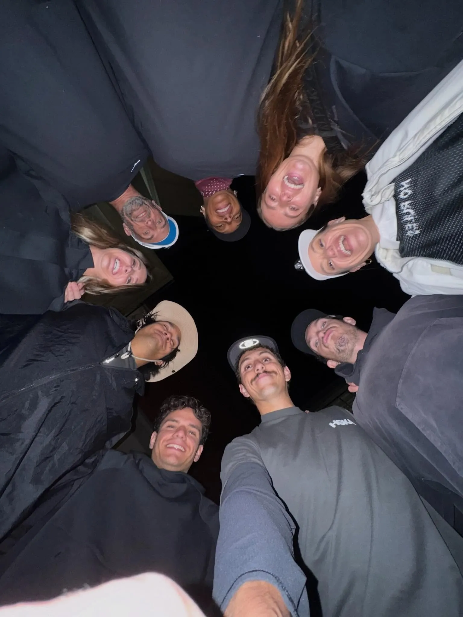
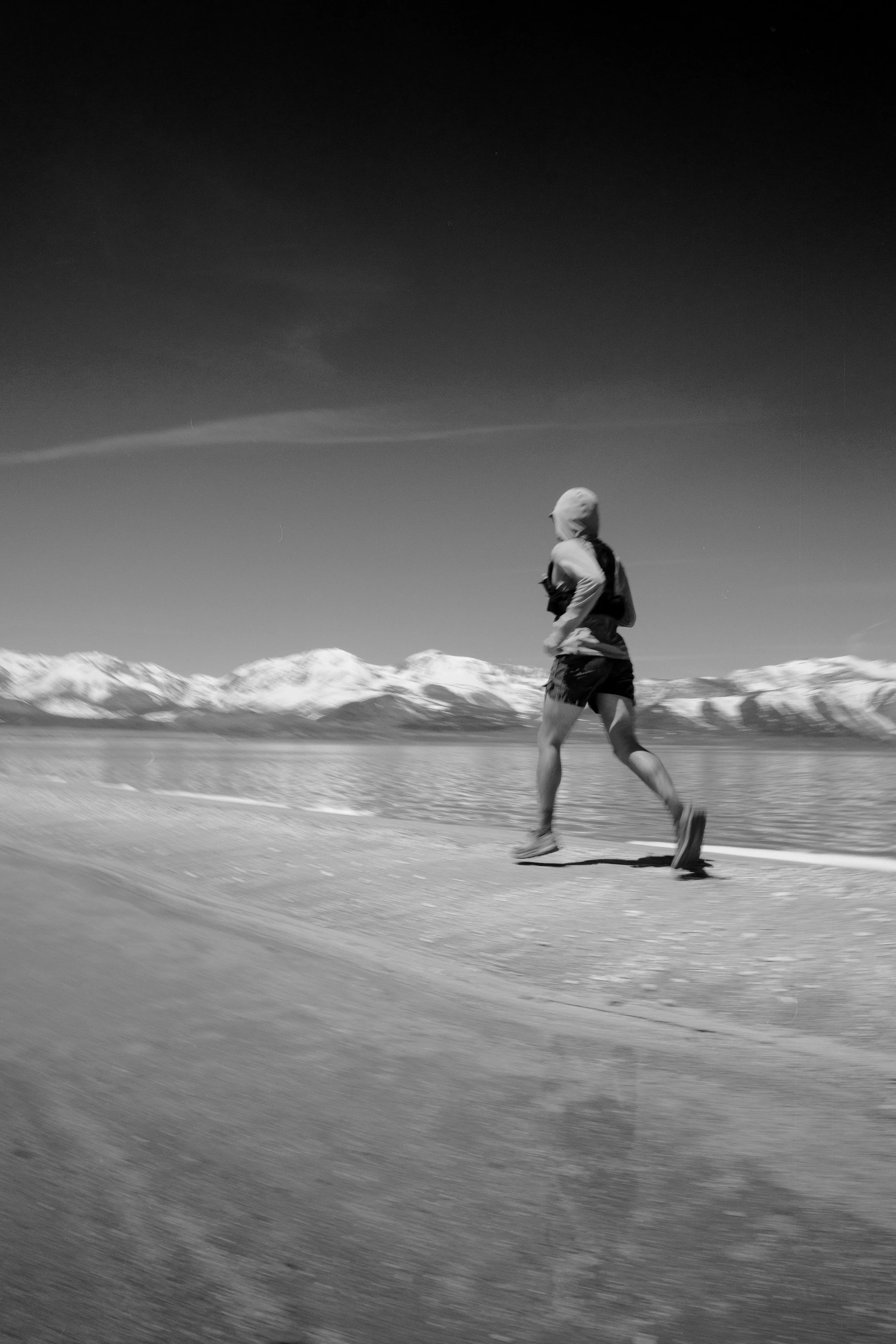
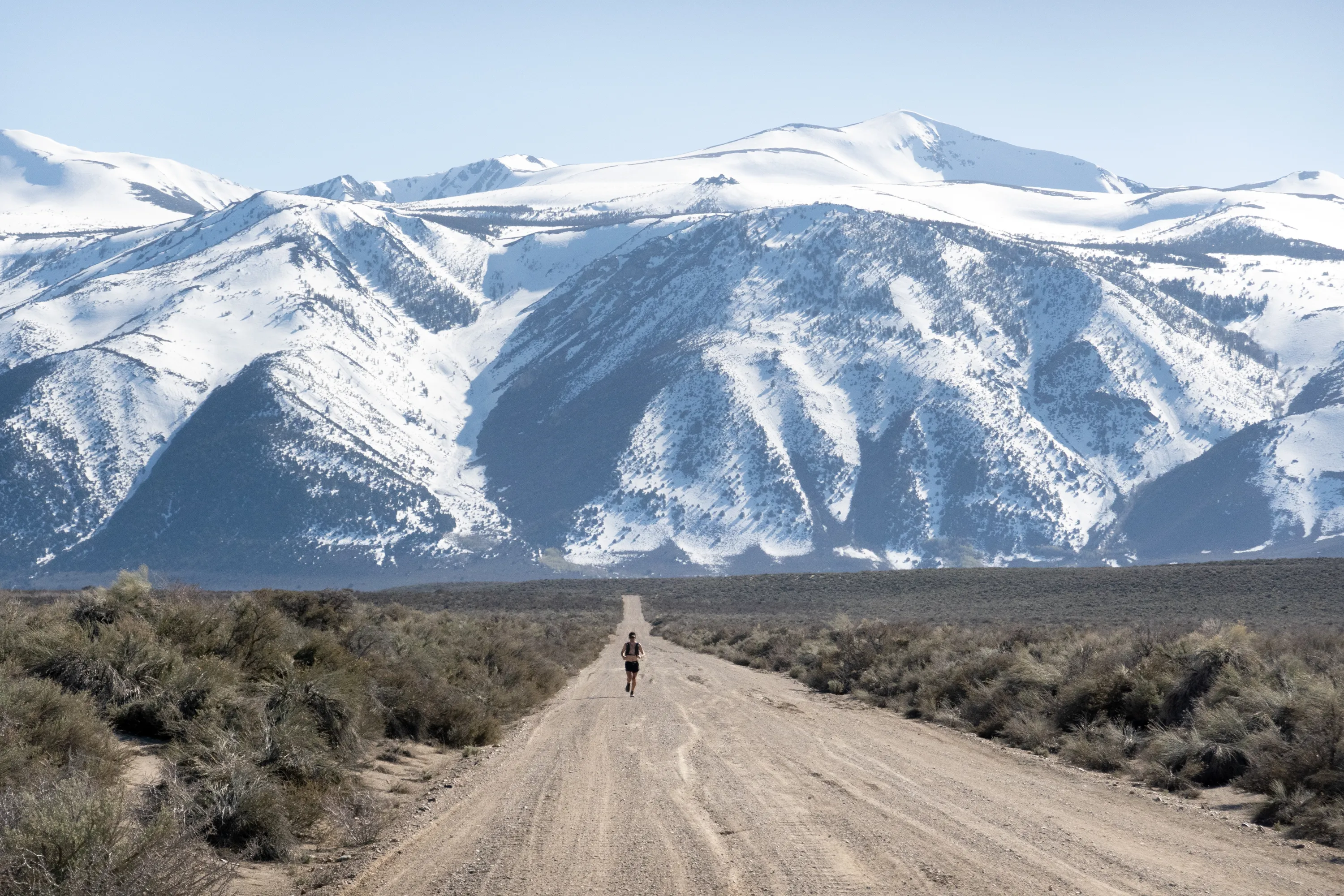
300 miles, 41 hours. 6 friends on foot, 4 crew. When you get asked “want to run a relay race from the beach to Las Vegas” one possible answer is no, but then none of this would’ve happened. Gather in the lot. Heavy eyes but we snap each other out of it. Rough idea, we head out.
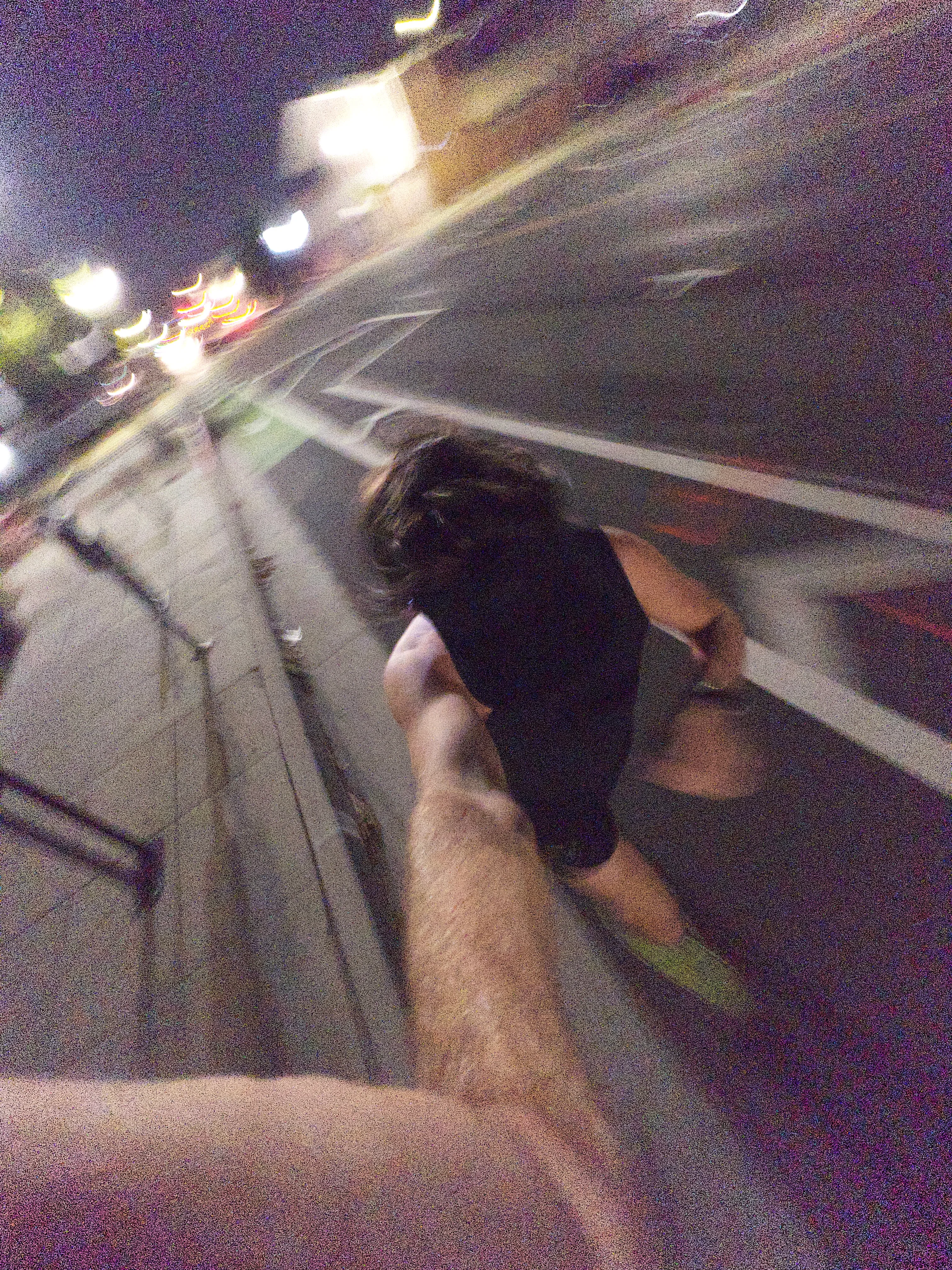
Cold front spilling down Newhall pass, headwind like a hurricane climbing into the desert. Sand blasted. Hop out, run, handoff, hop in, again and again and again and… a lot of movement, a little progress.
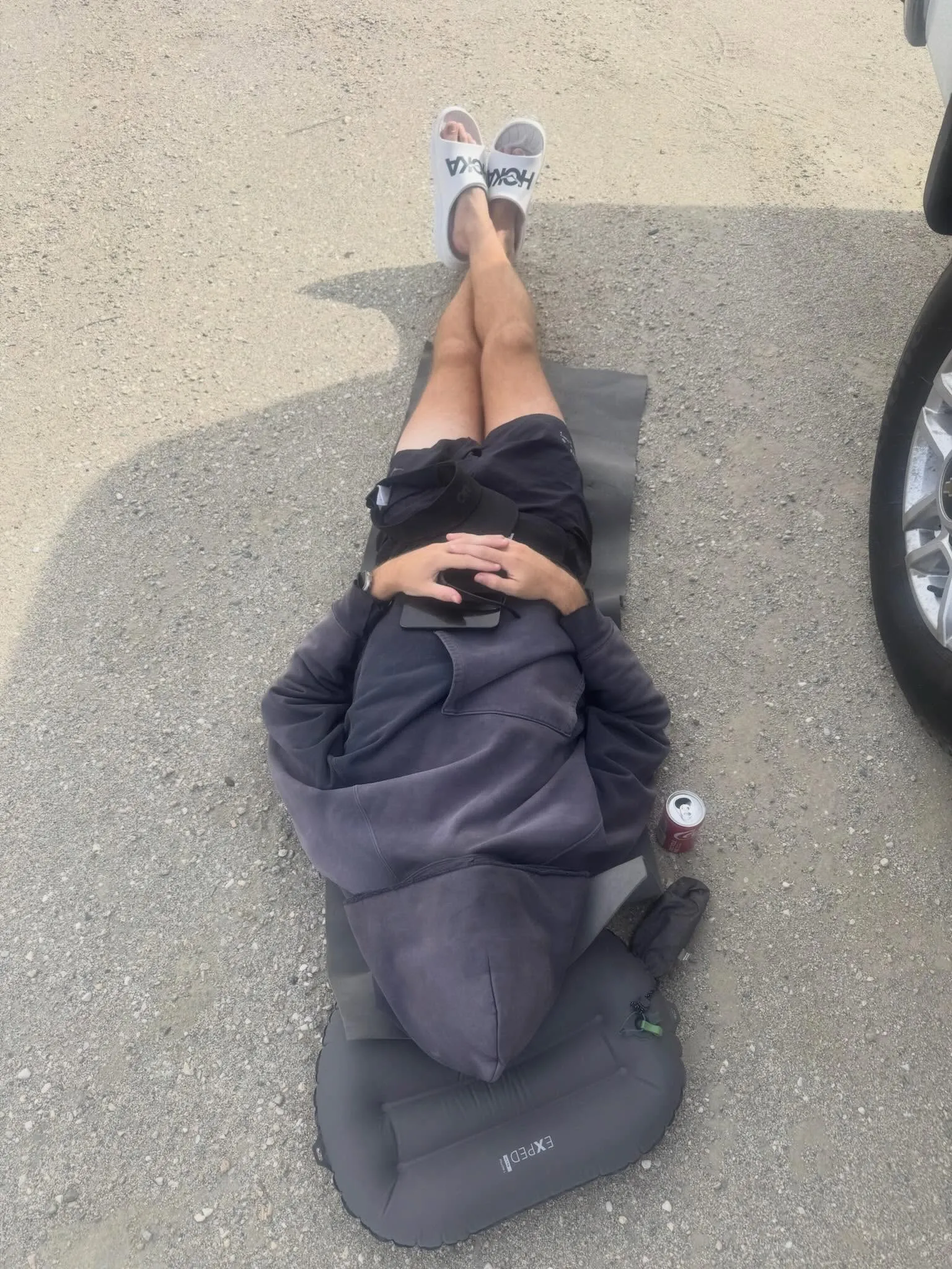
Ruffles and Electrolit never tasted so good. Pour the crumbles over me and let me bathe in it. Dirt naps never last long enough. Dogs bark as the sun dips heavy, headlights rip past while hugging the shoulder. Moonlight illuminates folding terrain as the chaparral cast dancing shadows.
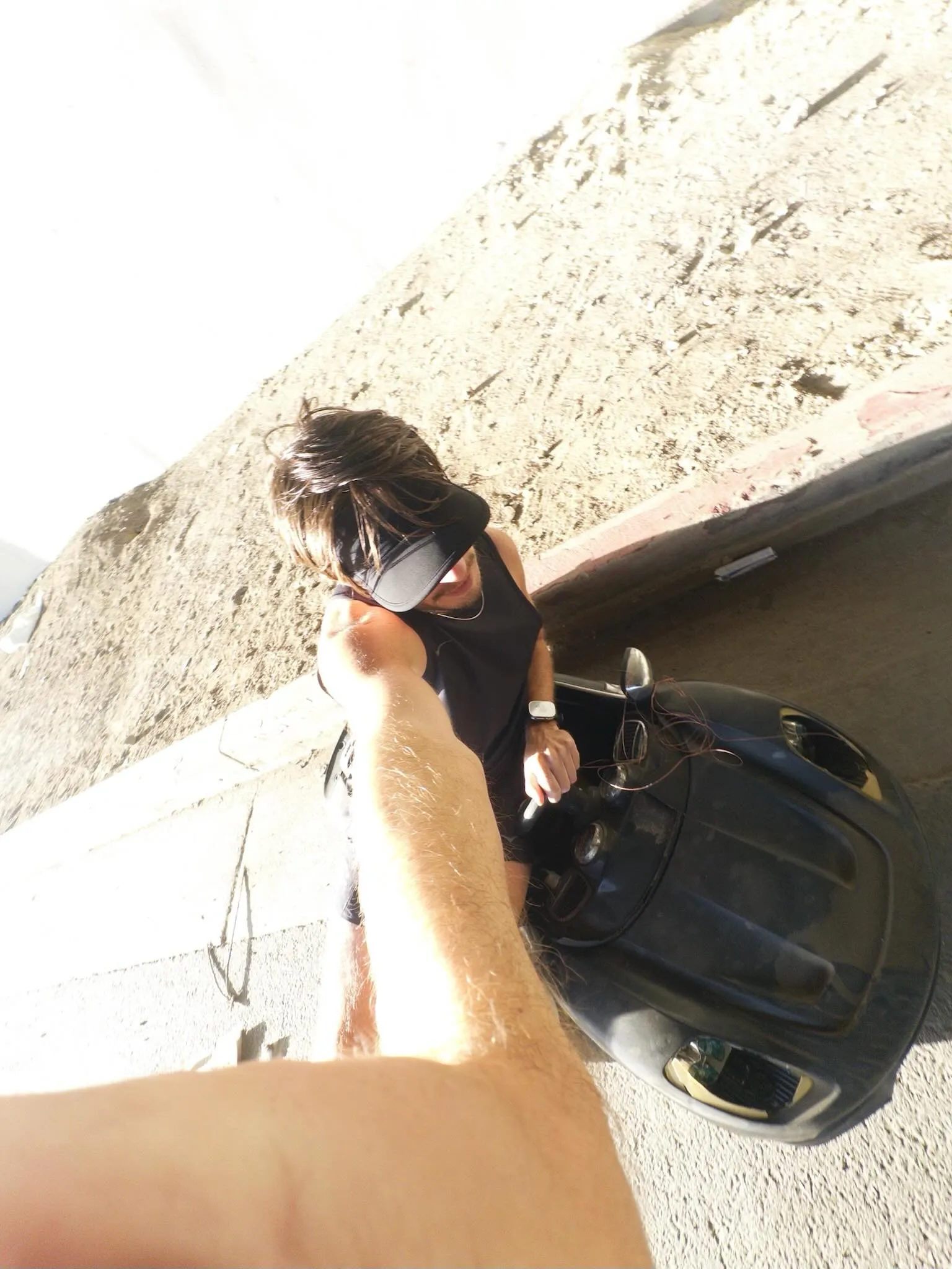
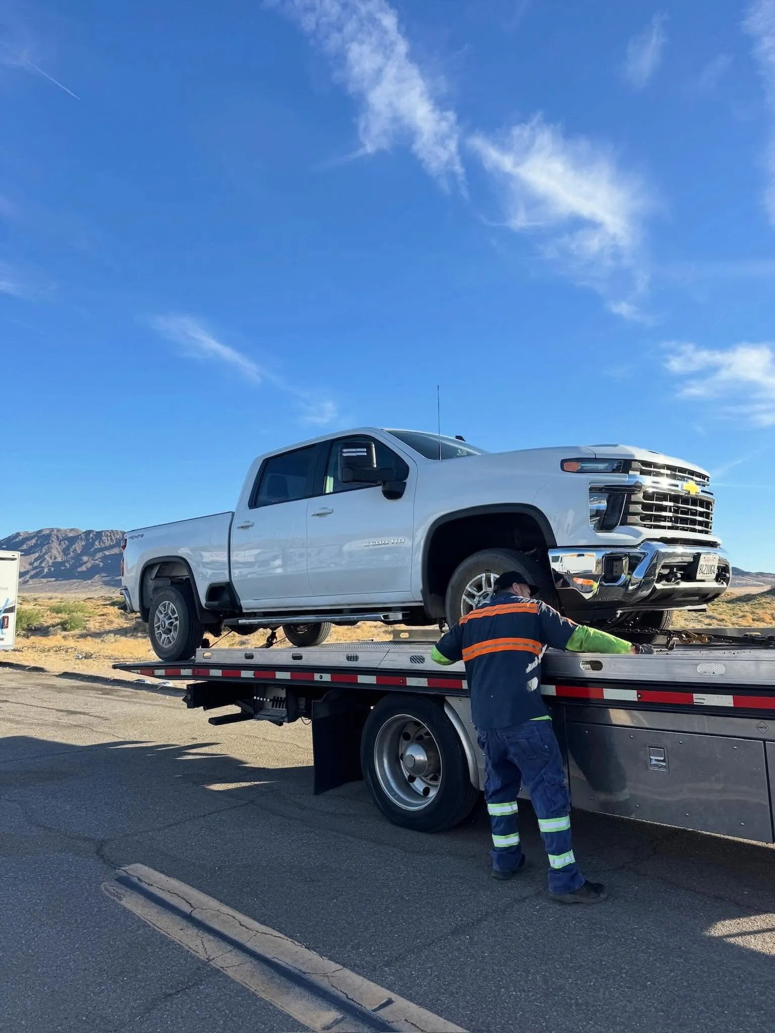
Sunrise. Heavy duty trucks aren’t supposed to fly like that. Any snapped necks? Somehow not. On the feet, on the toes. The other truck tosses in the hat and I might not be far behind. Tow it in. Sleep? What sleep? Nap here, nap there.
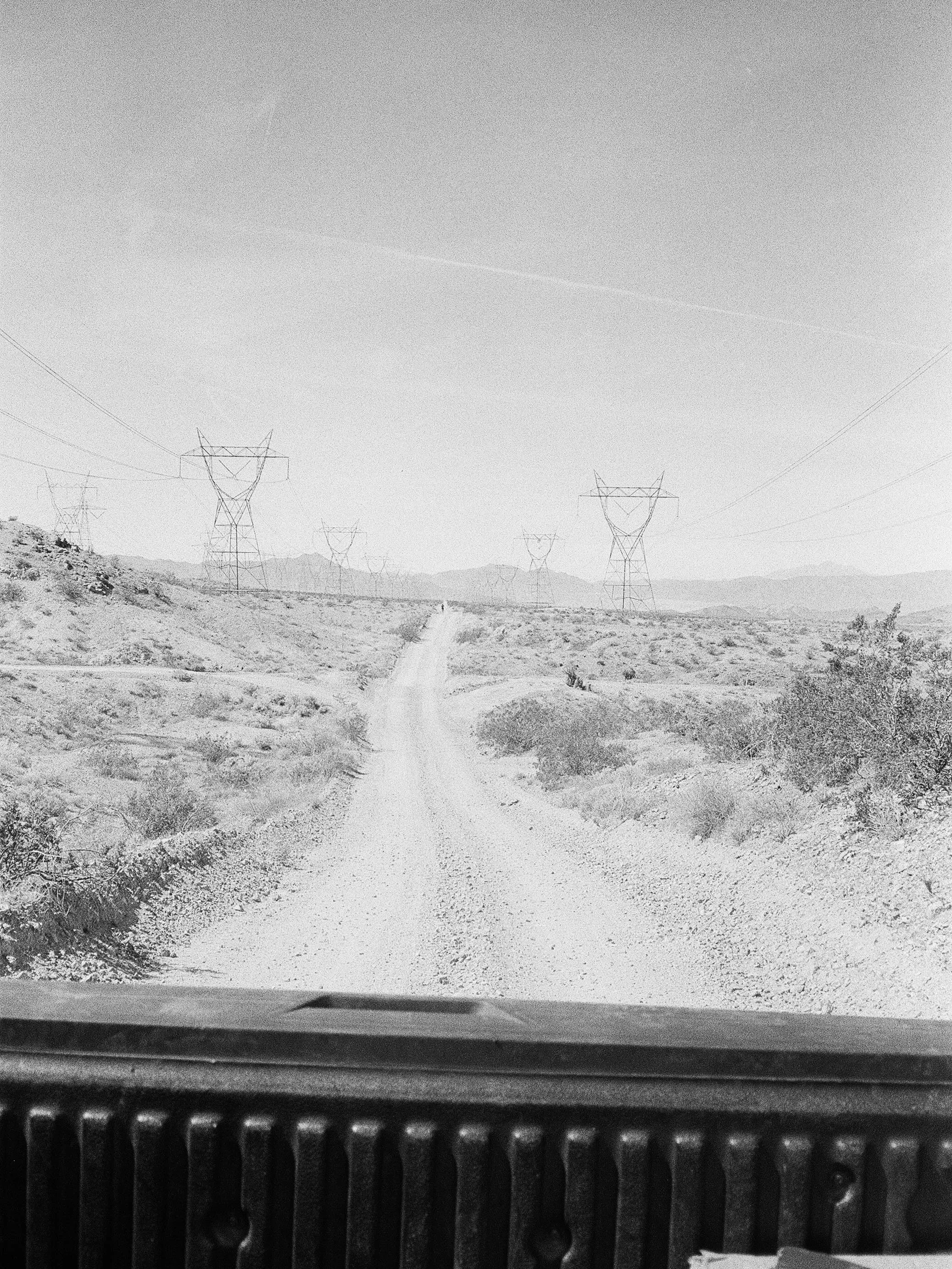
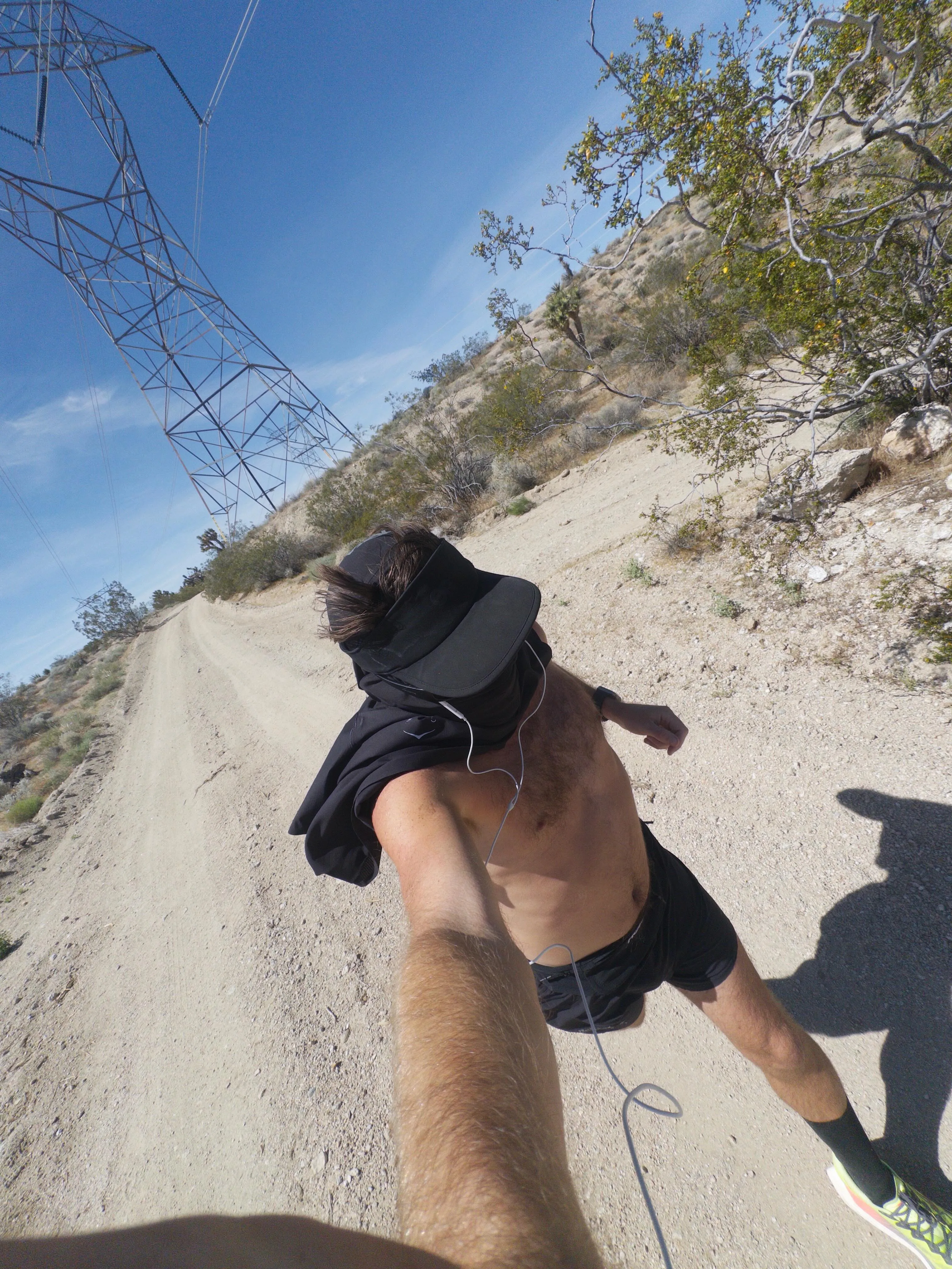
Roasting under power lines in the mid day. Where do they lead? Doesn’t matter. Another step, might as well be for eternity. Only this, always, forever, why not? Earth spins beneath our feet as we fall eastward towards the light. Forget the plan. Whoever has legs toss yourself out of the truck bed and get moving. Sprinting or crawling, whatever way it goes.
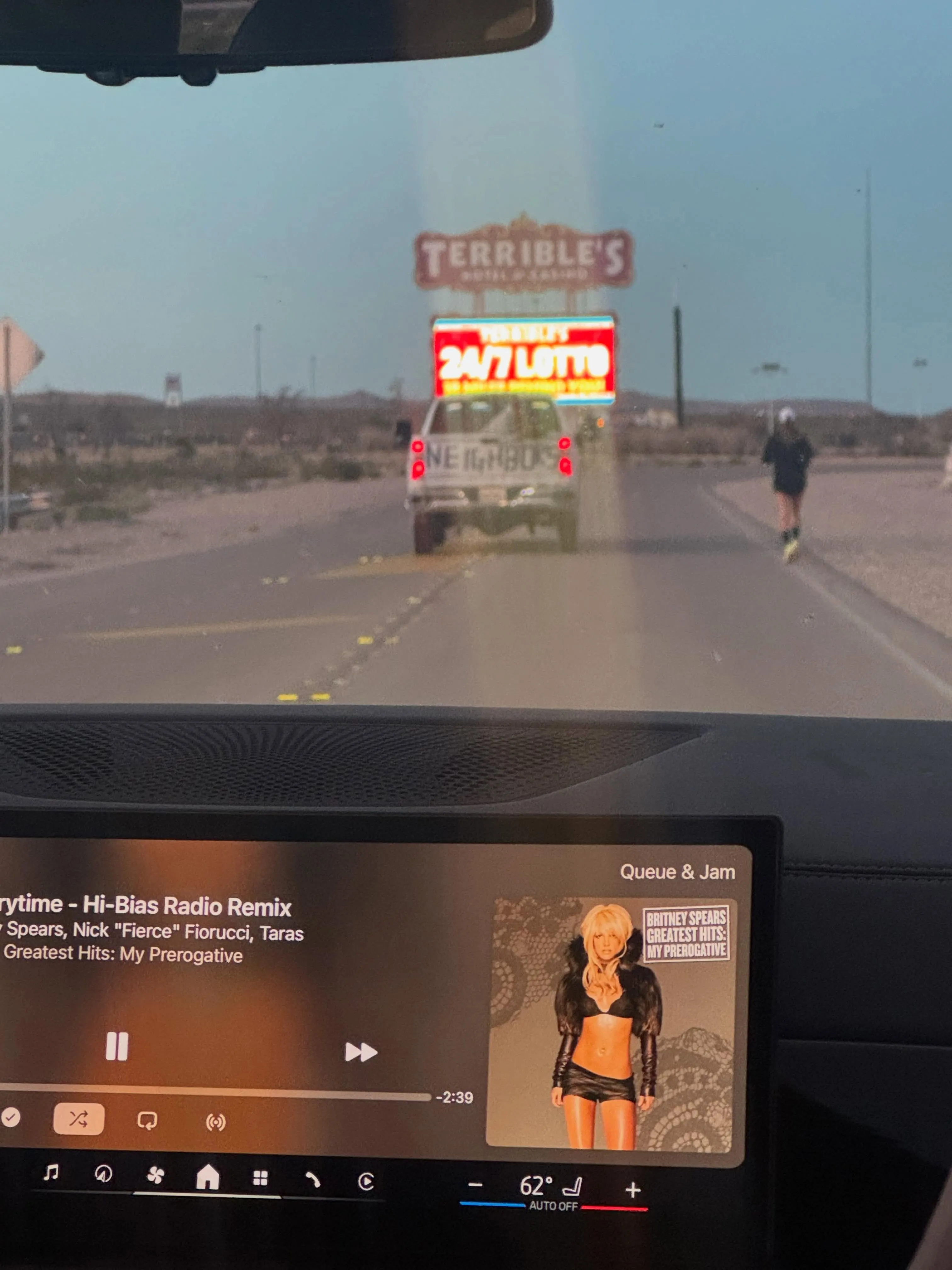
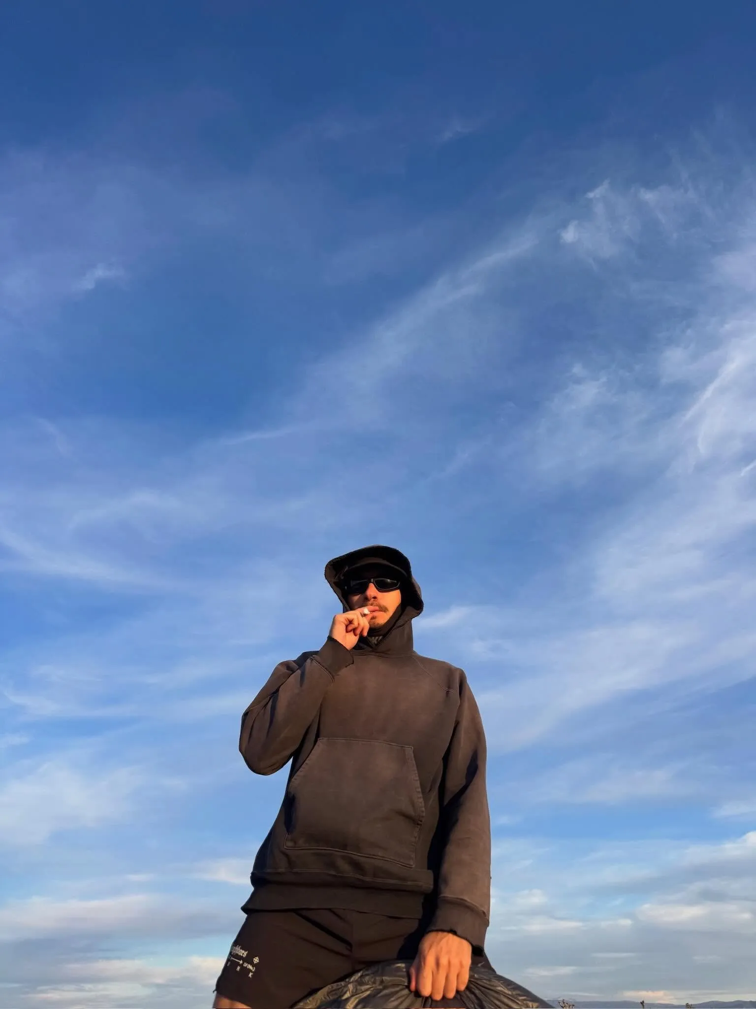
A special serving of 50 miles for each. Exiting the void, entering the mirage. Here it is, take it. Meandering the casino floors in a daze. Casino bathing in the style of forest bathing. Let the dust settle. There is always something to Learn from Las Vegas.
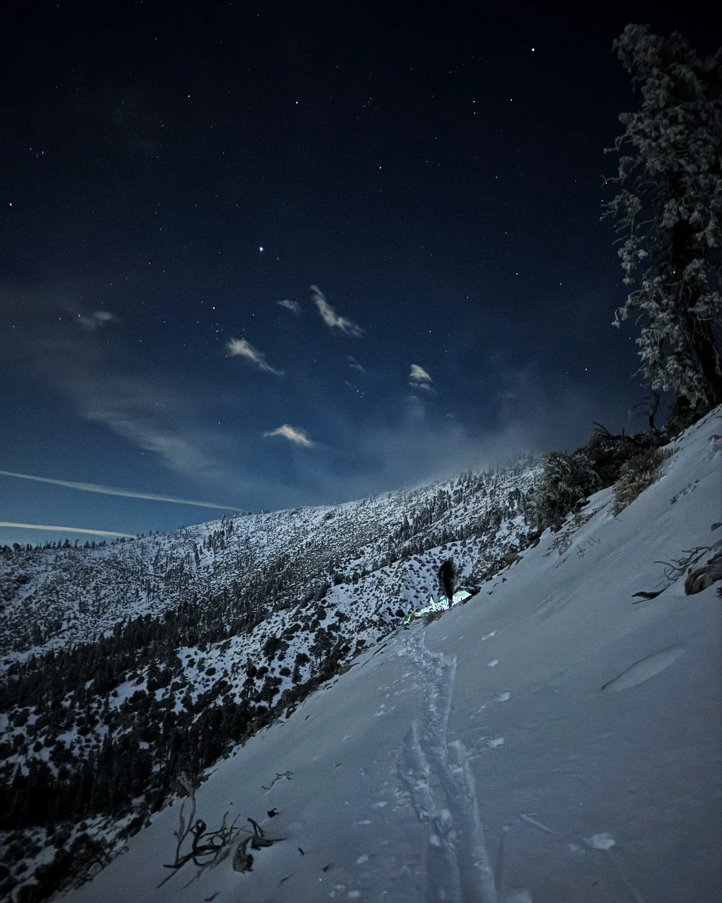
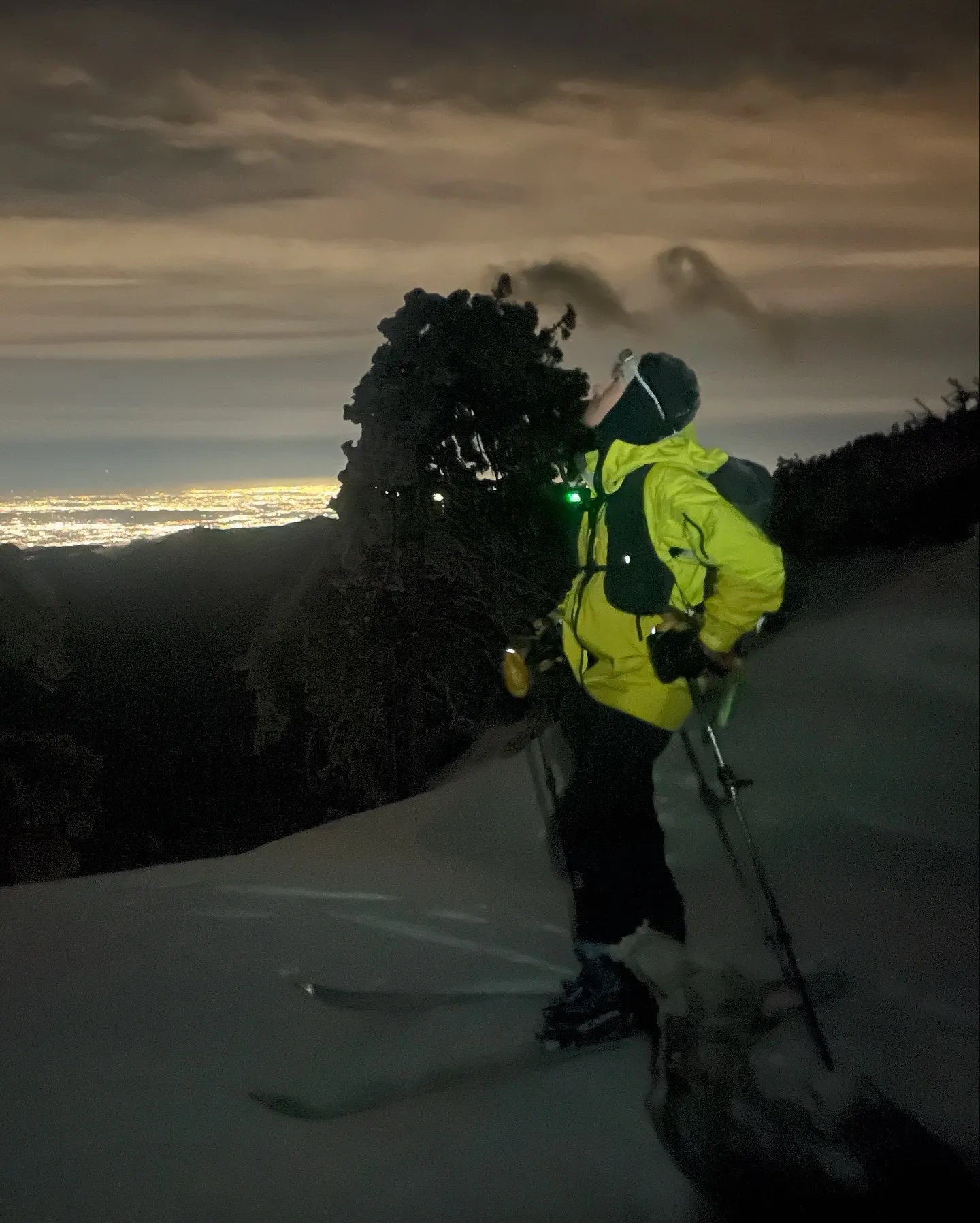
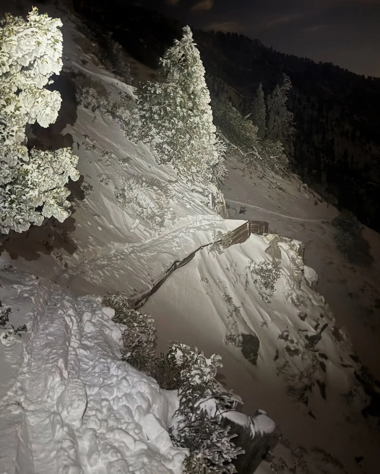
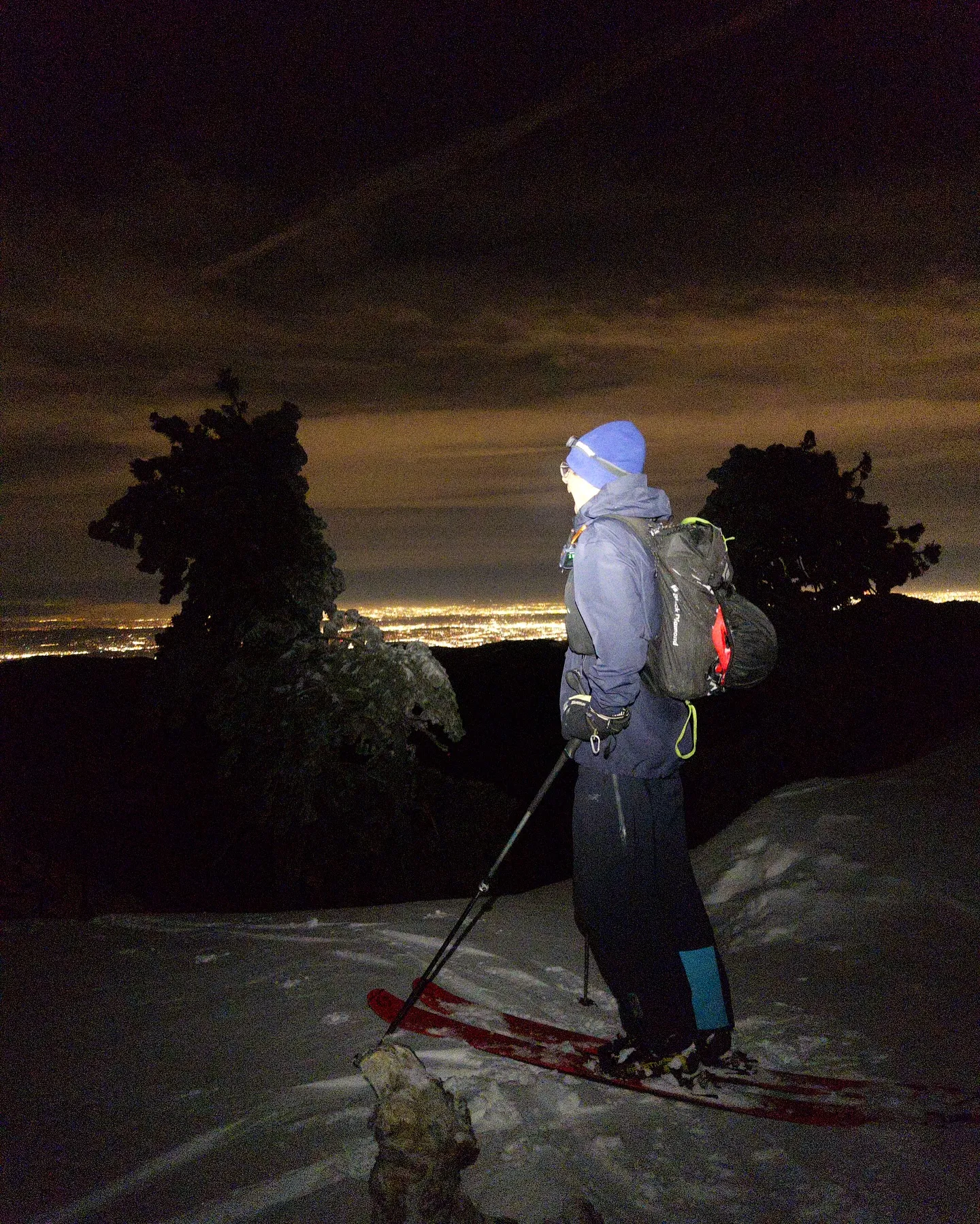
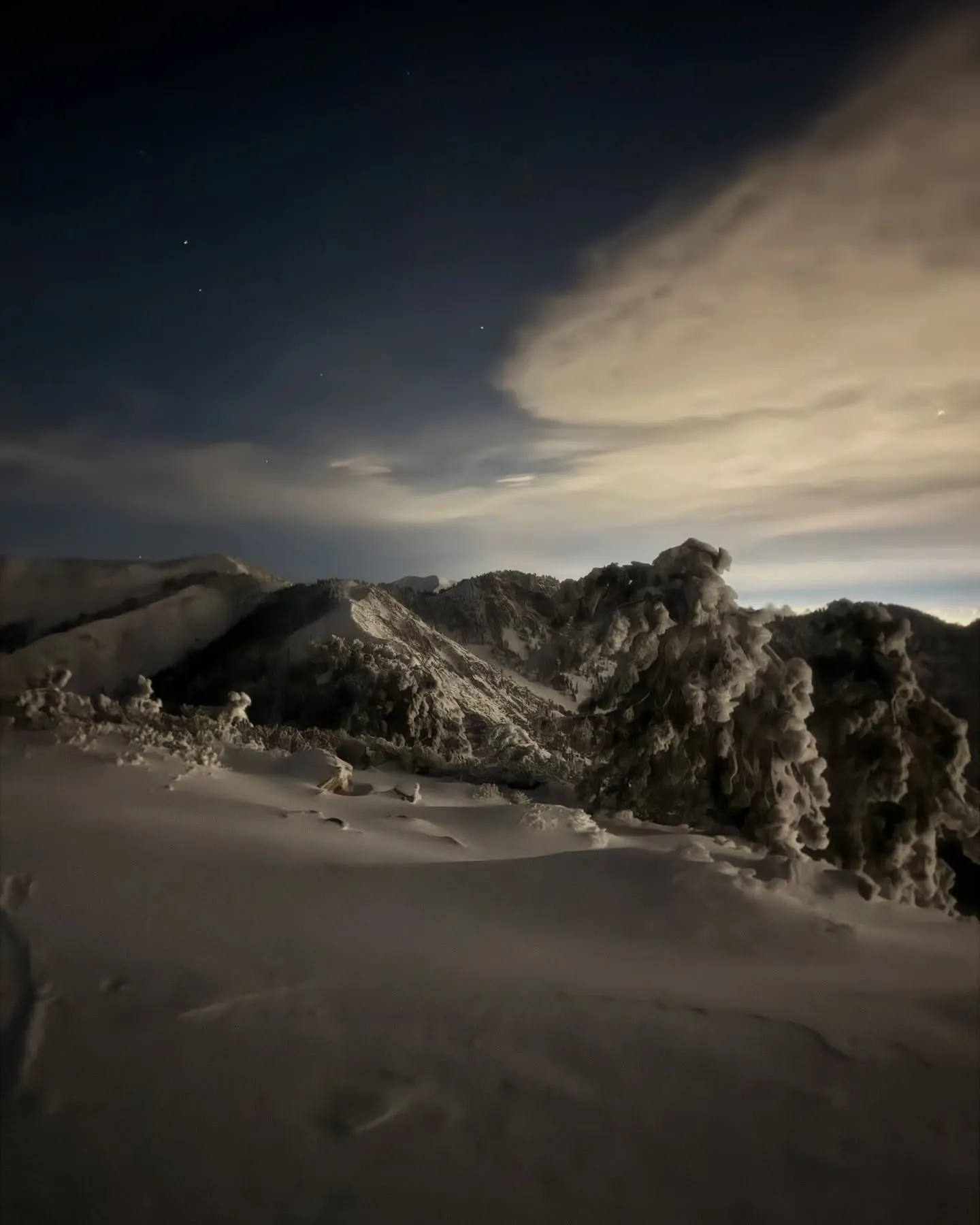
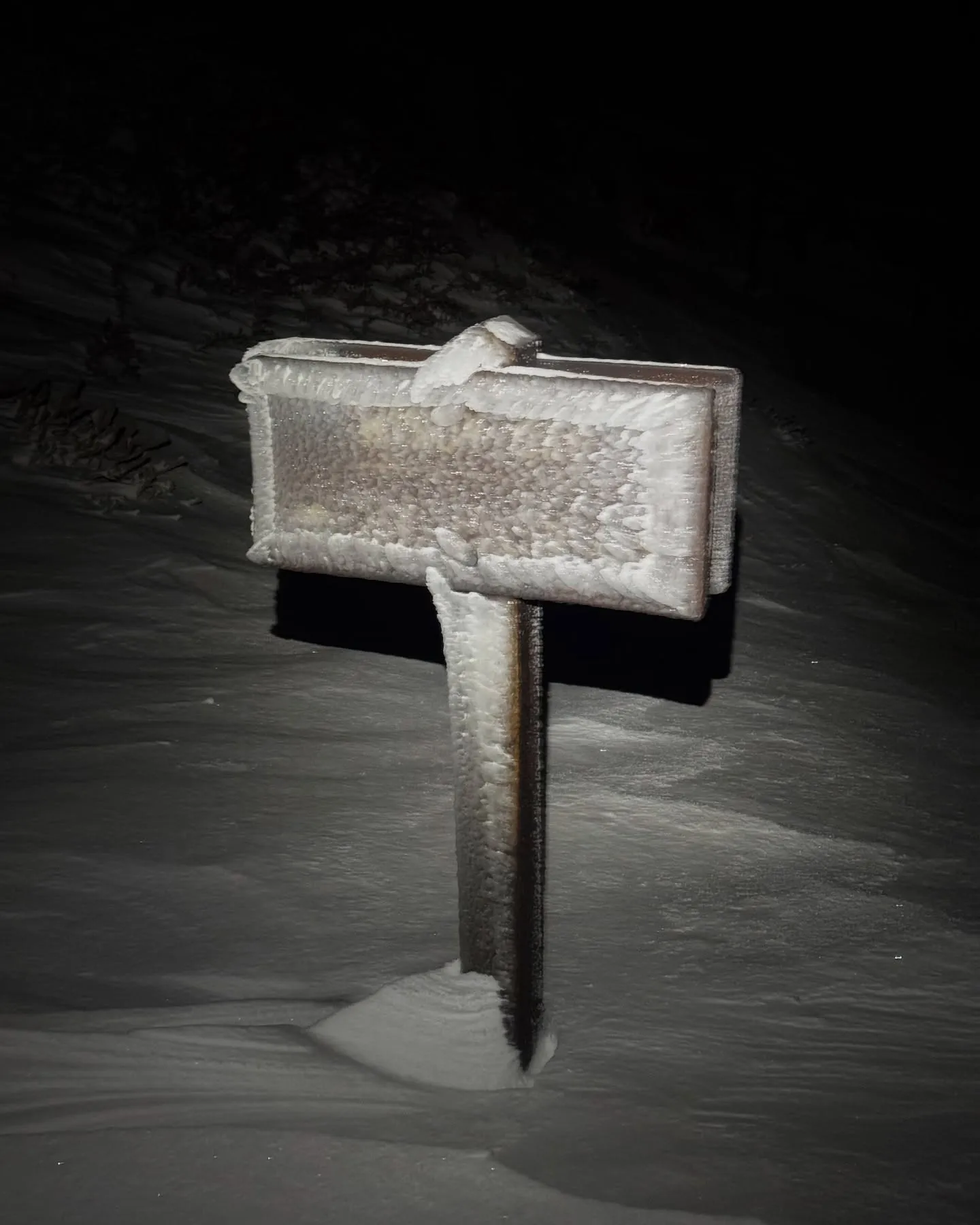
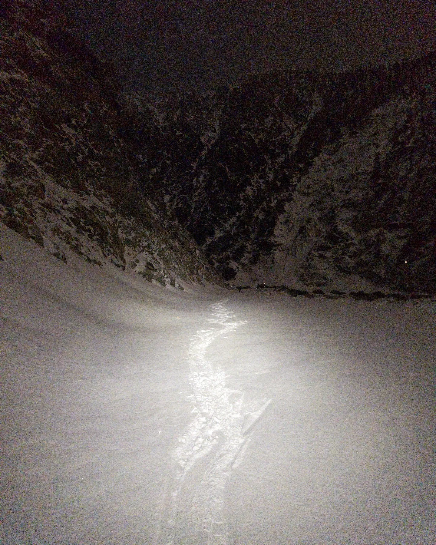
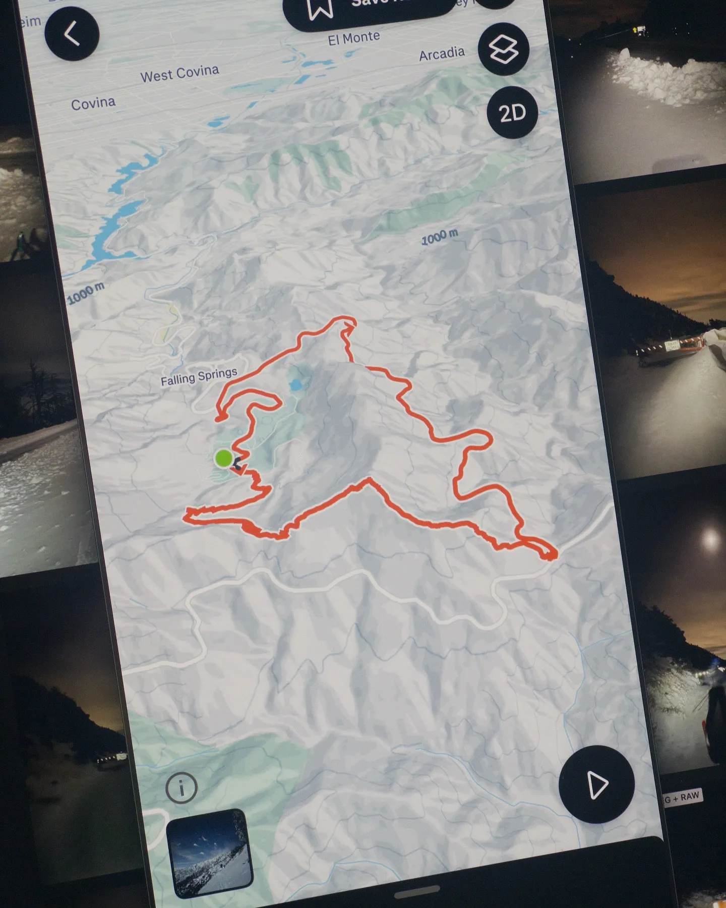
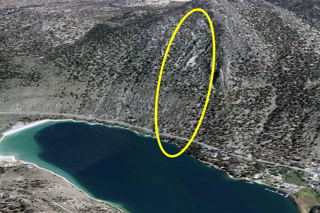
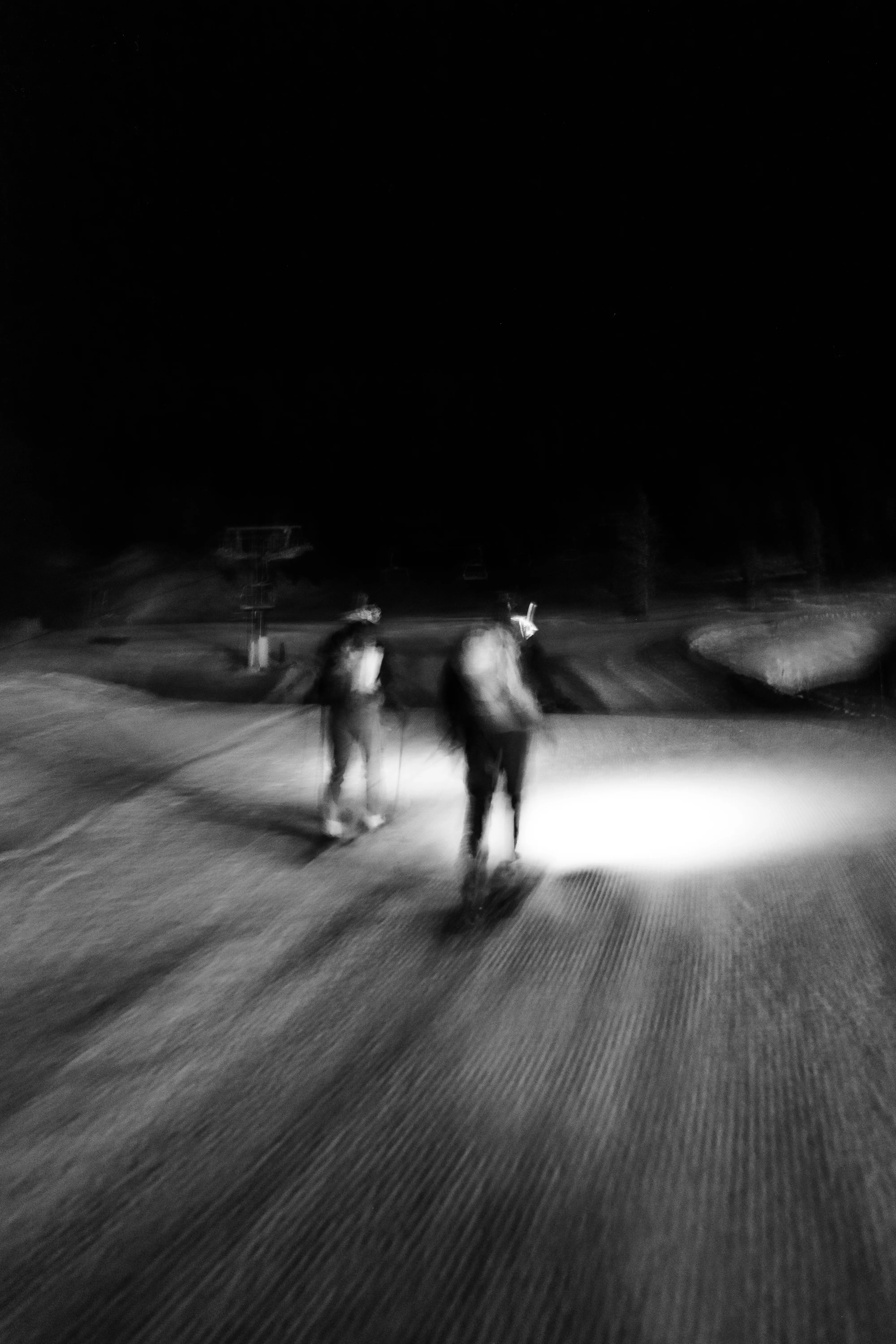
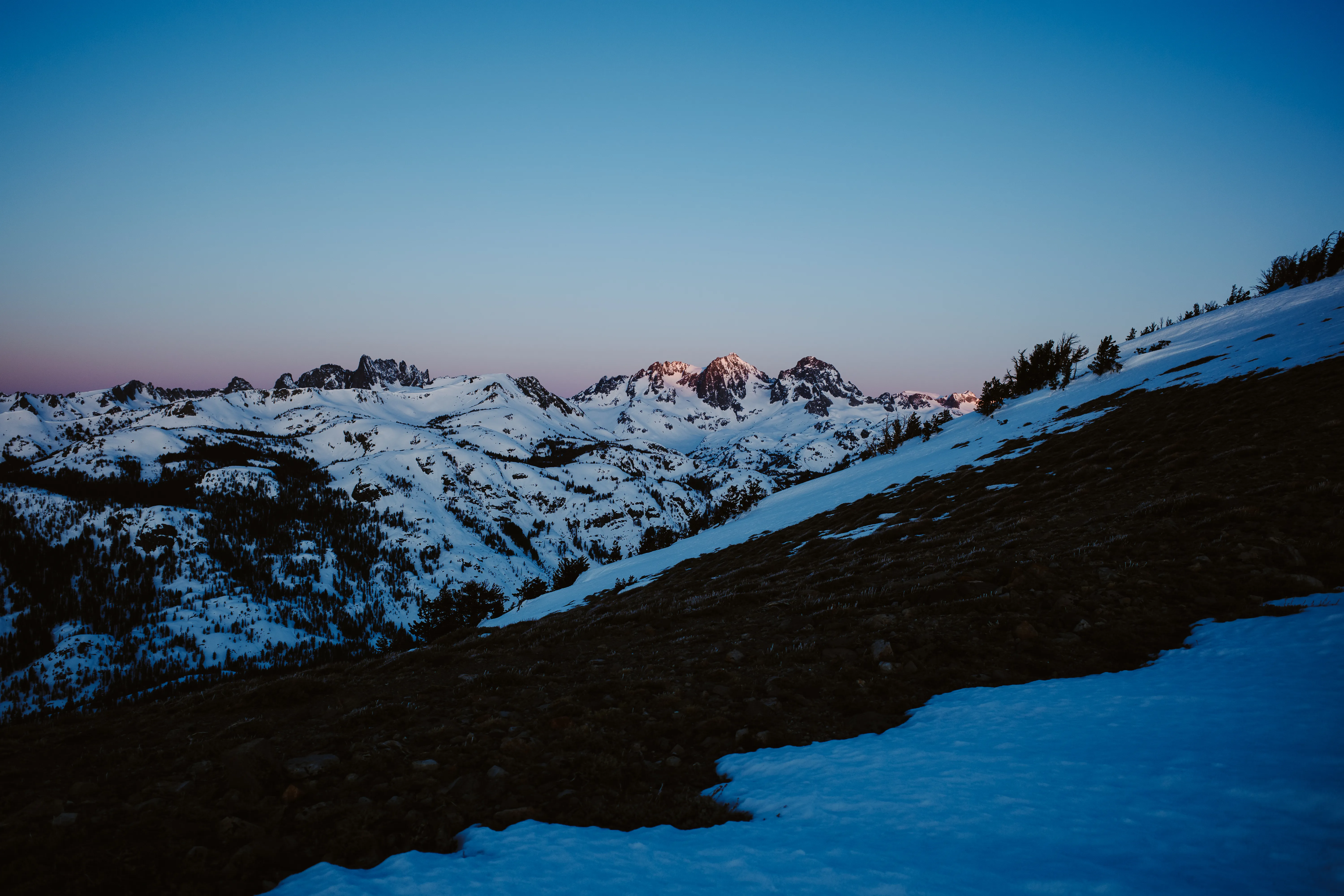
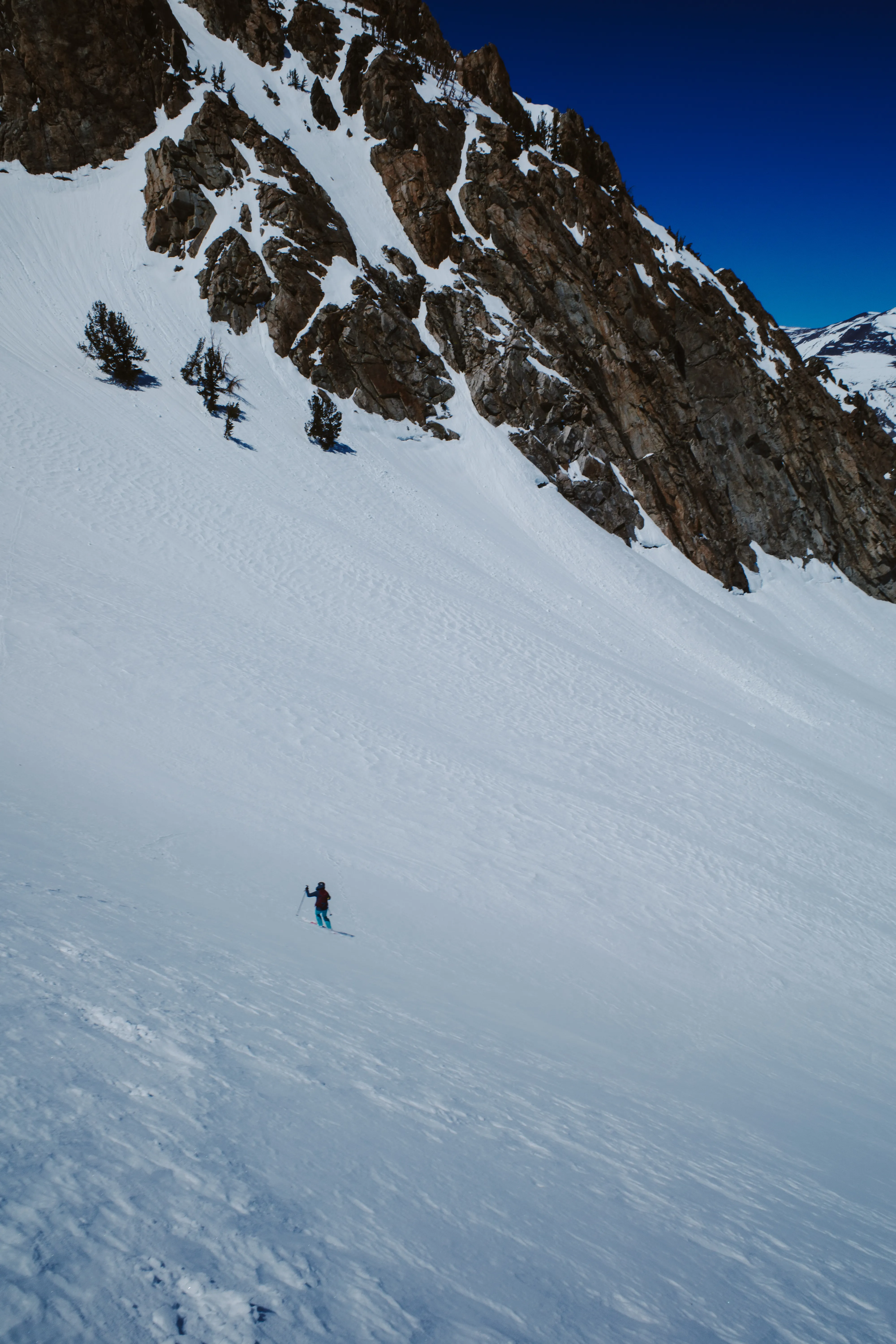
This was a once in a lifetime evening in the local mountains of Los Angeles. Sometimes it all lines up. This was one of those times. Two days of snowing in the San Gabriel with a weather window during a clear night. Turns out there was also a total lunar eclipse. What! @_alex_reed and I drove up with the hope of skiing powder turns with the city lights beneath us. We aimed it at Crystal Lake not knowing how coverage truly was going to be, and a looping route covering 16mi and 3.5k vert drawn up the night before.
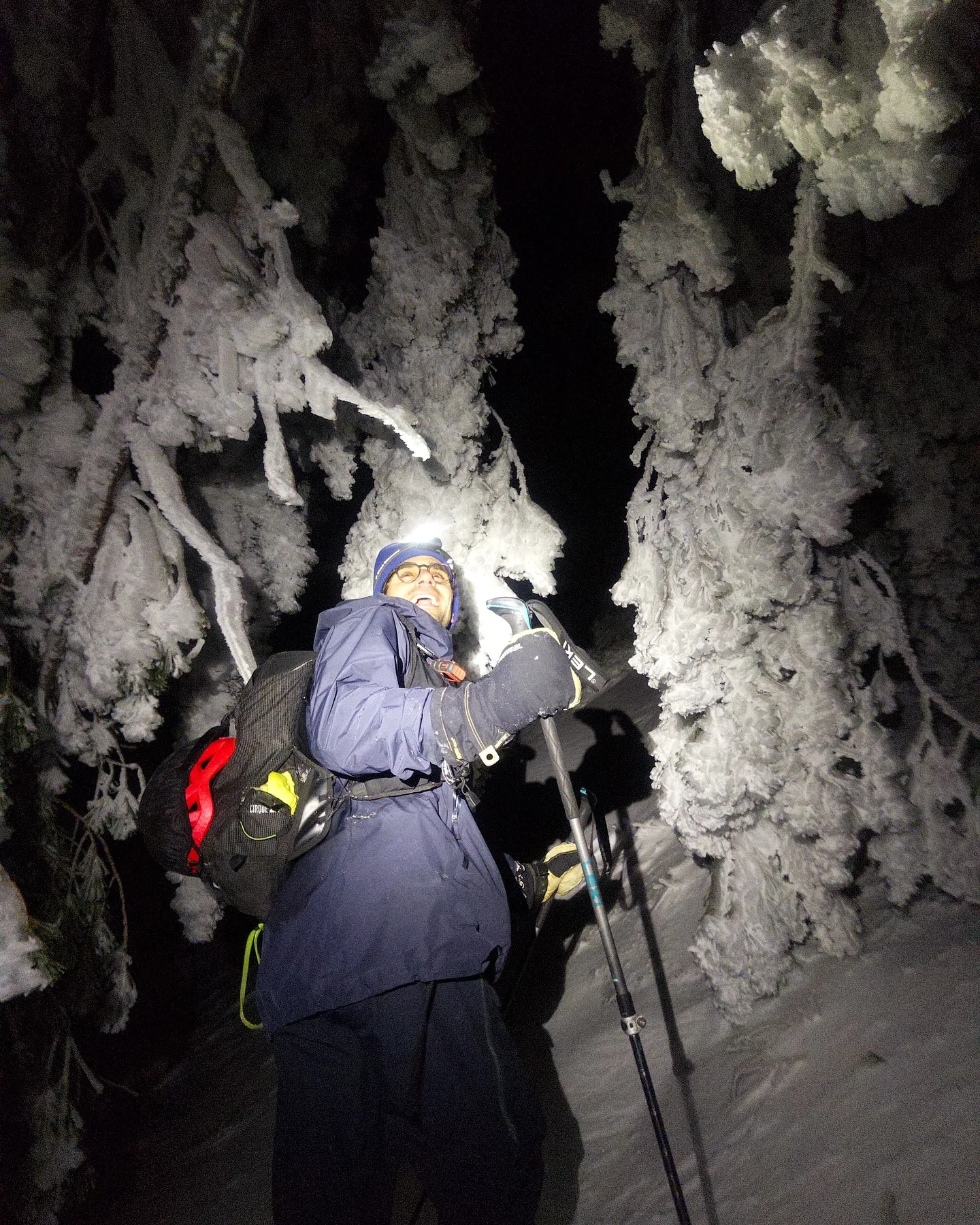
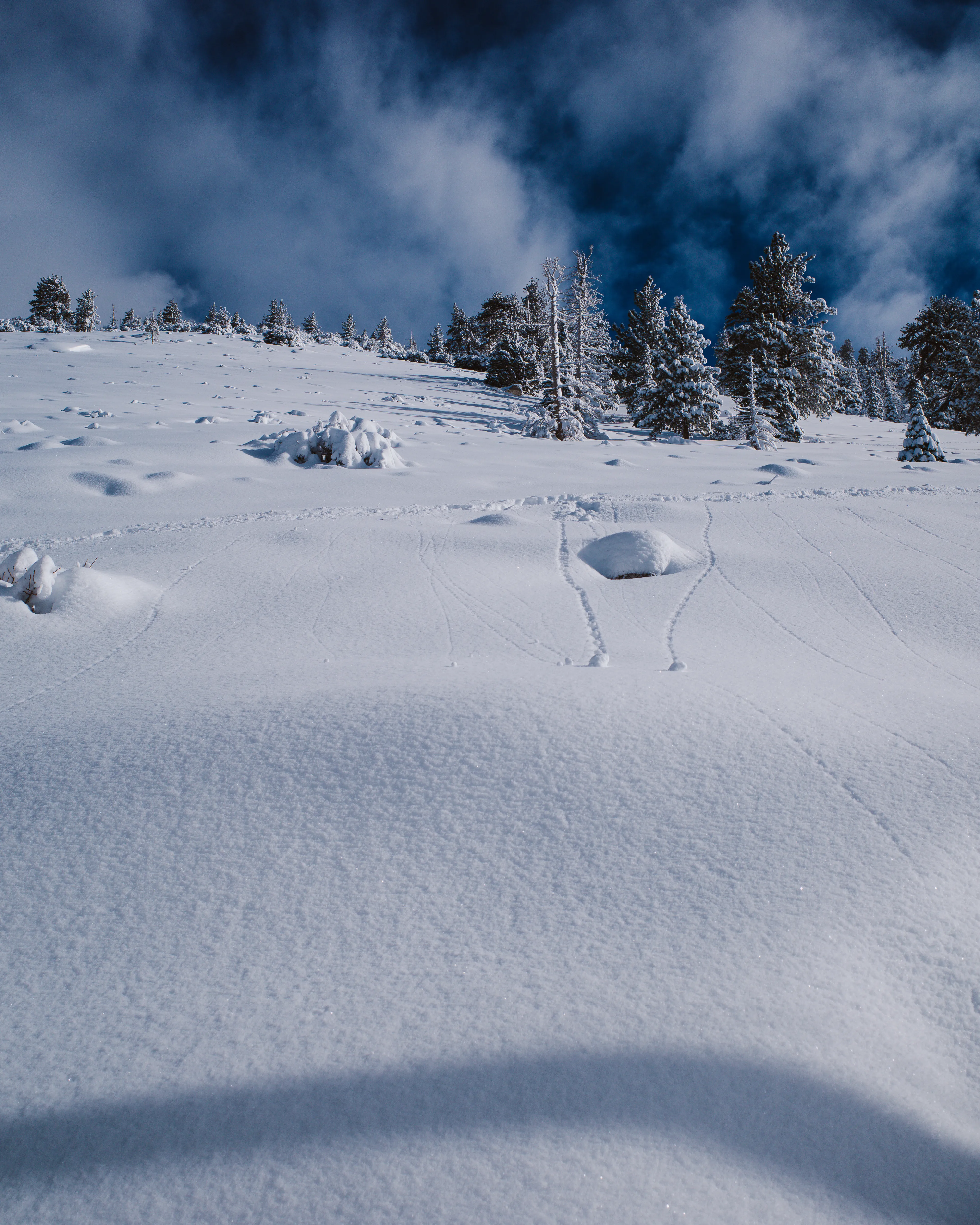
We began, skins on (no joke), at Crystal Lake at 9pm. Climbing up to Windy Gap was illuminated by the still full moon. No headlamps needed. The manzanita falling over the trail due to the weight of the snow and rime ice. Just had to power through. Some wind board firmness on exposed sections left us wanting ski crampons. The celestial event began as the earth’s shadow became visibile overhead.
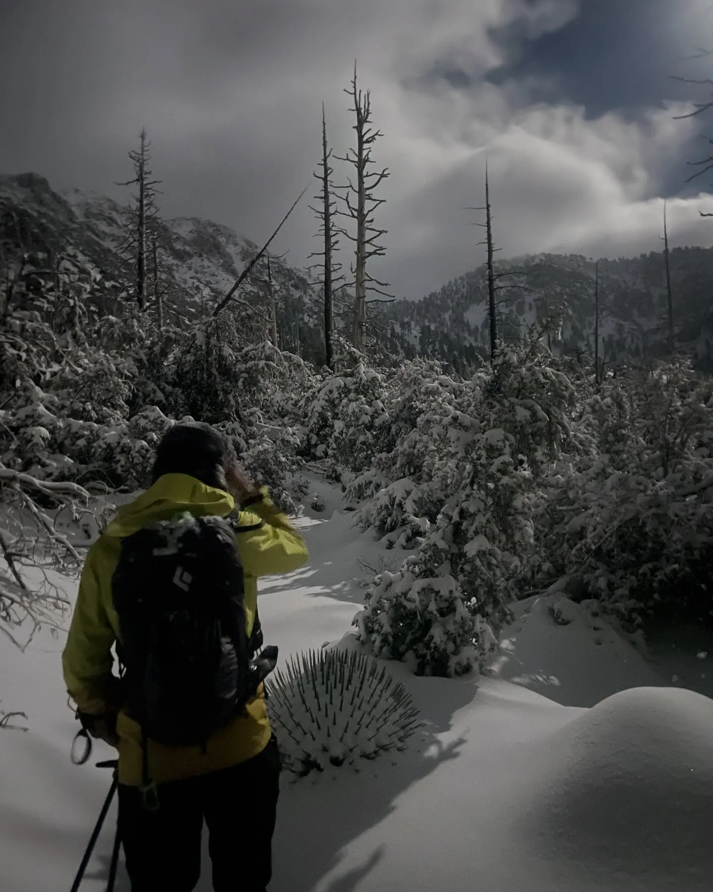
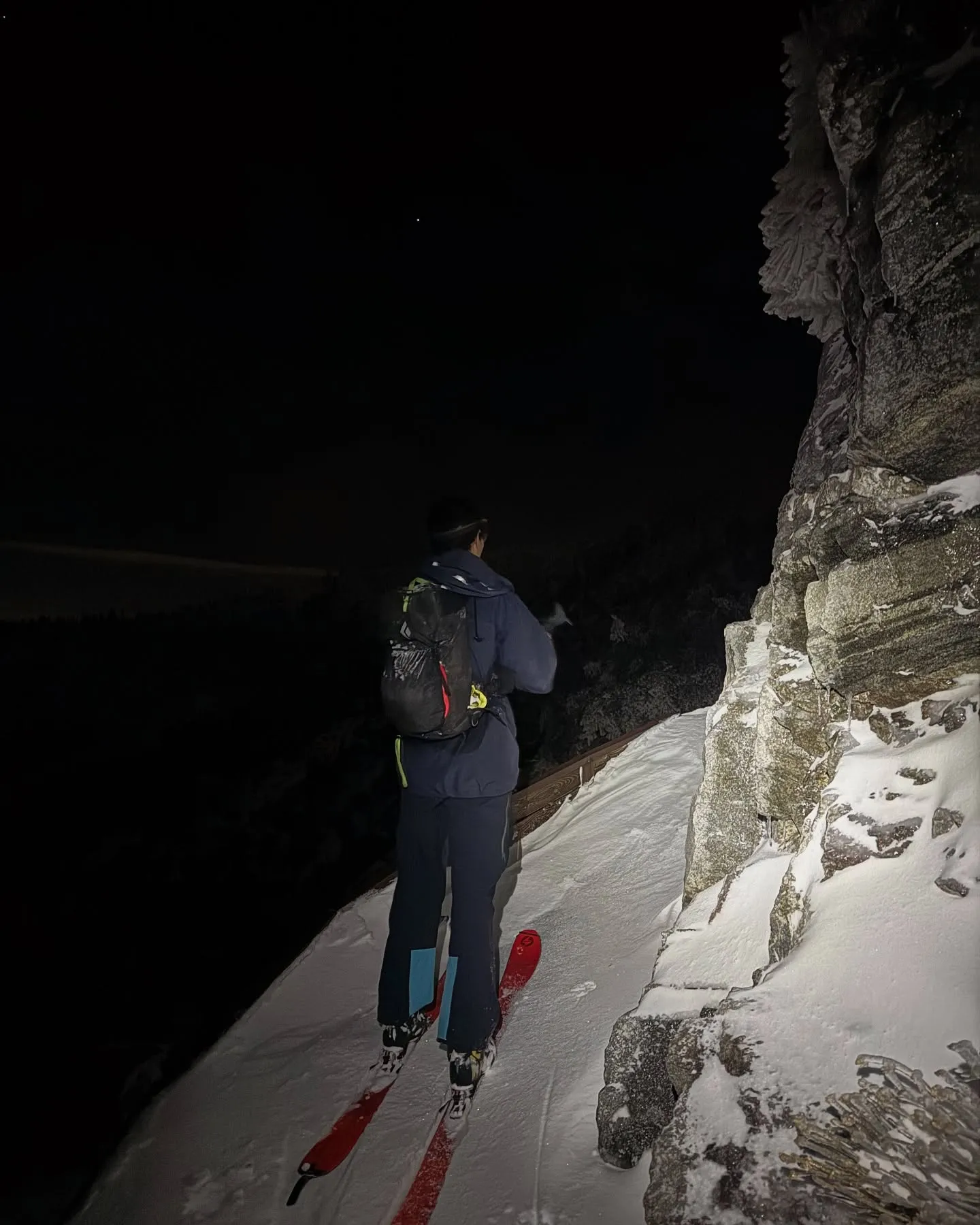
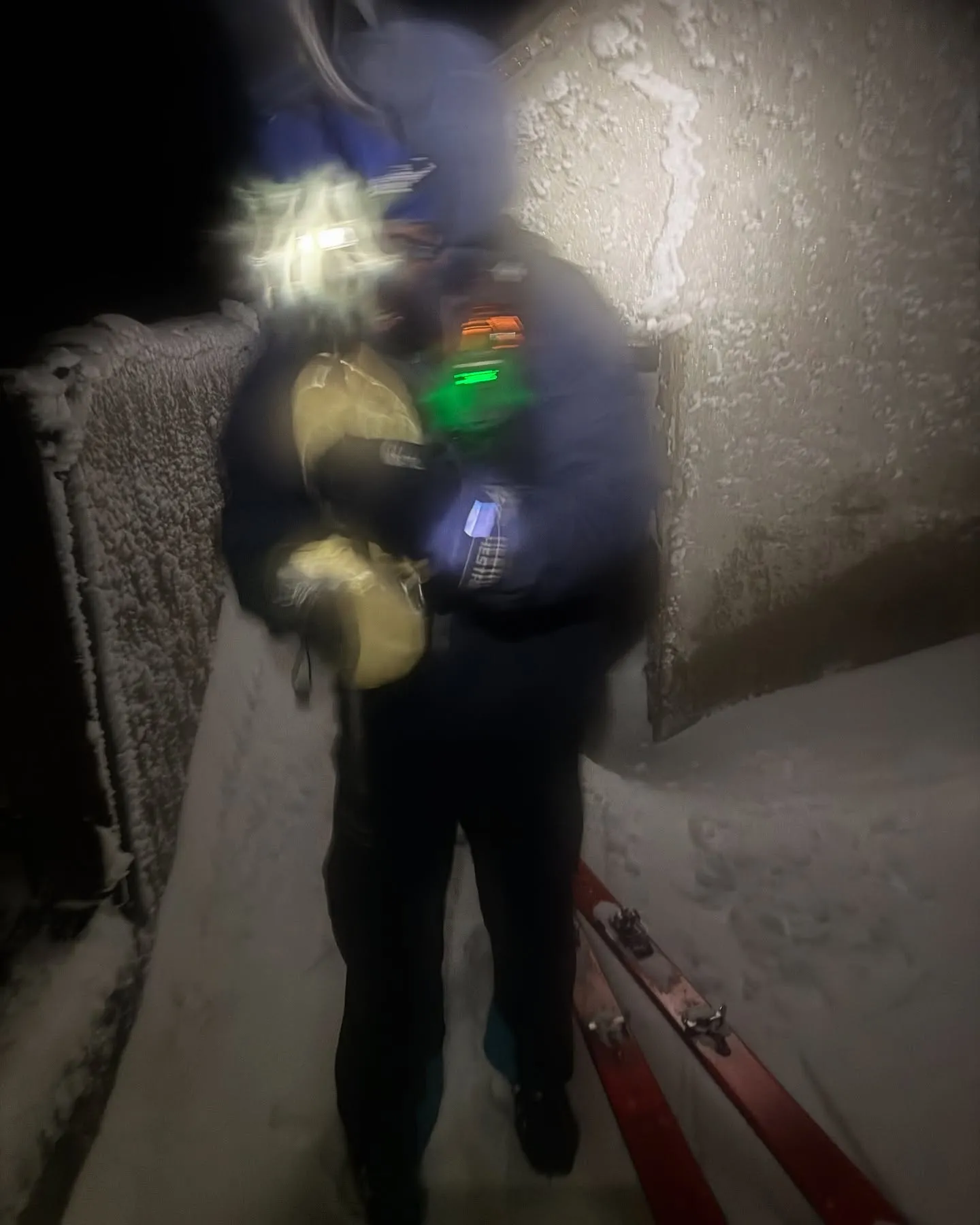
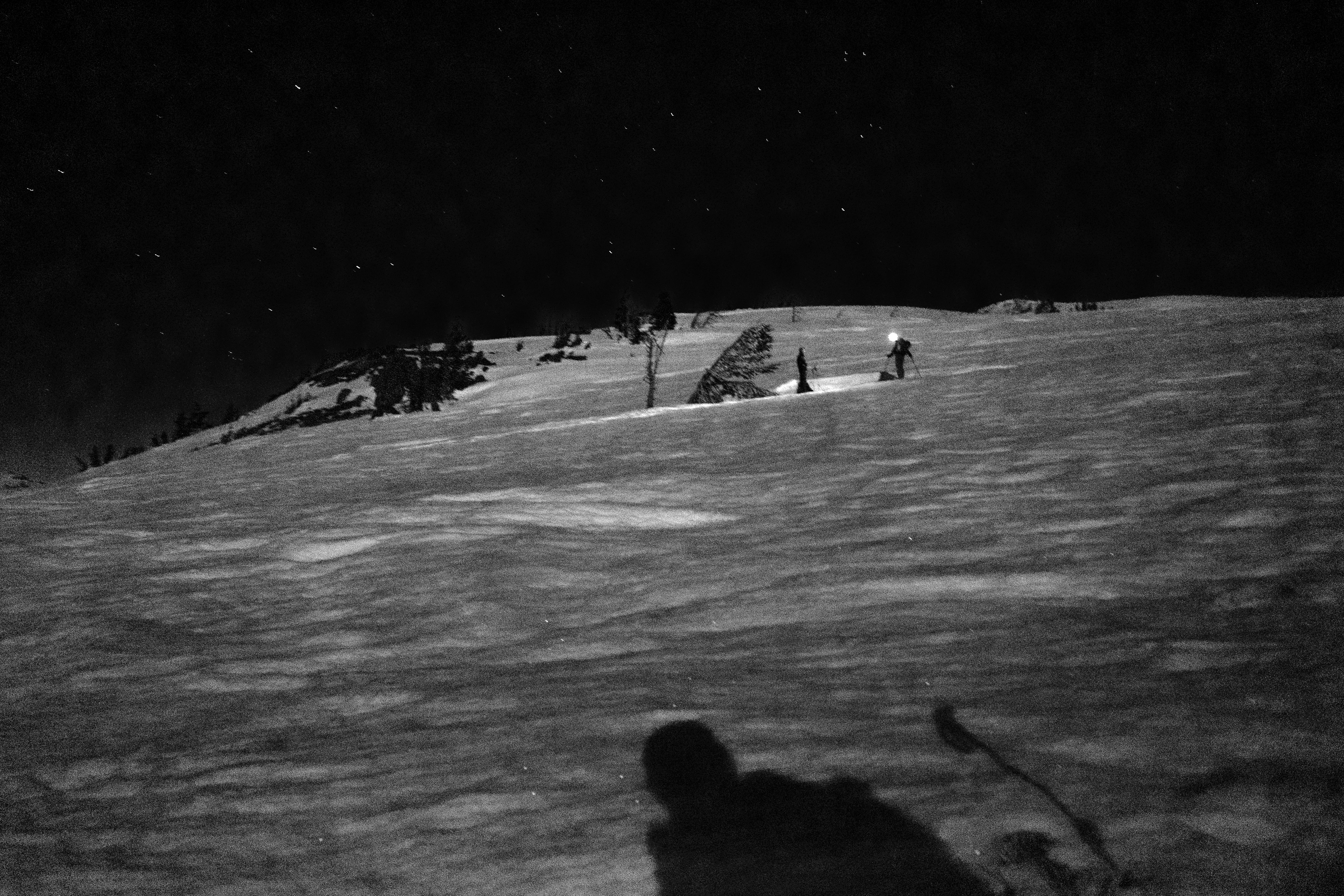
Just as we gained Windy Gap the eclipse entered totality. Deep deep red. The glow of Los Angeles below us, the snow reflecting the distant street lamps. No words, truly. We climb and summit Mount Islip. The wind picks up and temperature greatly drops. Can’t feel the hands, feet are drenched from the uphill pace. We duck into the remains of a cabin and transition for the downhill.
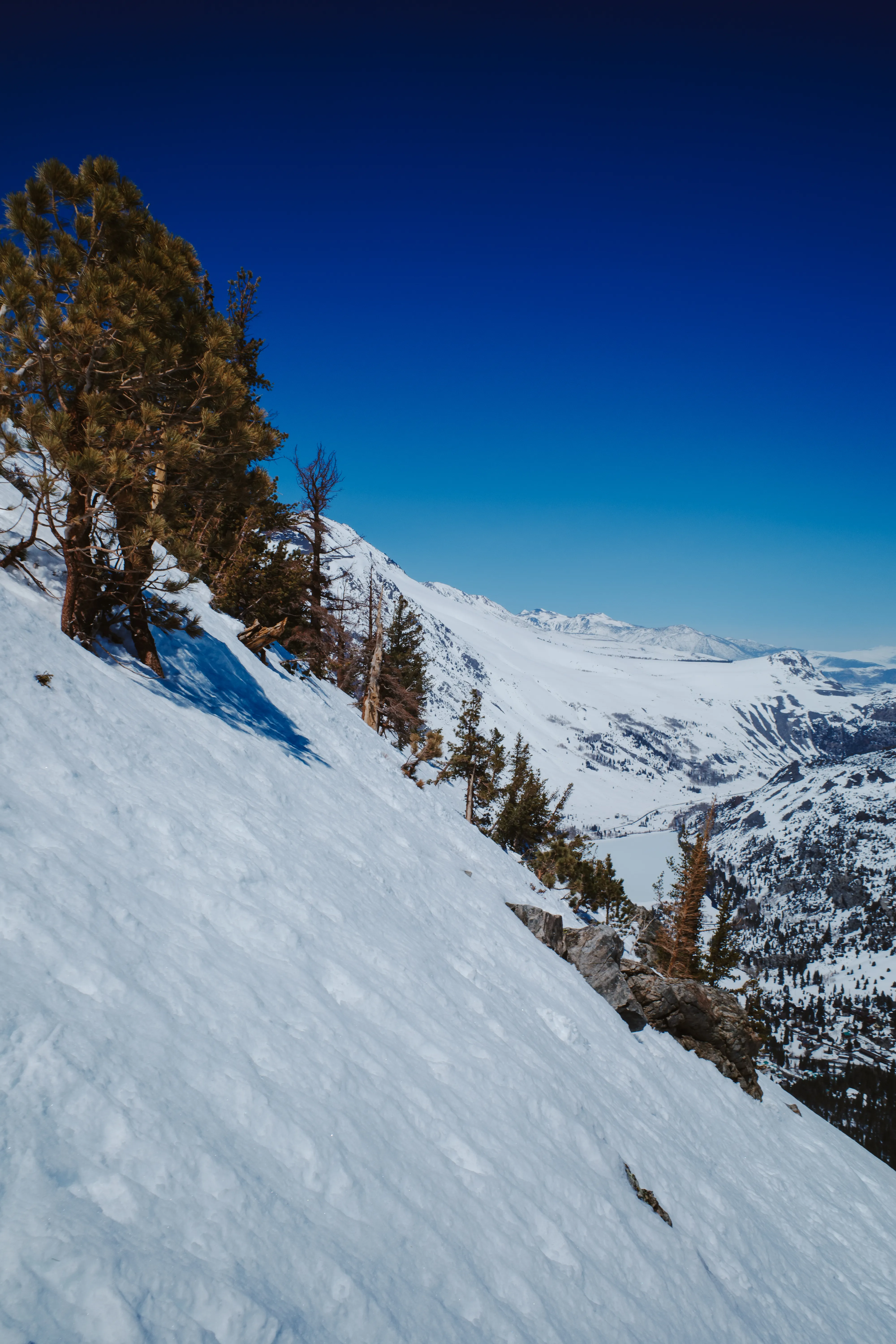
I can’t believe we are getting powder turns under a full moon in the San Gabriel. It’s good. Really good. We stay high and aim for Islip Saddle. This is magic. The chaparral begins to poke out of the snowpack as we descend, and just as it begins feeling a little precarious the Silver Moccasin Trail emerges beneath us. We hop on and descend continuously along a perfect ribbon of pow through the brush as the moon re-emerges overhead. It feels like an out of body experience.
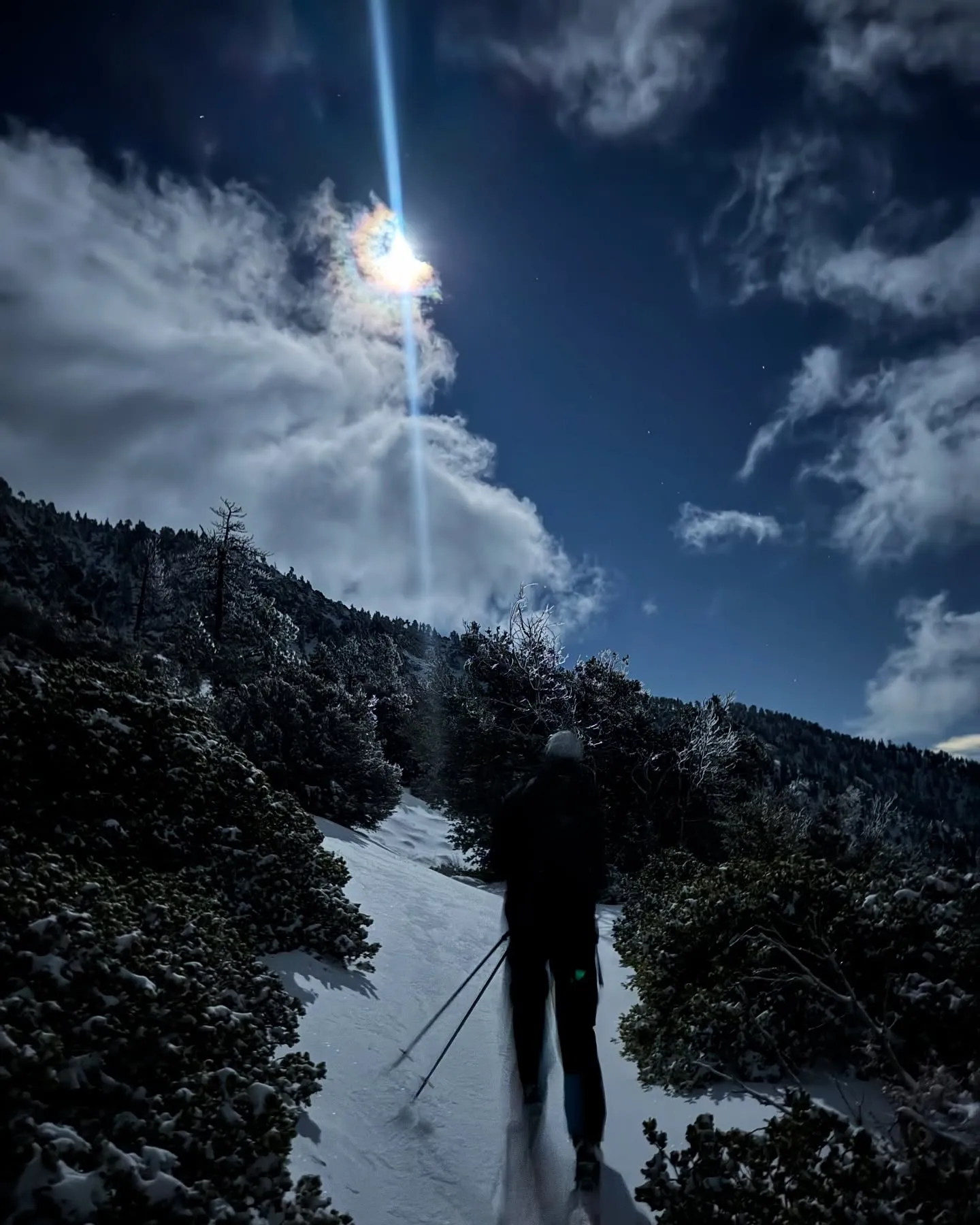
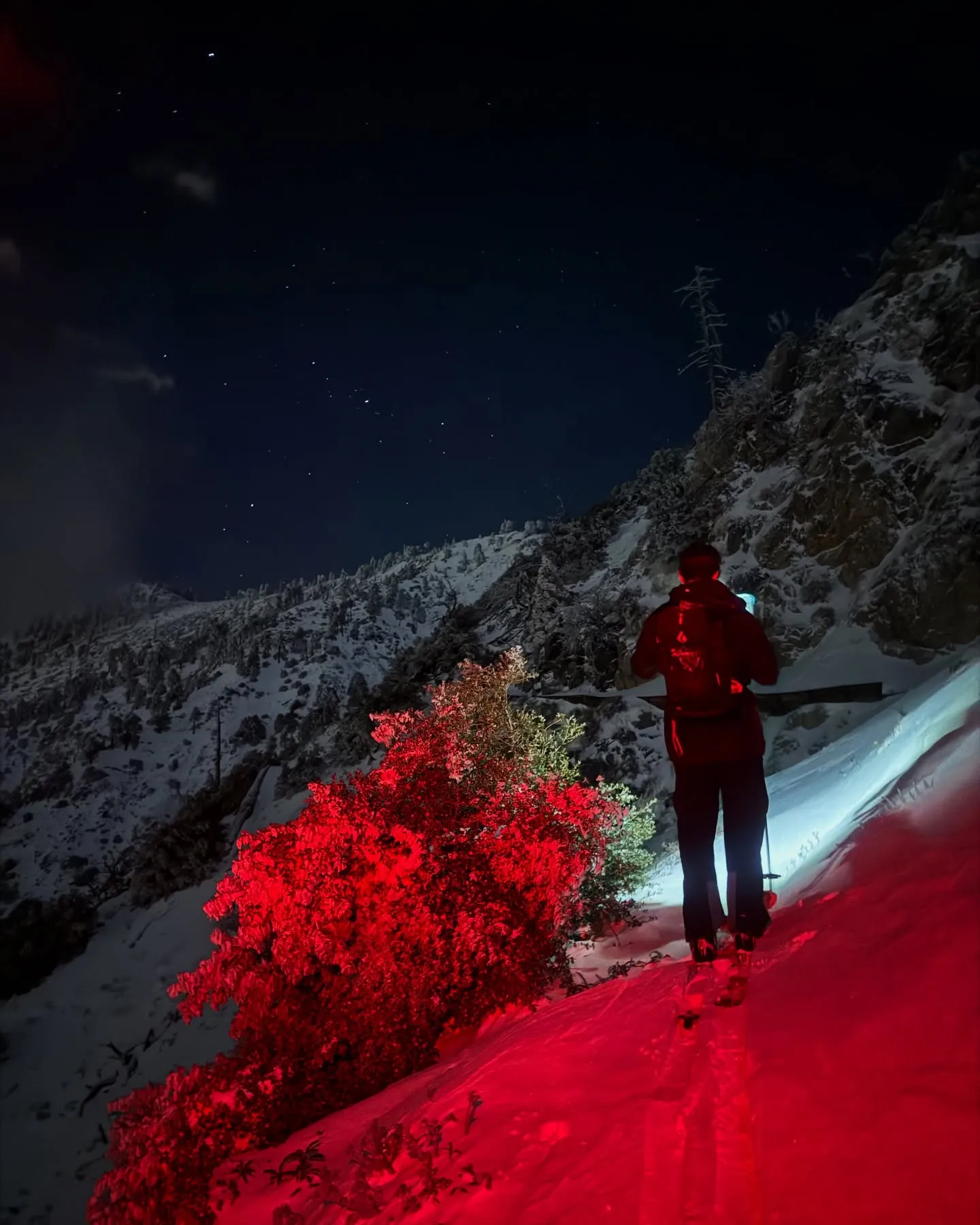
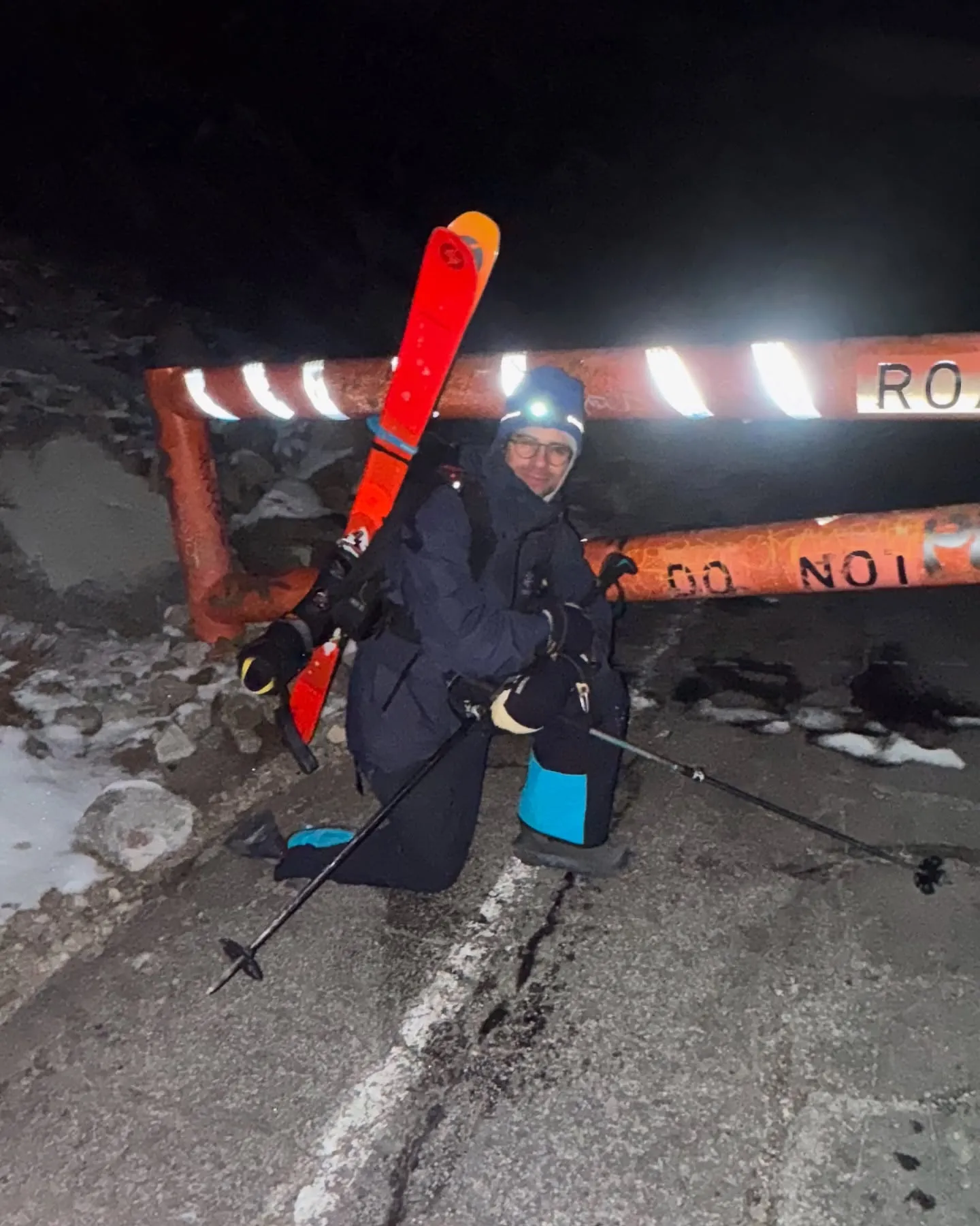
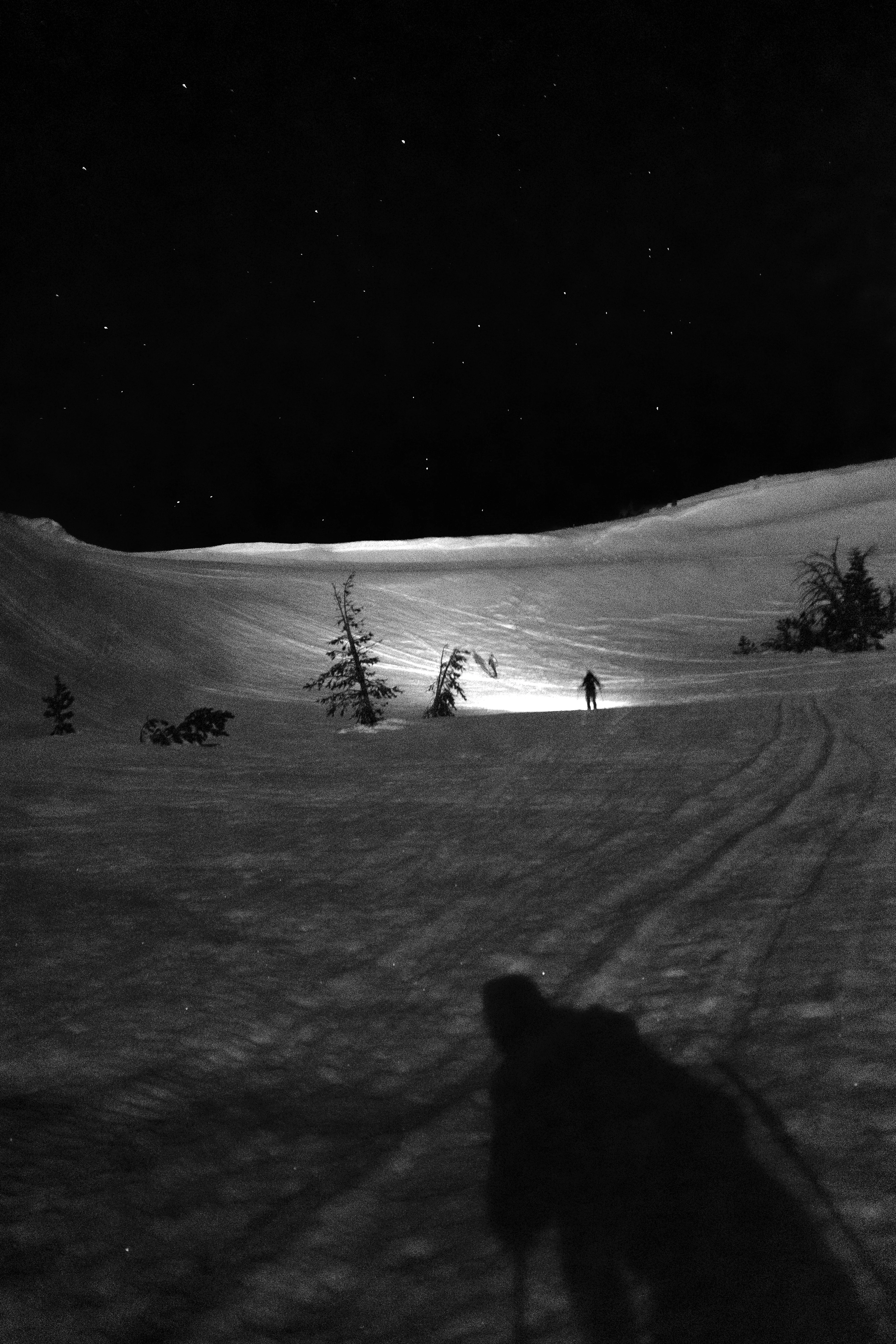
Ducking the road closed sign, we hop on the 39—a closed stretch of road continuously eroding along the angle of repose and no longer maintained by Caltrans. The snow is a little grabby at this elevation, and the grade not quite steep enough. We go into pseudo-tele mode. We settle into a zone and crank with massive views of a sleepy Los Angeles basin ahead of us and the most remote corners of the San Gabriel blanketed in white behind us.
We drop our packs and skis at the gate, which comes to bite us after 1.5mi of road walking where we reach another gate. We walk another 2mi to the car, grab it, drive to the lower gate, and walk 1.5mi up to grab the gear and another 1.5mi back to the car. I was mildly frustrated at the mishap as it was about 4am when we realized the mistake. But we warmed up in the car for a few minutes, popped some caffeine pills, and really charged up the road with all the energy and gratitude of the experience we just had. It felt like a victory lap. Back to the house at 7am.
No documentation of the descent because my hands were frozen and I was blissed out. Once in a life-time tour. Words can’t describe. Feeling so fortunate to live here and have a friend in Alex up for so eager to take on the unknown and share peak experiences with.
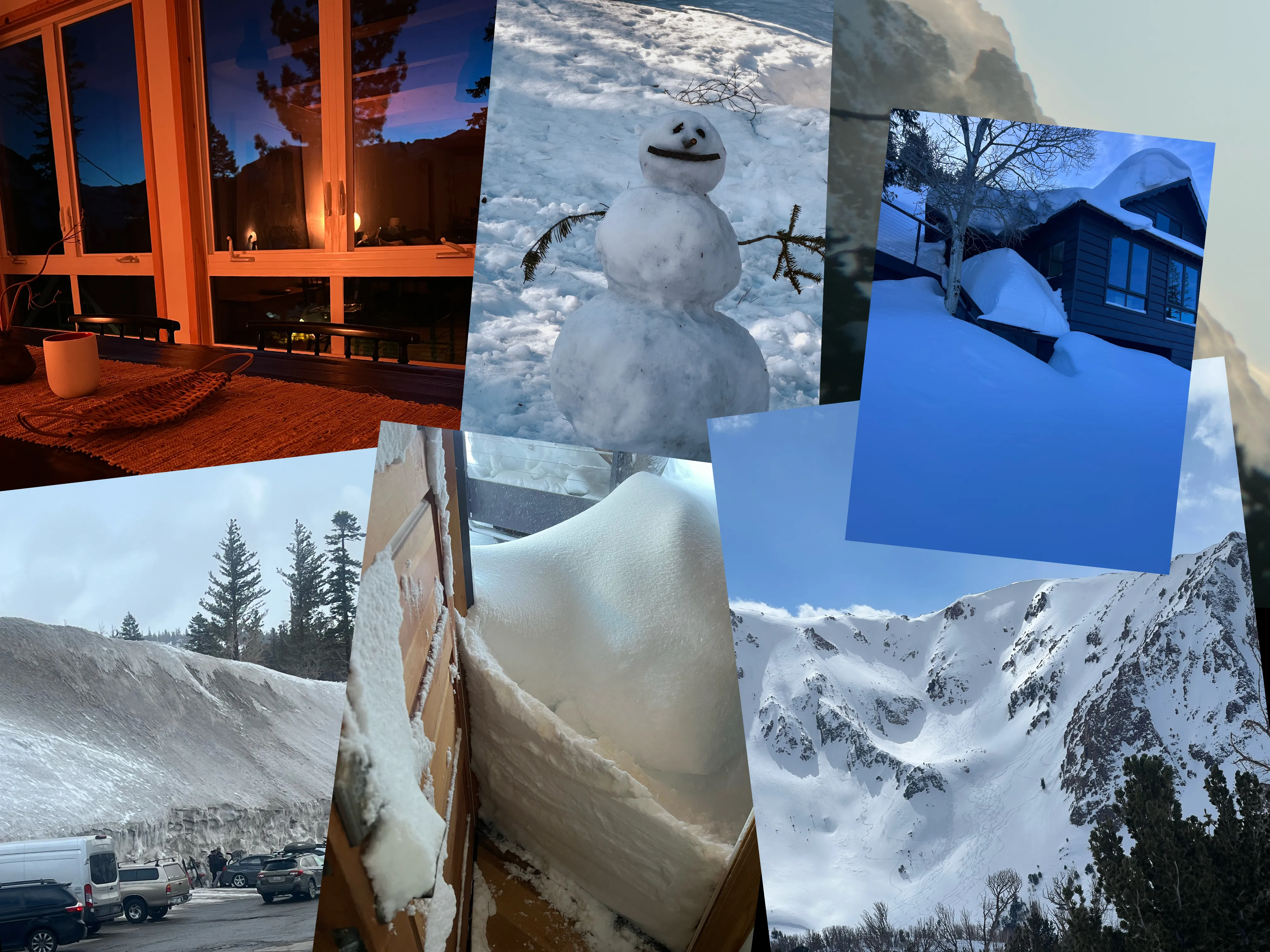
I intended to write this after the snow had melted. Until the winter felt truly over. But sitting here now on my couch, writing this in late October, I can see snow almost a year old out my window on surrounding peaks.
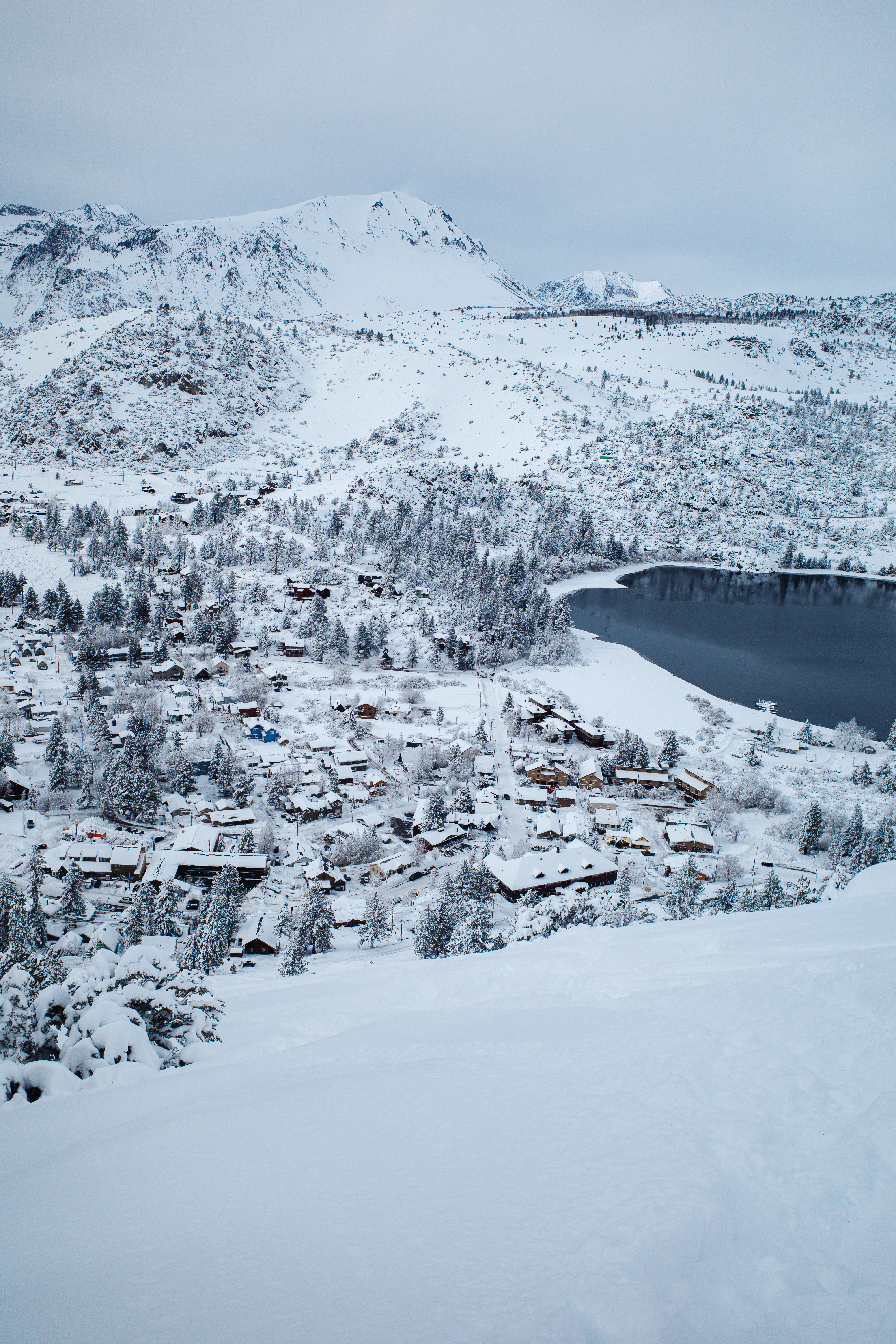
I’d been living over the summer in June Lake, an alpine town of four-hundred in the Eastern Sierra, and knew the winters could get intense. About three-hundred inches is the average—it sounded astronomical. Talking to neighbors after moving in calmed the nerves.
“Yeah, it’s hard for maybe a week total each year, after big storms move through, but generally easy.”
The house cantilevers off a forty-five degree slope. A door at street level leads to a dark storage area beneath the primary floor. Cords of wood are stacked floor to ceiling, enough to heat the place through the winter.
The first snow system of substance drops several inches the evening of November 2nd. Every few days a few more inches accumulate. The ski resort twenty minutes south, Mammoth, opens a week early on the 7th.
Having never skied before, now seems the time to learn. Backcountry ski touring is goal—a way of staying active when snow blankets the trails, and means of gaining access to fresh snow each day.
This winter is unique. Warm, wet tropical air moves in off the coast and hits the Sierra crest. Atmospheric rivers. Rain is rare in the winter. Temperatures are cold, but these pockets of air are relatively hot. Sometimes it rains when the leading edge passes through, creating an upside-down, unstable snow pack.
When this happens I get a call in the morning from my new friend, Chris, who works for Mono County. “Hey bud, things are looking pretty unstable and loaded. We’re issuing a mandatory evacuation.”
My street, line with around ten houses, is one of only three streets in Mono County to receive mandatory evacuations. Last week a few houses were taken out down in Aspendell in similar conditions.
Not wanting to be the ultimate kook and die of an avalanche asleep in bed, evacuating seems reasonable. A neighbor down the street mentions sleeping with their avalanche transceiver strapped to their chest, backcountry snow shovel next to their bed.
“If you don’t hear from me tomorrow, start digging.”
When evacuations are ordered I call up a few friends who work at local hotels. My favorite is located across the main drag of the 158. From the couch on the second floor rooms I can see my house, and the bald sloped snowy face behind it. Not wanting to be in the house if it goes, I sure would want to watch from relative safety from across the street. What a show.
In total, I evacuate five times over the winter—the longest period for almost a full week.
The 158 leads from the 395 and through the horseshoe shaped glacial moraine called the June Lake Loop. Driving westbound into town, the road passes Mount Downs. It’s not particularly astounding compared to the jagged fourteen-thousand foot peaks ahead. But there is one avalanche prone steep gulley.
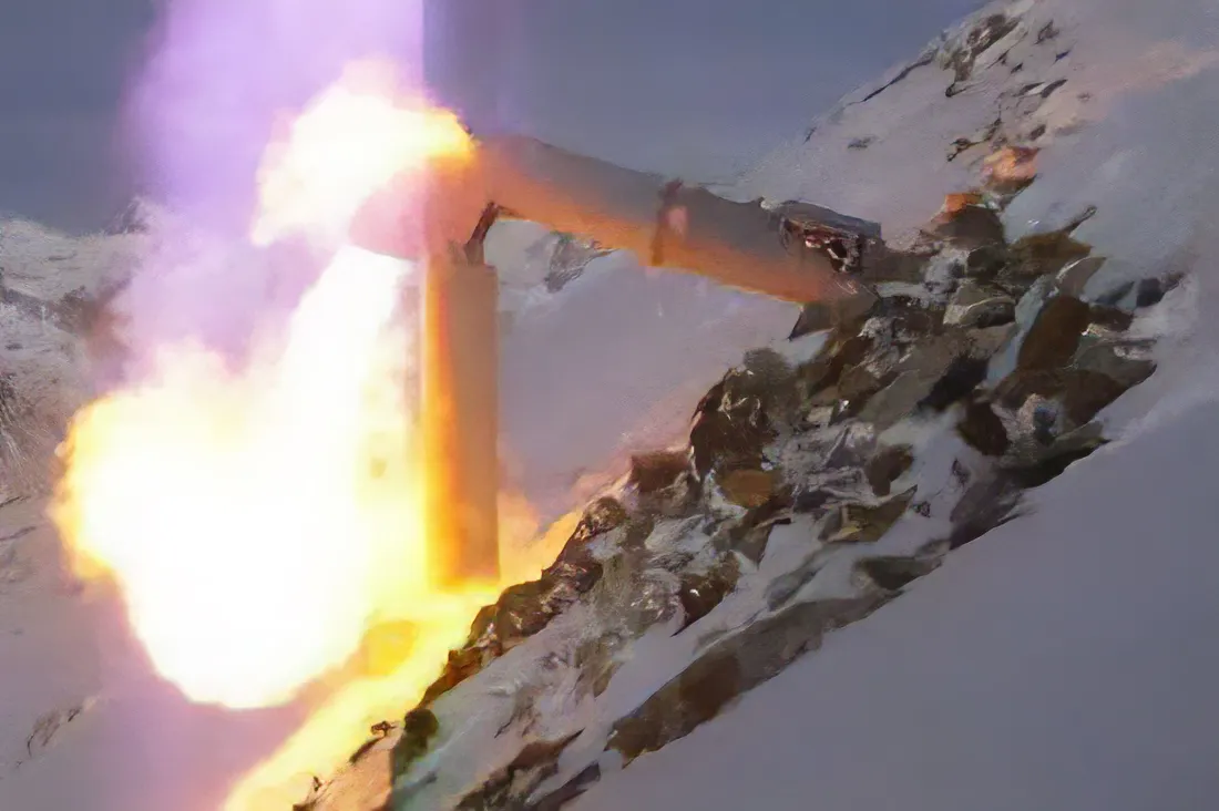
Thankfully, the California Department of Transportation has placed a series of Gazex systems within the gulley. Metal tubes jut out of the mountainside, fill with natural gas, and are then ignited. The blast produces an acoustic shockwave, triggering unconsolidated snow to slide and stabilizing the chute.
Sitting on my couch one night, snow falling outside the windows, the entire loop lit up like the afternoon sun was out. Massive booms shook the house a few minutes later. Impressive.
This process prevents a naturally occurring slide from potentially sweeping a car, carrying a powder hungry family, down a cliff and onto the ice-covered surface of June Lake—thank heavens.
Once a week over a three week period an atmospheric river system would bring rain and heavy, wet snow. With another system only a few days out, and the hassle of clearing the road after each storm, CalTrans simply left the 158 unplowed, blocked at the east and west gates.
When this happened in the past the town became entirely cut-off. There is no hospital. Emergency vehicles were stranded either inside or outside, along with everyone else.
A road was proposed, and then constructed in the late 1990s, leading around the north shore of June Lake from the entrance to the ski resort and bypassing the Gazex closures.
This makes life easier, but doesn’t solve all the problems.
While the North Shore route around the avalanche chute off Mount Down helps, it transportation challenges remain. Large systems also tend to shut down the primary north-south artery of the eastern Sierra—El Camino Sierra, also known as the 395. On these days the North Shore leads to a dead end, and the June Lake Loop is again entirely cut-off.
These were some of my favorite days of the winter.
Snow is unstable after a storm. It doesn’t like rapid loading. That could be a person skiing, natural rockfall, or simply rapidly deposited snow. It needs time to settle, discouraging skiing immediately after a big dump.
Waking up on mornings when the highway is closed is the best. Your eyes open to the sun peaking up over the ridgeline, bombs echoing off cliffs at the ski resort—only a quarter-mile from doorstep to lift for me.
June mountain is unique. Only a small ticket office sits adjacent the parking lot. A single chair—wooden, with room for only two—takes you from the parking lot to the main chalet, where the rest of the mountain is accessed. Something more common in Europe, but unheard of in the states.
The ride takes about 13 minutes—anything but high-speed—giving you plenty of time to take in the scene, and make small talk when sharing the open seat.
On the biggest days, only this first chair at June Mountain spins. But this is fine by me. The terrain is all steep stuff, double black, and endless fun.
These days are spent lapping the first chair with maybe 10 other June locals, and a handful of tourists who make it out of the hotel room. 4:00pm rolls around and there’s still plenty of undisturbed lines to be had the next morning. It’s magic.
After each snow storm, and handful of snow plows begin clearing roads. Some are pickups fitted with plow attachments for clearing parking lots at hotels. The county brought in a few smaller wheel loaders.
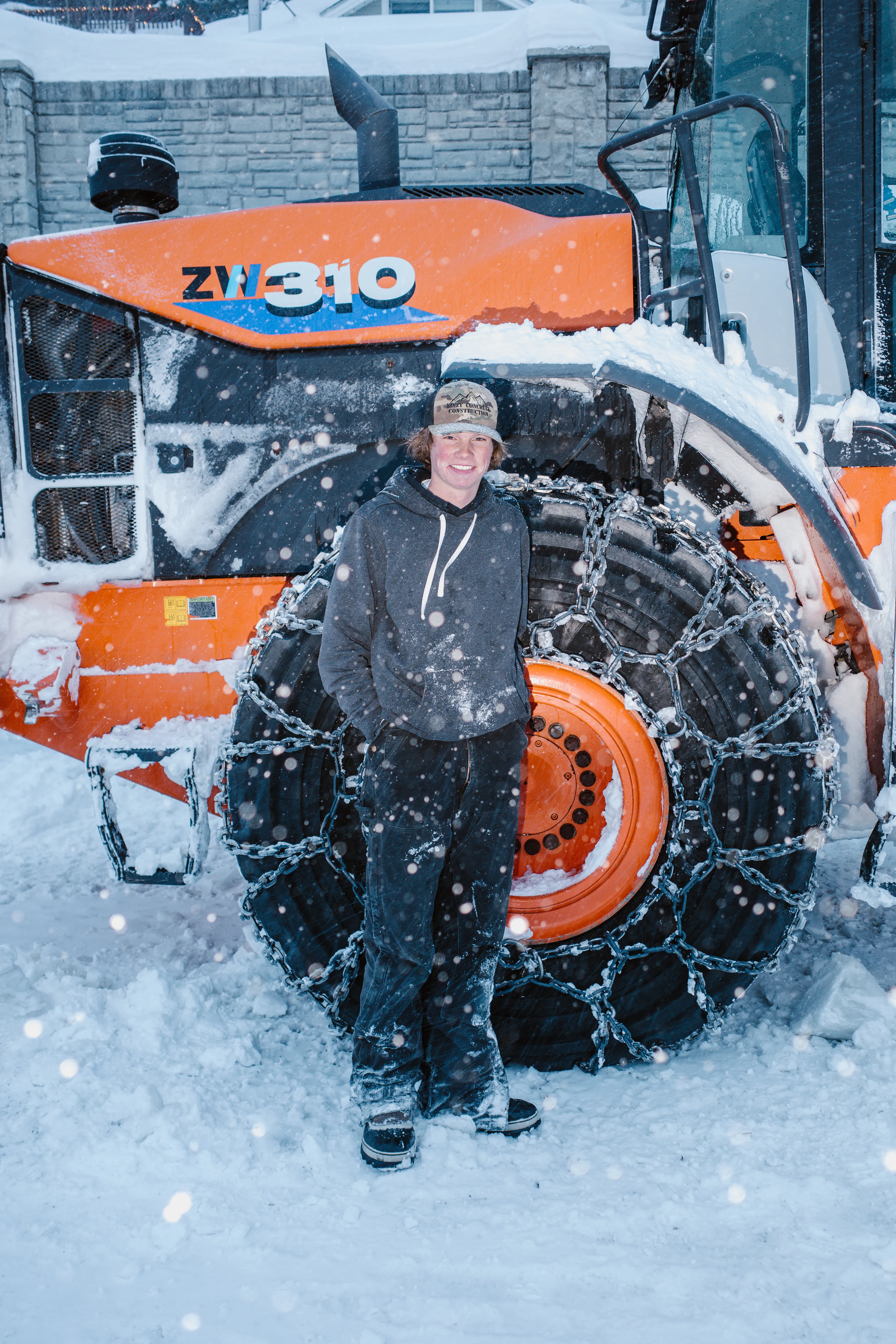
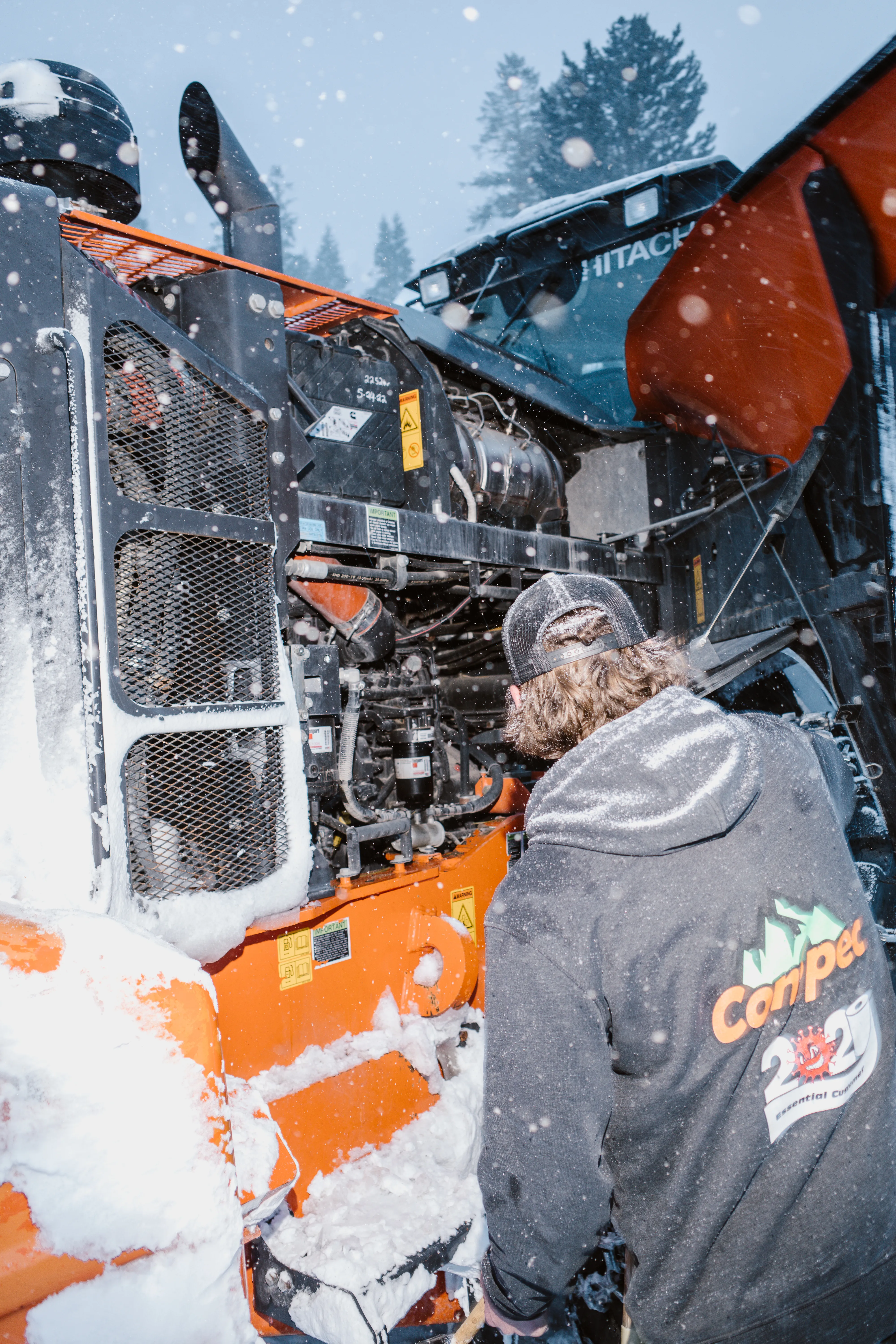
But the biggest, baddest loader is a bright orange Hitachi ZW-310, driven by a kid who goes by Murt. He absolutely rips up and down main street, both forward and in reverse, in white-out blizzards, neck craned backward to reduce the chance of crushing any cars, or at least get a good look at them if he does.
I ran outside when I saw him shutting down the loader for the day. A Mercedes S Class, parked in front of the post office, had the entire side ripped off. It’d been sitting tarped up for about a week. “Did you see that car that got torn up on main?” I asked. “Oh, yeah.” “It was a Mercedes S Class!” “Wait, that was a Mercedes?”
He looks like he just got his driving permit. Fresh face, rosy cheeks. The dinosaur of a machine makes him look even smaller.
Some kids have a dog, but Murt has a Hitachi ZW-310.
The road the house sits on hadn’t been plowed in over a week. The slope in the backyard was too unstable to plow, the county was afraid it’d set off a slide.
Walking to the coffee shop at the end of the street, head down to ensure stable steps in the fresh snow, walking became more difficult. I was walking uphill. Looking up, it became clear the hill had slid overnight. Not a huge slide, but enough to leave a runout across the road.
Looking around, the slide managed to take out a neighbor’s gate, and push all the trashcans quite a ways down the hill. A berm piled up almost past the second floor of the their house.
Later that evening some friends came over.
“Right, park at the end of the street, because my road isn’t plowed. Climb over the berm, it’s pretty tall, maybe 16ft. Walk about 100 yards and then you’ll climb up and over the avalanche runout. A little ways further and you’ll have to duck through a snow tunnel and up the stairs to my door.”
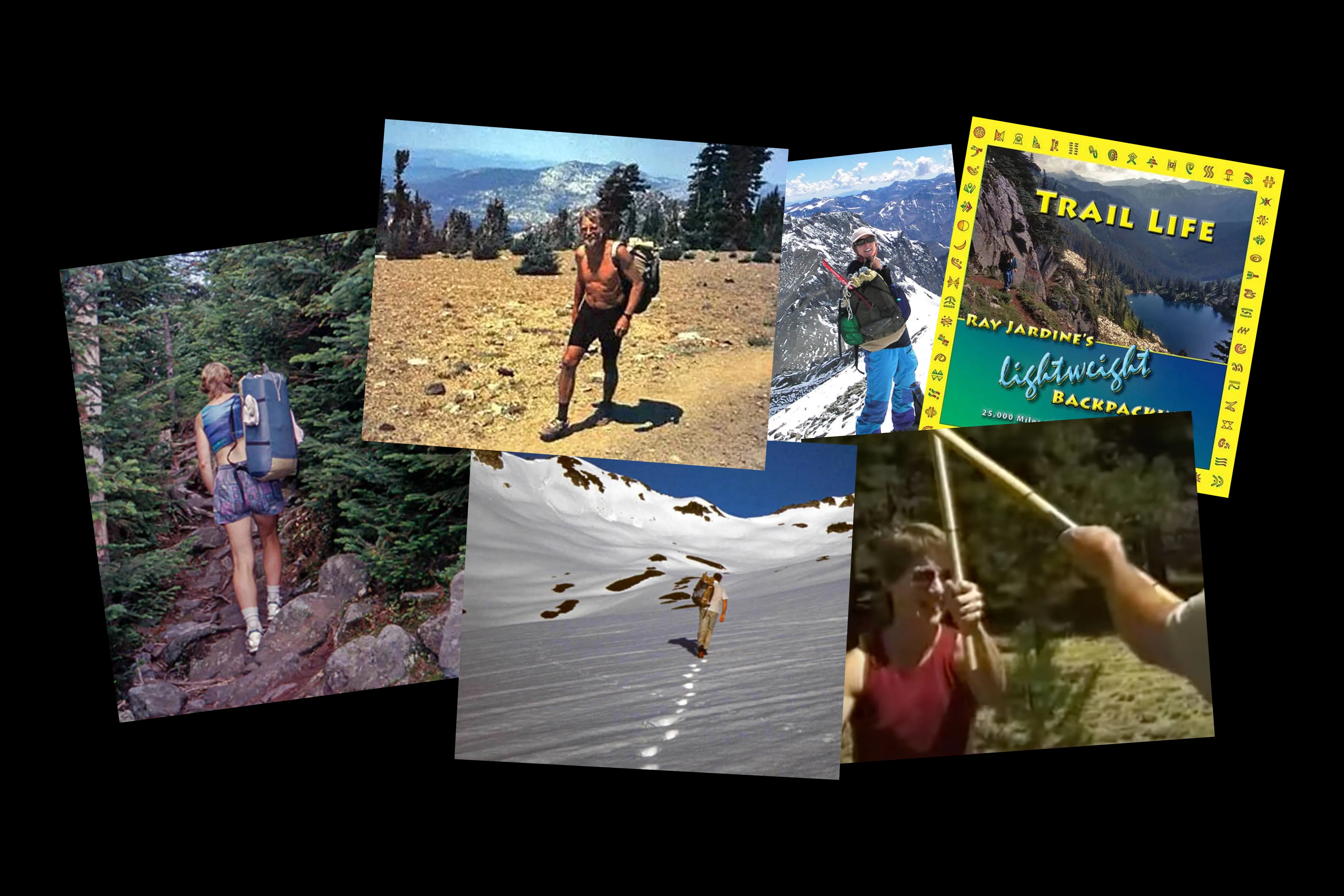
There’s an abundance of resources available on any topic. It’s easy to stumble into paralysis. When I was planning for the Pacific Crest Trail, the question of what to bring with me felt heavy in a literal sense. Each gram counts when you’re carrying it on your back for a few thousand miles.
Like any beginner, all I knew was I didn’t know.
One afternoon I scrolled across Ray and Jenny Jardine. Together they are true OGs of ultralight backpacking equipment. Packs were once heavy canvas bags with metal frames and chunky hip belts. The Jardines began creating their own packs that answered to their personal requirements.
Essentially trash bags with straps.
Single volume, silnylon, no hipbelts, or any other fuss. Ray often wore his pack slung over a single shoulder.
I could go on about the Jardines. There is a page on Ray’s site with highlights including:
Was the first person (with Jenny) to thru-hike more than three long-distance trails of more than 2,000 miles in length (1993)
Founded the American Long-Distance Hiking Association-West (ALDHA-West) (1994)
Coined the Term “Triple Crown” related to long distance hiking (1994)
Originated the “Triple Crown” Award (1994)
Presented the First Plaques to the Triple Crown Recipients (1994)
Ray and Jenny received the world’s first Triple Crown Award
To recap… He was the first to do a thing, then created a foundation for the thing, created an award for the thing, and presented the award to the first person to do the thing: himself. Truly a visionary.
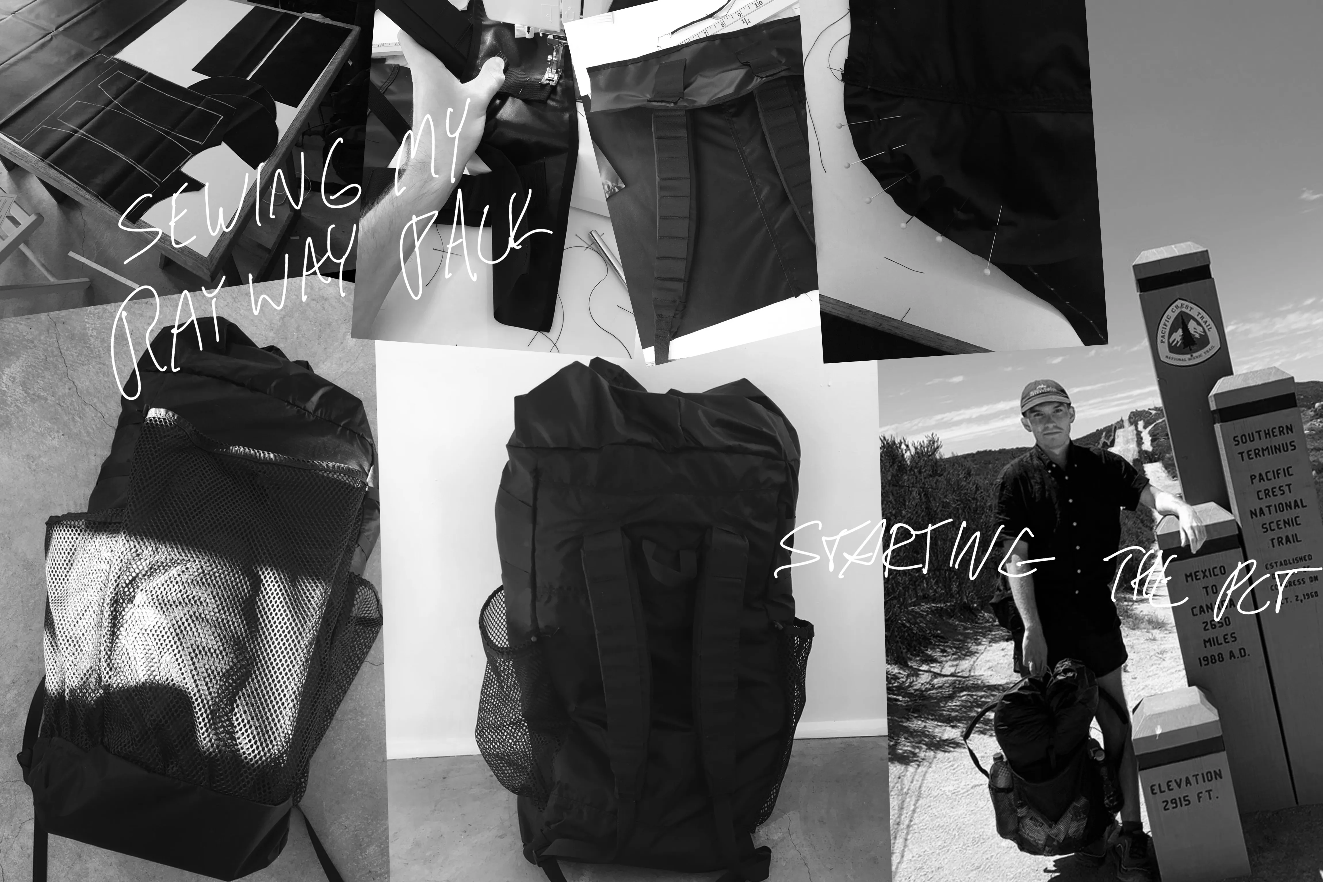
What excited me when running across Ray were the backpack kits. You can order the material, patterns, and instructions from Ray to create a Ray Way ™ Pack. I was convinced to give it a shot after reading an endearing essay, “Why Sew?”
Ray Jardine observed: “People will spend hours studying commercial gear in magazines and online. What do they get? Heads full of hype, closets full of superfluous gear, and depleted savings. But if they spent a fraction of that time making their own gear, they would spare themselves the hype and monetary loss, and would produce gear that is serviceable, satisfying and rewarding.”
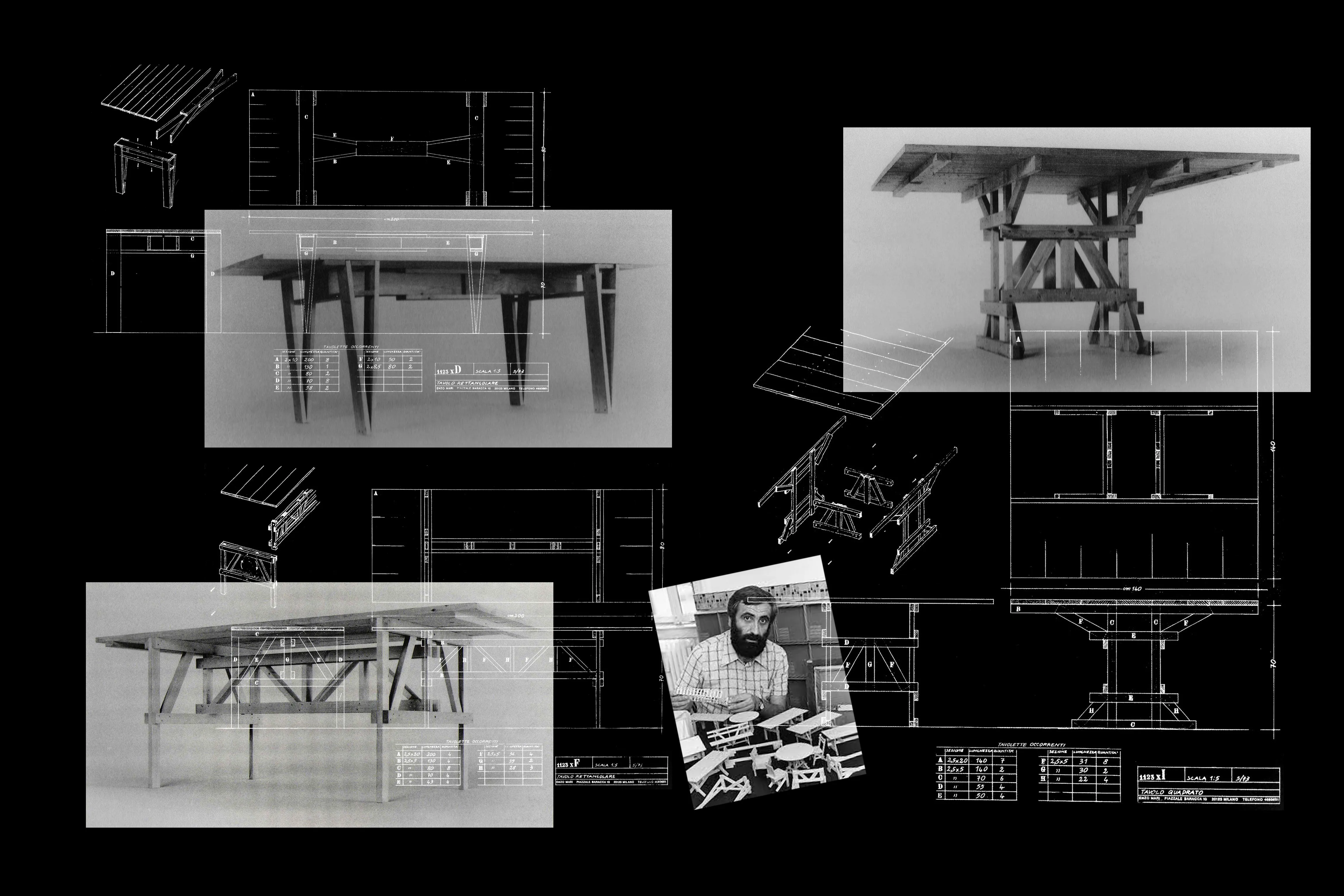
This reminded me of Enzo Mari’s Autoprogettazione, a project created to encourage understanding of what makes furniture good furniture. You’d mail order a booklet, find a piece of furniture, and build it using cheap and common lengths of wood, a hammer, and nails. There are no instructions; only self-describing illustrations.
The pieces are not only functional, but beautiful in their focused simplicity and modest material use. For several years I furnished each of my apartments with pieces built from Autoprogettazione. Each time I moved, to avoid the hassle of moving furniture, I’d list everything for free on Craigslist. “Free Midcentury Italian Table.” It’d be gone in seconds. And I’d start from scratch and iterate at the next spot.
After a few years I became pretty good at making simple furniture. Building pieces from memory, and adapting them to my personal domestic requirements.
And so I ordered for the Ray Way kit. It arrived within a few days, and I got to sewing. As promised, it was easier than anticipated. I learned what makes a good pack good, felt liberated to modify it, and capable of fixing it in the future. There was no pressure to baby it on trail, having flaws right out of the gate.
I carried it with me the first 700 miles of the trail, until entering the alpine Sierra Nevada. This stretch requires a bear can, ice axe, and some extra clothing. I also brought along a stove for morning motivation to warm up get moving, something I didn’t fuss with the rest of the trip.
It was easier to make a decision on what pack to grab for this heavier carry—now I knew what I was looking at.
Hands on experience is priceless. Critical understanding through practice. The knowledge is carried with you, and applied when making future decisions. Recognizing when and why something is good.
It’s not possible to build every tool in your box, but there are similarities between tools that make an experience relevant beyond an immediate application. Packs, bags, shelters—even clothing. Using silnylon once makes you more confident to repair other gear. But having a set of instructions, and working on something you crafted helps relieve the pressure of farming your first more demanding repair job.
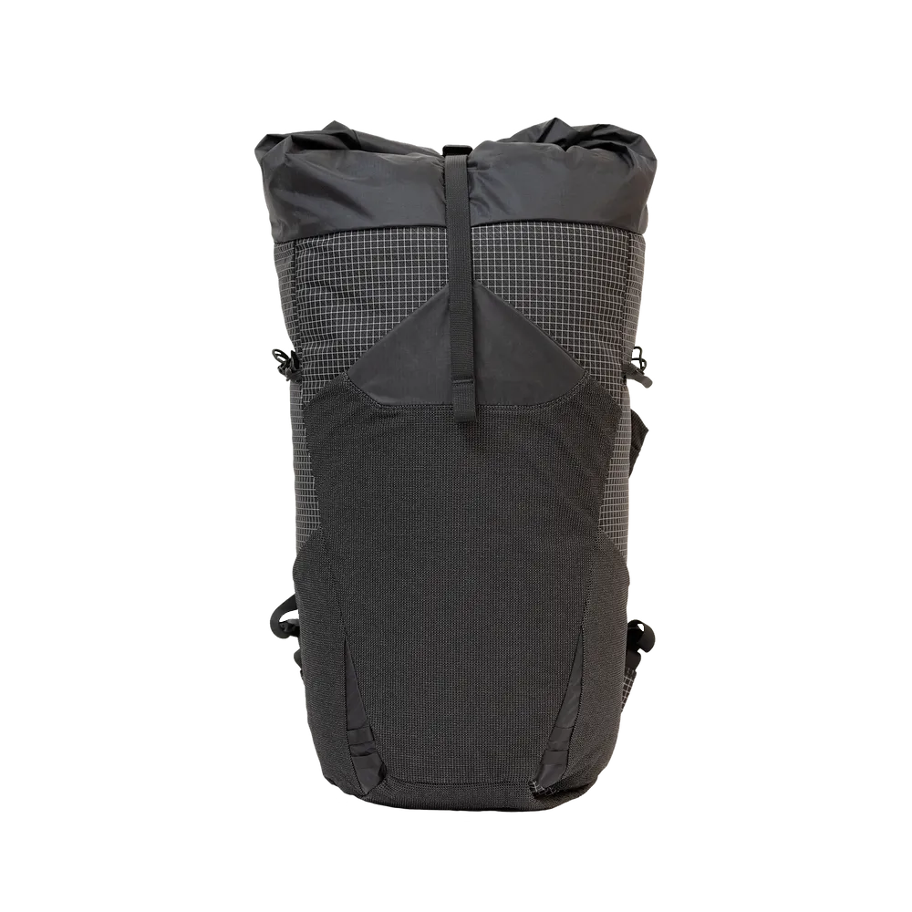
One of my favorite packs is the Pa’lante Joey. It uses nylon ripstop to create a single volume and has vest-style straps. While I could’ve made something similar myself, I recognize the craft that went into the Joey, and what Pa’lante is trying to do.
There’s a satisfaction in supporting people going out on a limb and doing good work. In purchasing a pack from a cottage company like Pa’lante. Helping to sustain a small business making good gear accessible more to people. They’re generally more nimble than larger manufactures, and experimenting on the edge.
Or grabbing a bit of kit from a larger manufacturer who funds experimental projects, like Goldwin and their Goldwin 0 series of campaigns by OK-RM.
According to Goldwin 0: “A garment is made from materials and energy. An intergenerational garment is made from all the materials and energy it has saved; by rendering their production unnecessary. Functionality and performance are not incompatible with ethics and responsibility.”
The clothes come at a premium, but ultimately a purchase goes to funding experimentation and new material use. The hope is, as process is refined, these techniques make their way into more common offerings.
My Goldwin jacket got a cut from the edge of a ski when shouldering them to the car. My familiarity with repairing technical fabric from fixing my Ray Way pack freed me up to make a simple patch repair with confidence.
Goldwin isn’t required to do the research, or fund interesting projects like the OK-RM campaign. The gesture goes a long way towards motivating me to support the effort by making a purchase.
So in thinking about gear, all of this leads to a loose manifesto:
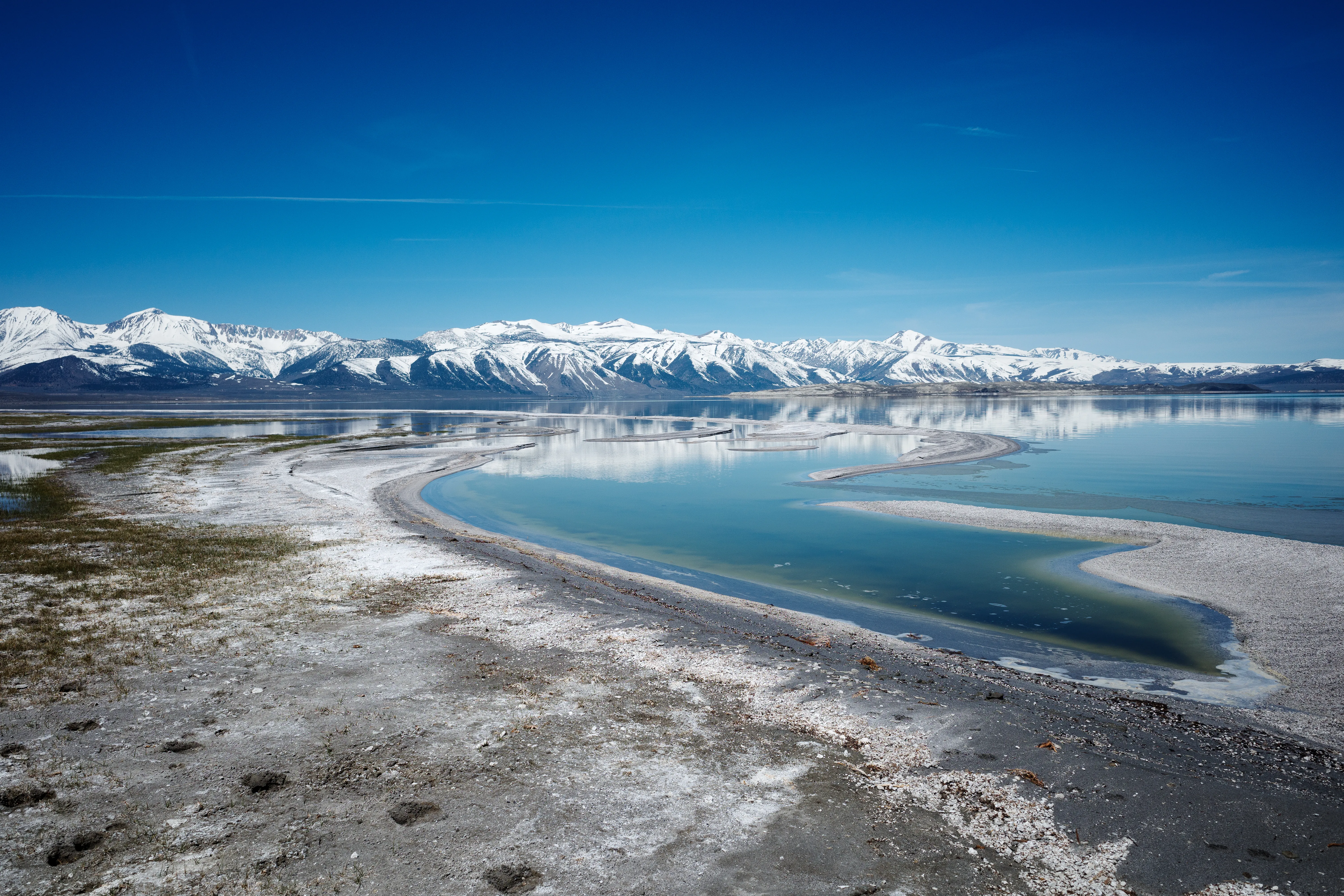
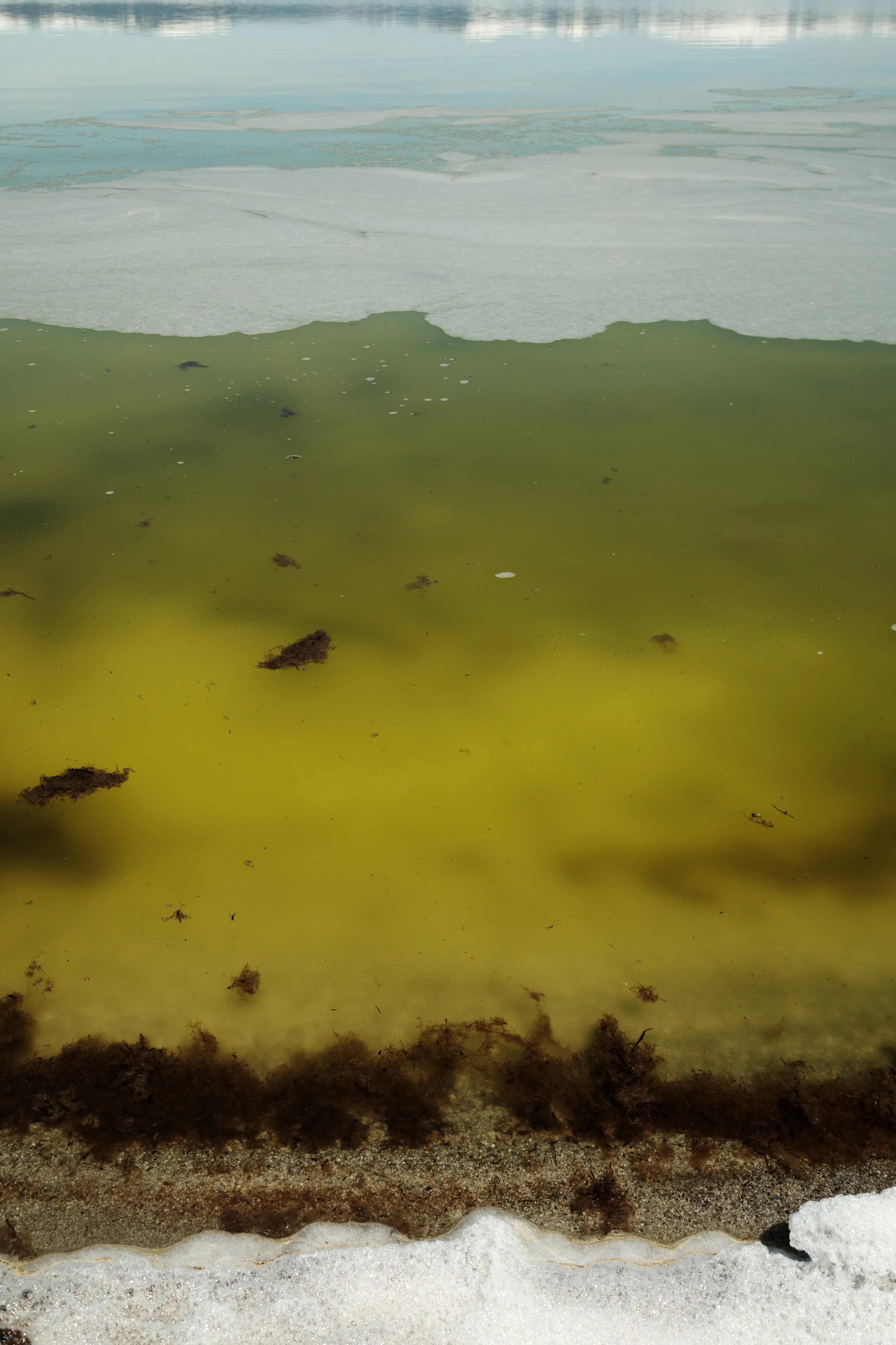
The water of Mono Lake is unlike other bodies of water. It’s hypersaline and alkaline, thick and viscous. On days with calm wind, the amplitude of each wave stretches like elastic. Elongated and skewed towards horizon. Like the oceanic planet in Tarkovsky’s Solaris.
The Mono Basin might be the closest you can get to standing on an alien planet without the hassle of actually traveling to one.
Last week my good friend Ethan hosted a pizza topping potluck. I brought oyster mushrooms, ricotta and basil. We tossed ideas around while tossing toppings on the pies.
“…could be fun to run Mono Lake, you know?”
“Sand… a lot of sand… ”
“40 something miles, right?”
We glanced around…
“Sign me up!”
As the date approaches there’s a hint of hesitation on my part. The Bishop Ultra is a week after our planned date to run Mono Lake. I’ve signed up for the 50k. My performance in the ultra would be affected.
Running mono and running the race are goals of a different type, and surfaces questions of motivation.
“What is my focus?”
I decide to run the first half (20 miles) of Mono Lake, and leave the question of “do I complete this, or prioritize the ultra?” up to the moment.
8:16am · Mile 0
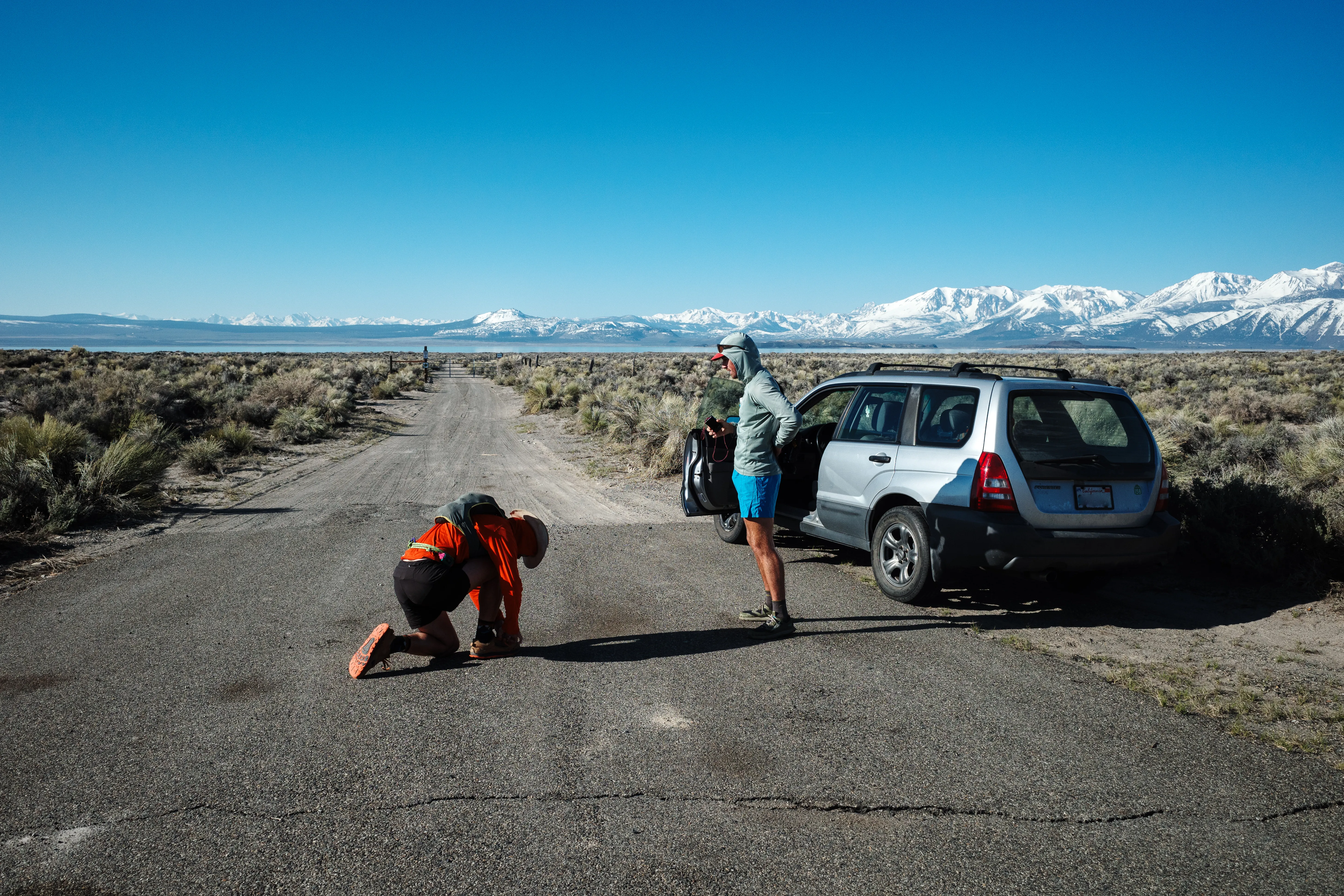
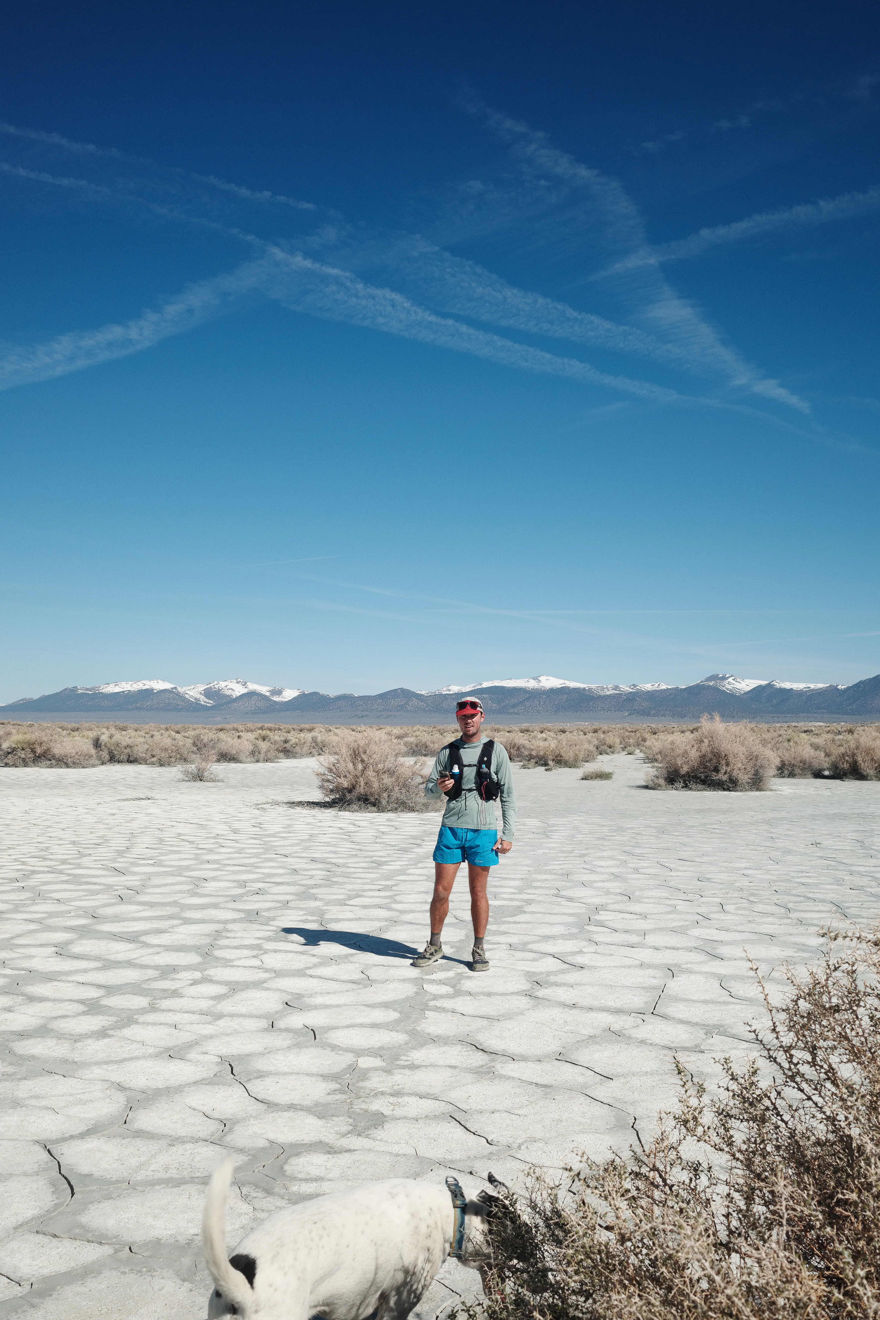
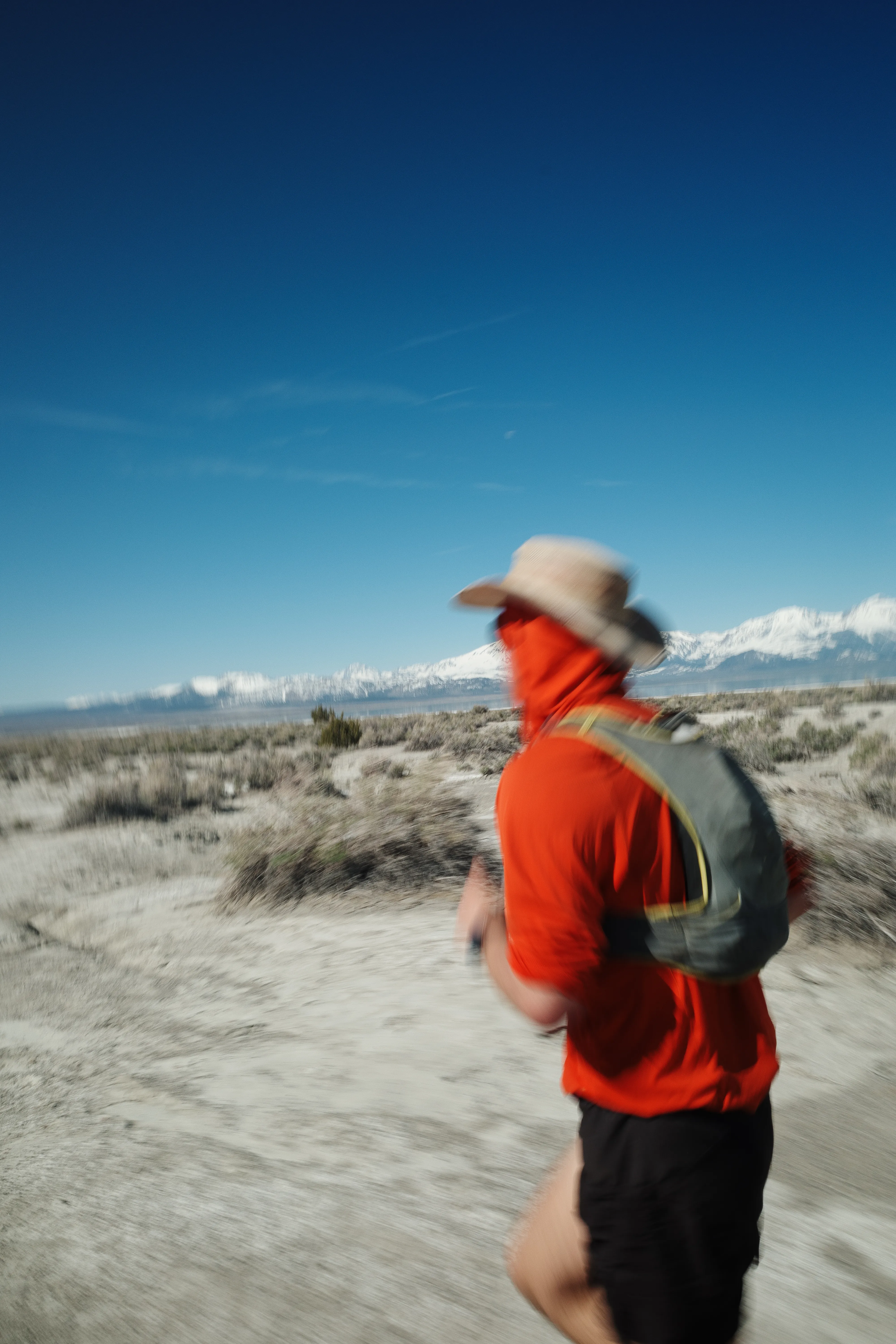
Here we are, standing at the north shore on a crisp early May morning.
Lucas’ dog, Spot, is running laps around the three of us as we do that awkward pre-run dance. Stuffing running vests with snacks, and swinging our legs around like we’re fighting off some invisible Force of the Lake.
Lucas placed the final piece of his kit on his dome, an oversized cowboy hat.
And just like that, we get moving.
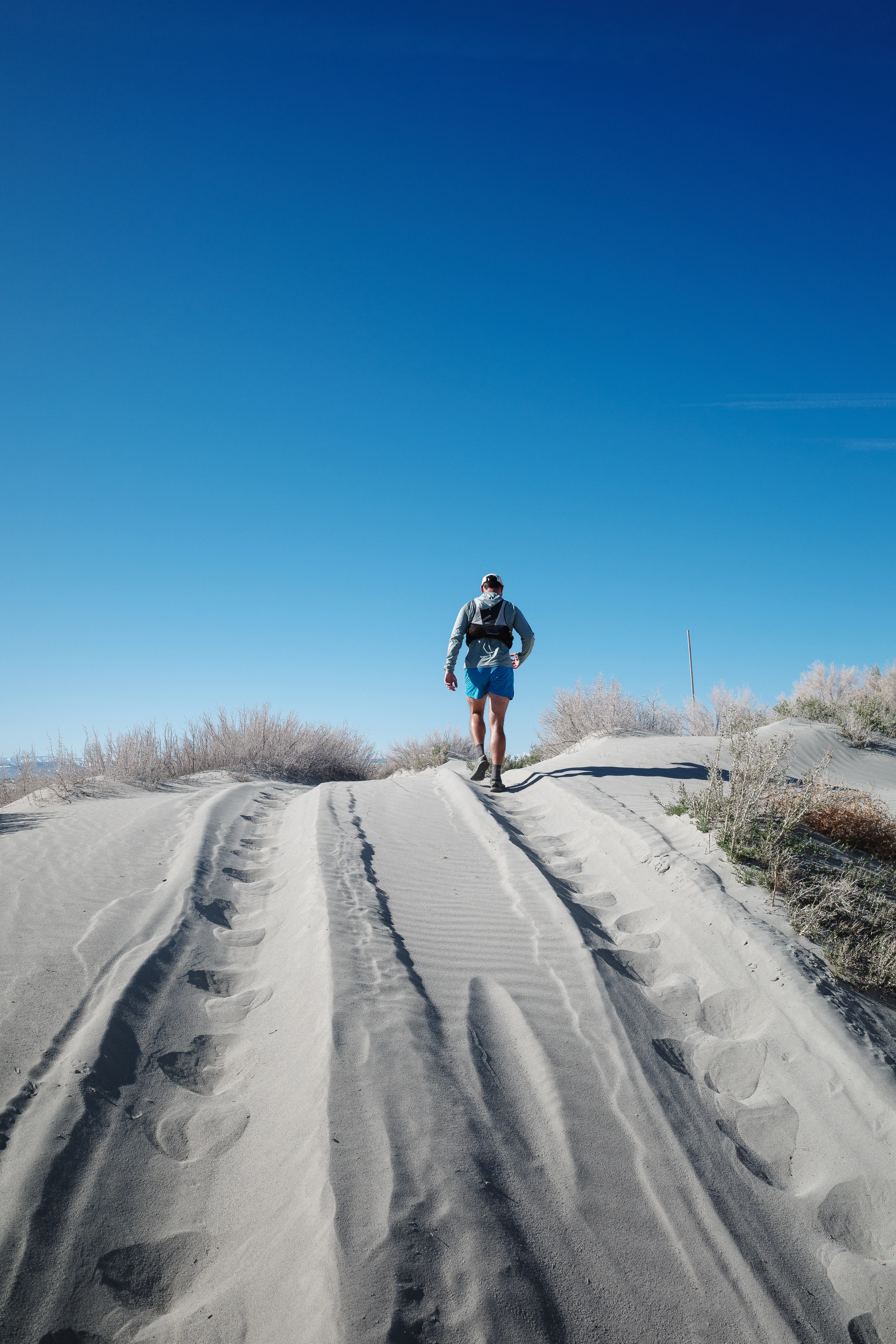
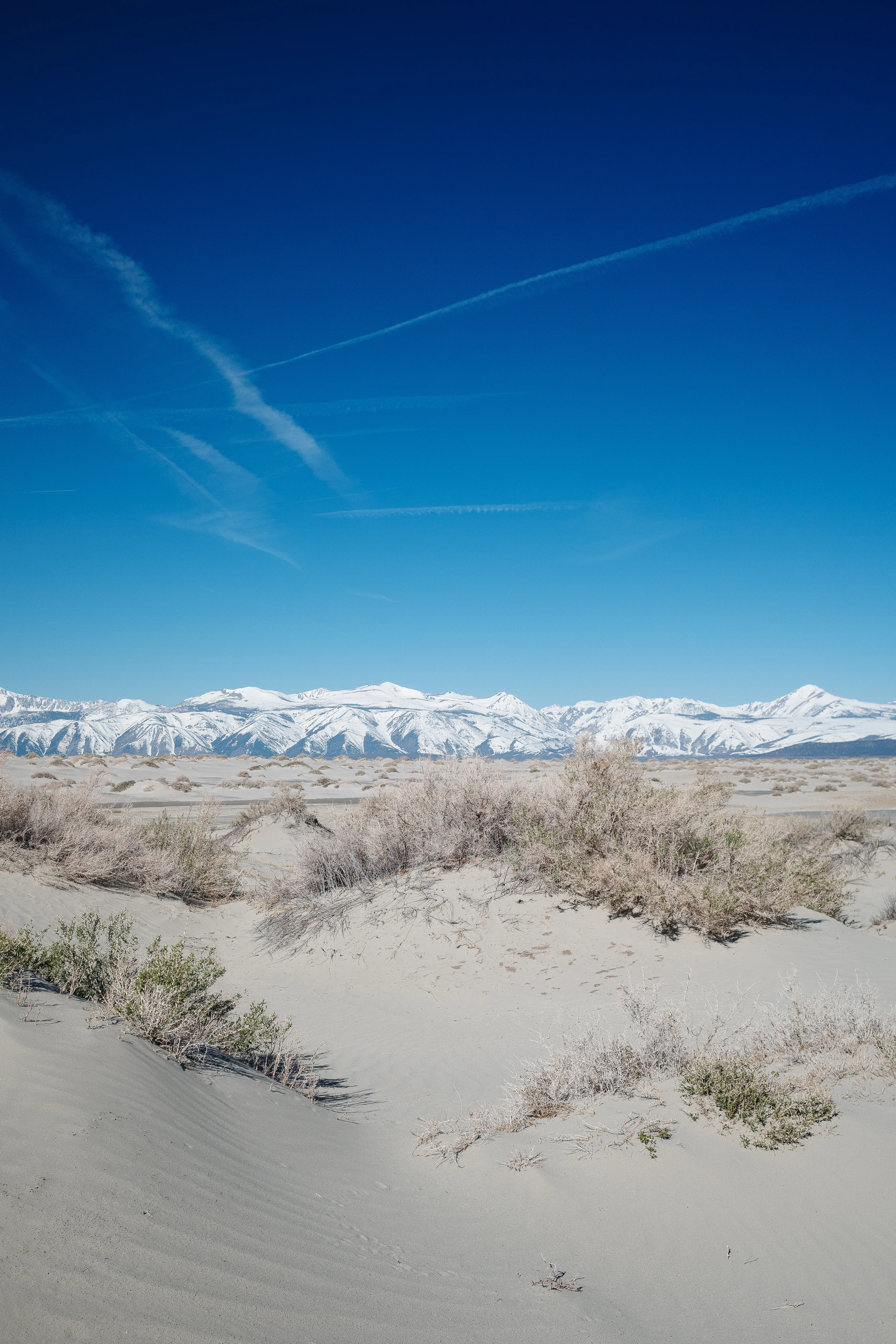
About that sand mentioned a few weeks back. It’s no joke, and all consuming within the first few minutes of running.
This isn’t sand you run at the beach, compacted by waves lapping. These are loose dunes, not doing any of us any favors.
Stakes in the sand mark where the road should be. The dunes drift season to season, wandering with breeze. Occasional gale force easterly winds, spilling over alpine passes, blow shoreline alkaline dust clear into Nevada.
The loose grains turn to bone-dry hexagonal clay plates. They collapse when stepped on, and emit a satisfying hollow timbred ting sound.
The full width of the Sierra between Bloody and Lundy canyons reflects in the Lake. Only within the past week did winter thaw out at our elevation. A unique perspective not many see from the north-eastern shore. Particularly on foot.
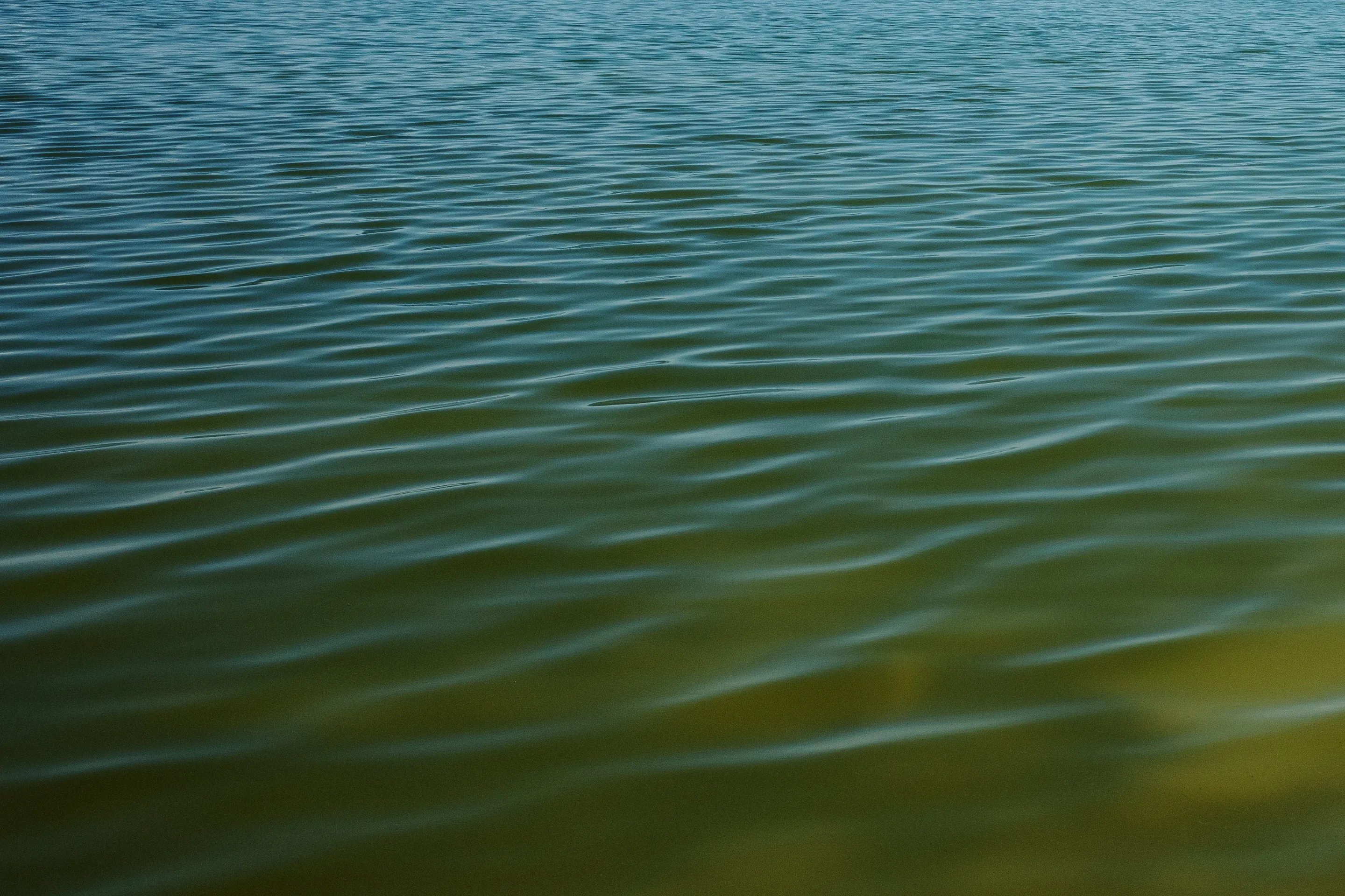
As the sun climbs higher in the sky the water’s tone becomes a deeper blue.
Lucas’ dog, Spot, takes off running after a herd of wild horses in the distance. There was nothing we could do to catch him.
About four-hundred wild horses live on the eastside of the lake. This winter was rough on them, with the record amount of snow making access to food difficult. There were rumors of a mountain lion stalking the herd. All of this has driven the horses closer to the lake, and has become a big interagency political project for wildlife and land management resources.
We’re still waiting for Spot, but after maybe ten minutes, he comes running back to us. Kicking up a cloud of dust and looking a little more tired.
A sense of progress isn’t obvious. We’ve been running for some time along this line of sand you could say resembles a road. The scale is becoming clearer through perception shaped by movement—not just what we see in-front of us.
We choose to drop down to the actual shoreline to break things up, contouring and gradually heading more westerly.
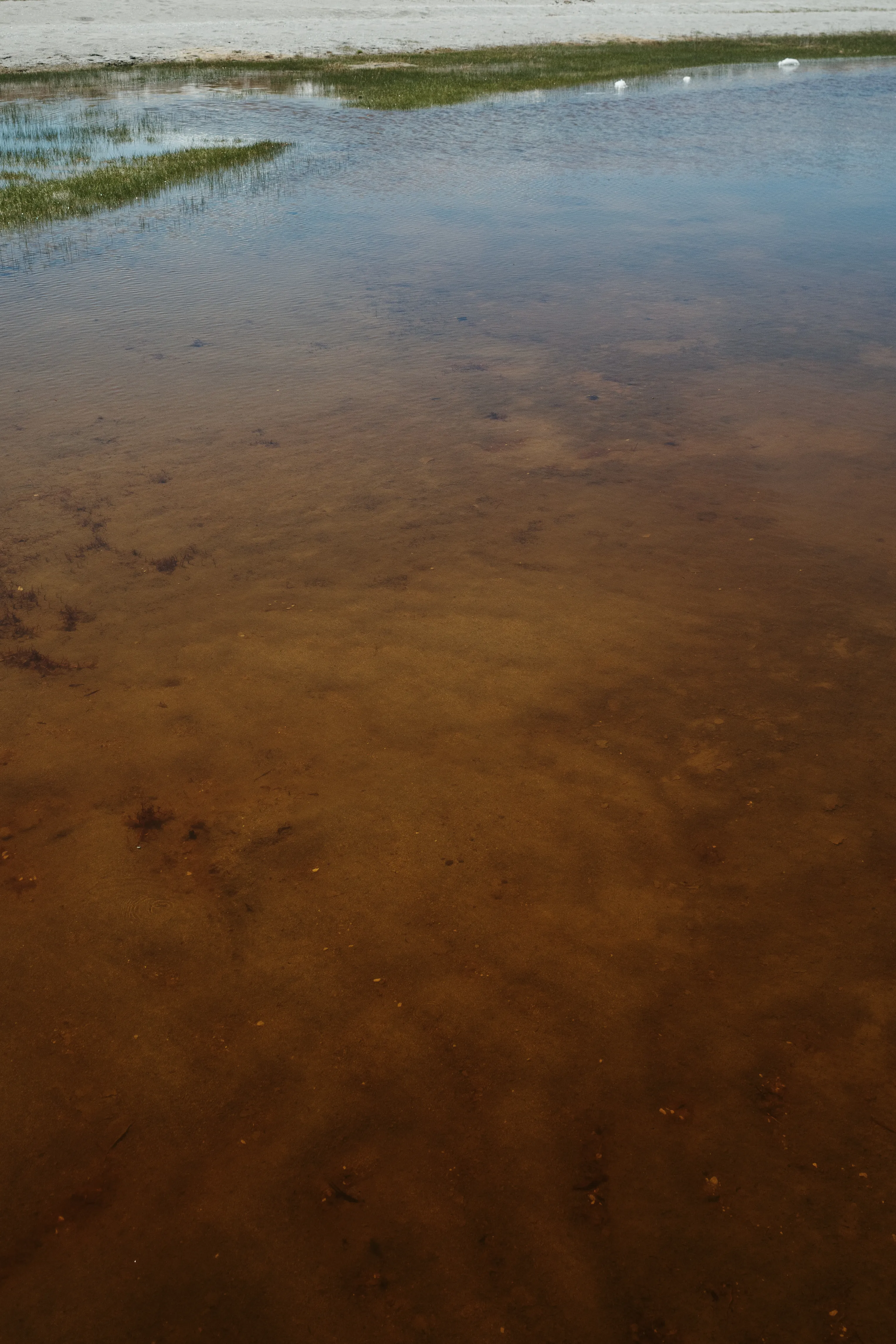
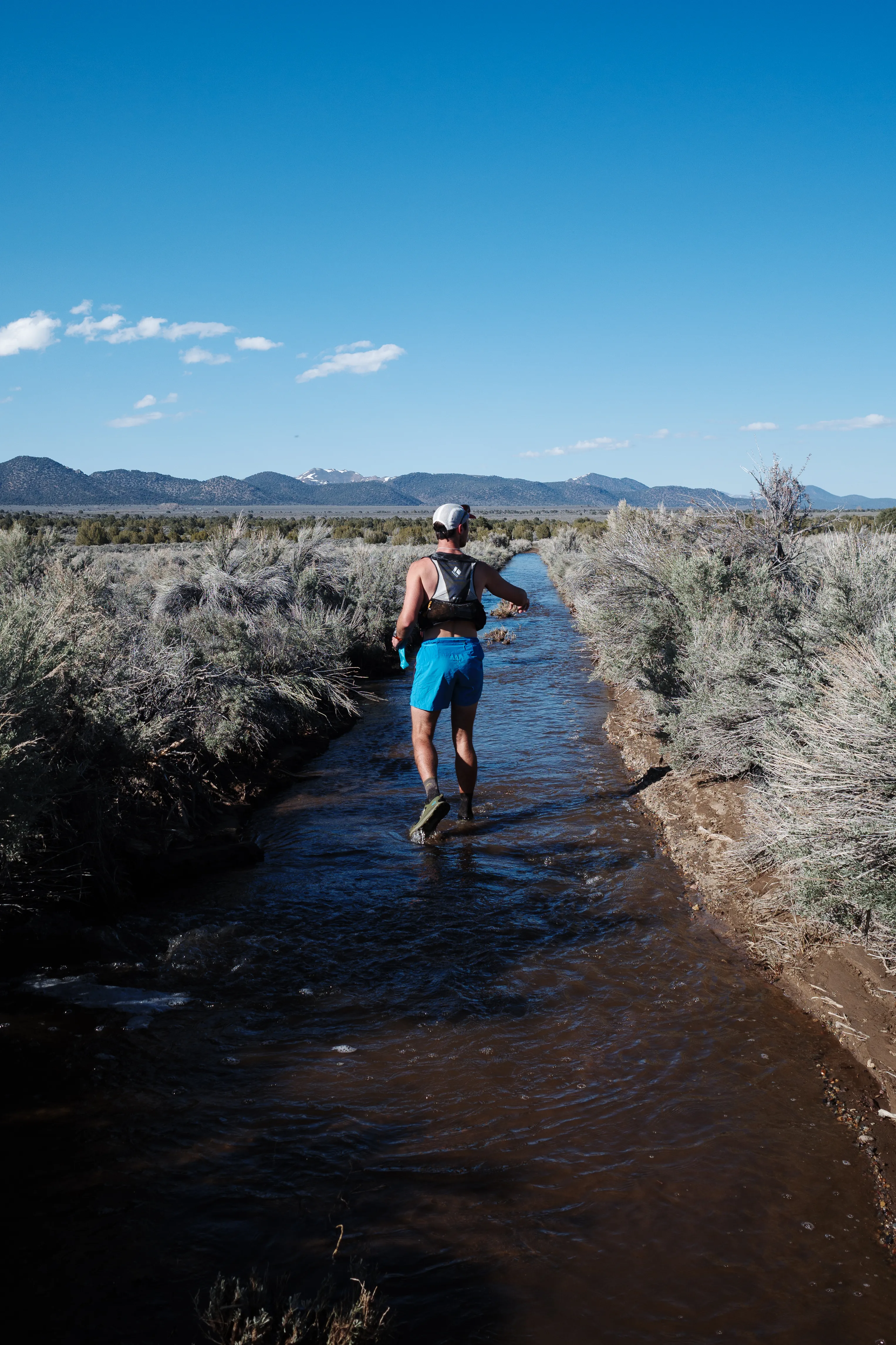
The turf becomes swampy, muddy, and surprisingly lush. Immense amounts of water from the record winter snowmelt remains at the surface. Wet feet progressively saturate with each step.
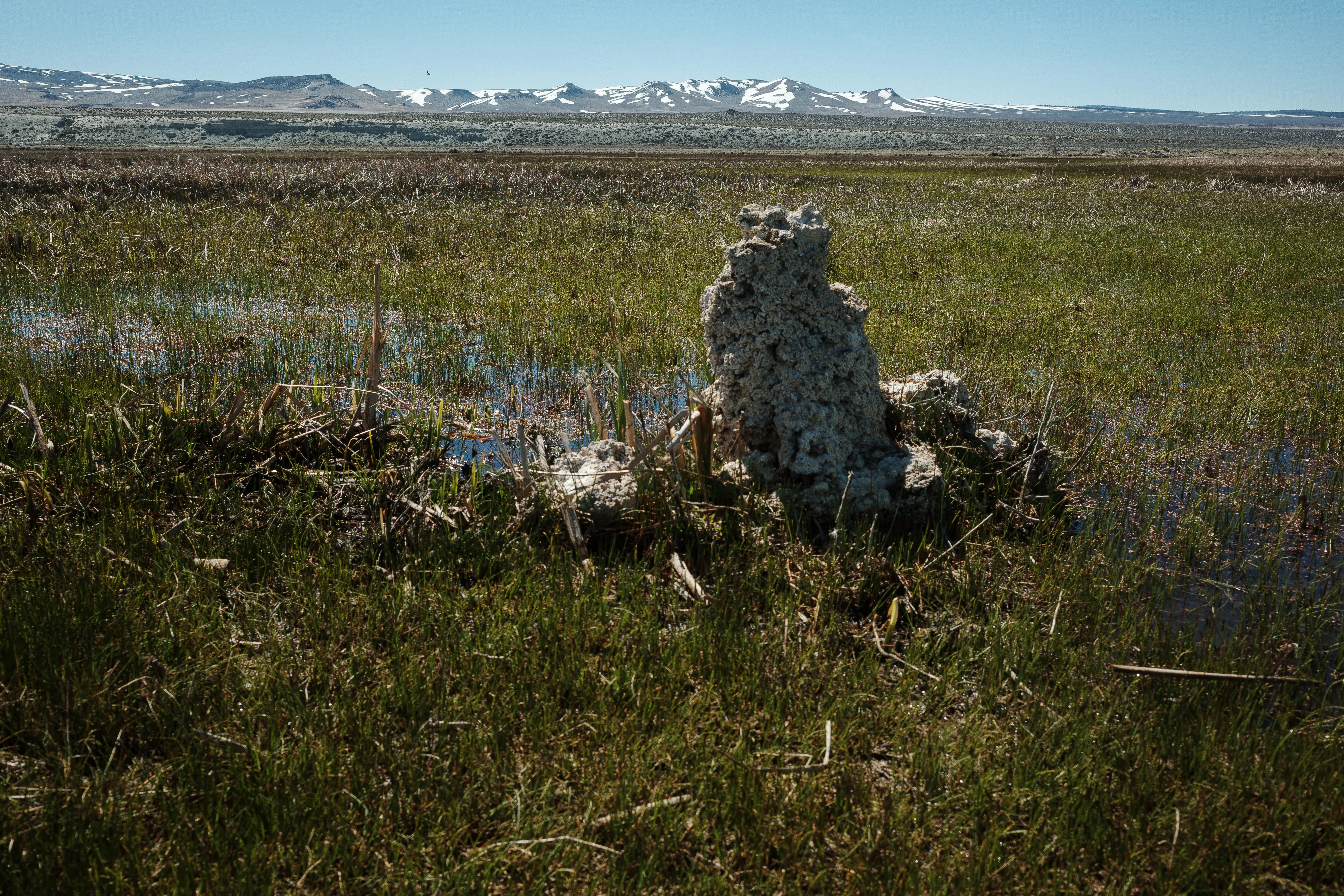
White columns of calcium carbonate, tufa tower, dot the expansive green ahead of us. They form when warm spring water percolates upwards from the lake bottom, and are only visible due to the receding volume of water in the endorheic basin lake.
The water is thick and slimy to the touch. Alkaline. The hues shift between burnt orange, azure blue, and emerald green. Narrow sandbars parellel the shoreline, the sand providing stable support one moment and swallowing your entire foot the very next.
It’s unclear if they lead to dead-ends, but we follow them anyway.
Ethan stops in his tracks, pointing towards what looks like a mummified mountain lion… or is it a polar bear? Reason tells you it’s not, but it sure looks like one. After a few minutes of debate we agree it’s an unlucky black bear who didn’t make it through winter.
Looking ahead, there’s speculation about what point on the horizon is the south tufa parking area. We’re getting close, but I find that never makes the distance go faster. Better to keep cruising and delay thoughts of snacks and stretching.
12:23pm · Mile 20
We step off the sand and onto asphalt, arriving at the van just past noon. Snacks sprawled out and foam mats on the ground. The first half went by surprisingly fast.
Lucas and Spot are planning to meet us again in another ten miles with more water and snacks. Ethan and I set back off down a dirt road paralleling the shoreline.
After a mile or so we begin settling into a focused cadence. Step after step becomes a drone of muscle movement. Steps syncopating with the heartbeat.
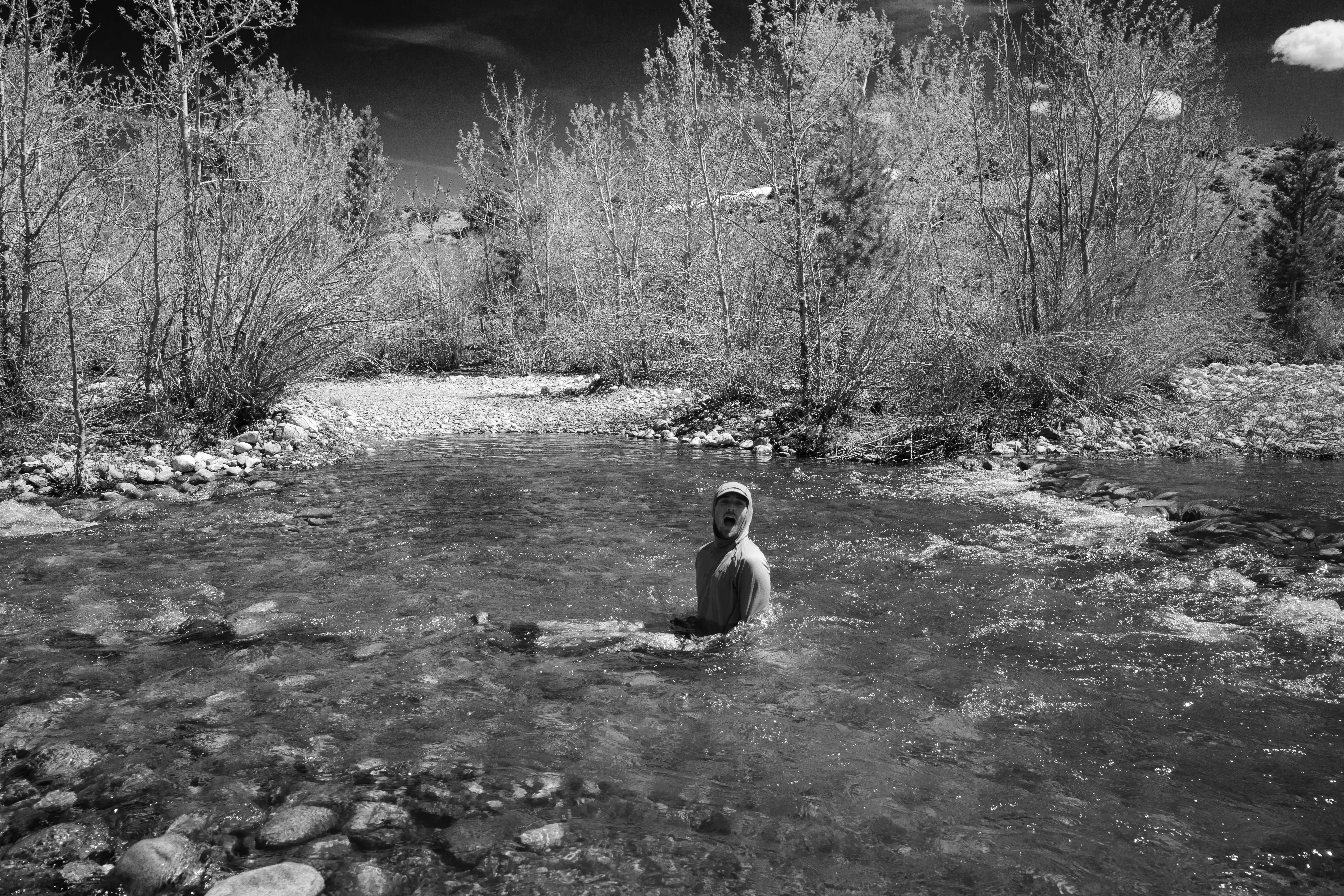
It’s beginning to get hot in the midday sun. A mirage appears; a stream of cold fresh snow melt crossing perpendicular to our path. Ethan hops in and dunks his head—an alpine baptism of sorts.
The water is incredibly refreshing, and we freeze for a few minutes before completing the last few miles of the leg. Within a mile we’re bone dry again.
The Mono Lake Visitor Center comes into view, and a beat later Spot is running our direction, leading us to the van.
3:15pm · Mile 30
We plant ourselves at a Picnic table and Lucas serves up fresh grilled cheese. Incredible. I stretch out and camel up. It’s nice to take little breaks, but each stop requires overcoming more inertia to get moving again.
This next stretch requires running a few miles of the 395. Semi-trucks barrel past us, and vans packed with families scream by. Necks turn to rubber while looking at us, in a “what the hell are they doing?” kind of way.
This is the mental crux of the day, but the views to the east over Paoha Island make up for it.
We pass the Mono Lake Inn and hook a right onto cemetery road. At this point we’re feeling increasingly sun fatigued. Pulling up to a fence, we lay down to stretch our legs.
It’s a good thing we did.
A few miles sit between us and reaching the 167—back to the start. The sand in the distance is a darker hue, and it becomes clear why;
Mud. Miles of mud.
Thick, gloppy, knee deep. The snow in the hills to the north is rapidly melting and cascading into the basin. I try to avoid it for a few hundred feet, but accept the inevitability that this is going to be messy and slow.
In a way, it’s a nice reprieve from the running. There’s no chance of efficient movement in this mud. A good excuse. Each step requires as much—if not more—energy than the pace we’ve been at, although the impact sure is reduced.
The cadence slows down the sense of time, and it drags on until finally Pole Line Road is underfoot.
It’s the final stretch, and excitement is high. After a few miles the hard pavement begins taking its toll on my feet. I slow to a walk.
So close!
With only a mile left I rally, while Ethan seemingly breaks into a sprint up ahead. Just like that, we’ve arrived back at our start, the loop now complete.
We take a moment to appreciate it, then hop in the car and head straight to Mono Cone where I order two large milkshakes. Oreo. I feel more haggard after annihilating them than I did at the end of the run!
This one was incredibly special. It’s a great line, and I relive moments of it each time Mono is in view. Either by car driving the 395 North, on an afternoon run around the south shore, skiing over at June Mountain, or when panning around the area scanning topo maps while thinking of what to do next.
The Mono Basin is an incredibly special place. If planning to be in the area, set aside a day for Mono. If not, plan a trip. Stop by the visitor center. And stop by the Mono Lake Committee. They have the best bookstore on the east side, and the history of advocacy for the lake is remarkable.
“Alright, 2:45 a.m. See you there.” The weather has been warm, creating an isothermal snowpack by late afternoon. Instead of exhibiting a temperature gradient forming cohesion, the snow becomes a sludgy soup. Unpleasant for skiing, and increasing the risk of wet loose avalanches. Spring skiing is all about chasing good timing.
The Eastern Sierra has an abundance of classic winter alpine traverses. One particular route stands out, as it connects my hometown of June Lake to the nearest town featuring a well-stocked grocery store—Mammoth. Ask any Southern Californian about Mammoth, and they will likely describe it as a premier winter sports destination. Being gratefully spoiled in June Lake with prime lift access to arguably the finest slack-country in America, my thoughts often gravitate toward avocados and kale.
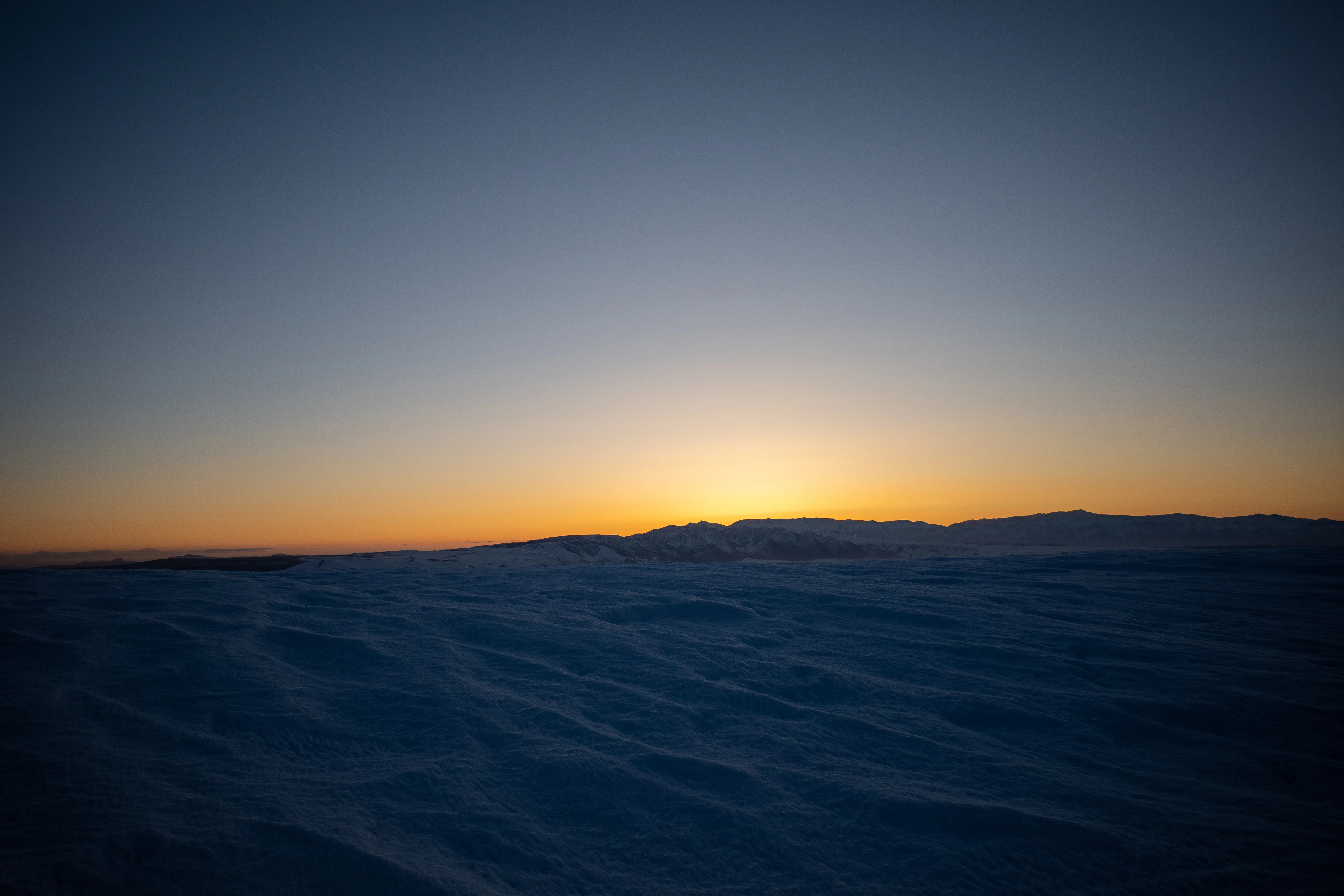
Driving south on the 395 toward the town, the horizon begins to radiate a warm glow. A brilliant orange orb gradually ascends, and though only half-illuminated during its third quarter, it casts striking shadows from the Jeffrey Pine trees.
Our designated drop-off location is Mammoth Main Lodge. In a matter of hours, it will be inundated with visitors from the south; however, for the time being, it is solely occupied by us. We swiftly attach the skins to the skis, double-check all the essential gear, and skillfully dodge a snowcat grooming the flat terrain. Only then do we embark on our journey into the darkness at 4 a.m., precisely as planned.
The route traces Minaret Vista Road, leading to a well-visited summertime overlook of the Ansel Adams Wilderness. Our group settles into a steady rhythm, with one foot consistently gliding past the other, reminiscent of socks on a kitchen floor, as toes pivot around ultralight pin bindings. Deep breath. Slide. Turning off the headlamp, we watch the moon rise above the summit of Mammoth Peak.
Scarcely any time elapses before we pass the gate leading to Devils Postpile, a striking geological curiosity characterized by columnar-jointed basalt formations. These mostly hexagonal pillars were shaped approximately 100,000 years ago, when lava cooled and fractured—a relatively recent occurrence on a grander scale. Rather than descending to Postpile, the route takes a right turn and begins its ascent along the San Joaquin Ridge.
Reside in the Eastern Sierra for an extended period, and the vista of Mount Ritter and Banner Peak becomes a constant, yet it continues to evoke a sense of awe. The unusual abundance of snow this late in the season causes the moonlight to disperse in every direction, magnifying the spectacle. Our group momentarily pauses to absorb the view and settle in to the ridge.
The ridge is infamous for its windy conditions, and due to the Venturi effect, which compresses the air and lowers temperatures, a cold night can become bitterly frigid. This frequently results in the ridge transforming into a sleek ice rink—sufficient reason to carry ski crampons. Fortunately for us, the wind remains tranquil for the time being, as the incline gradually becomes steeper with crampons securely stored.
Approximately two miles into the journey, we find ourselves fully immersed in the experience. However, our focus is momentarily disrupted by something reflecting the moonlight in our peripheral vision, only for it to vanish abruptly. We feel as though we are being watched, and then a pair of eyes materializes. A coyote dashes past us and lingers up ahead, seemingly curious about one aspect or another. It must be hungry, as this winter has been particularly challenging.
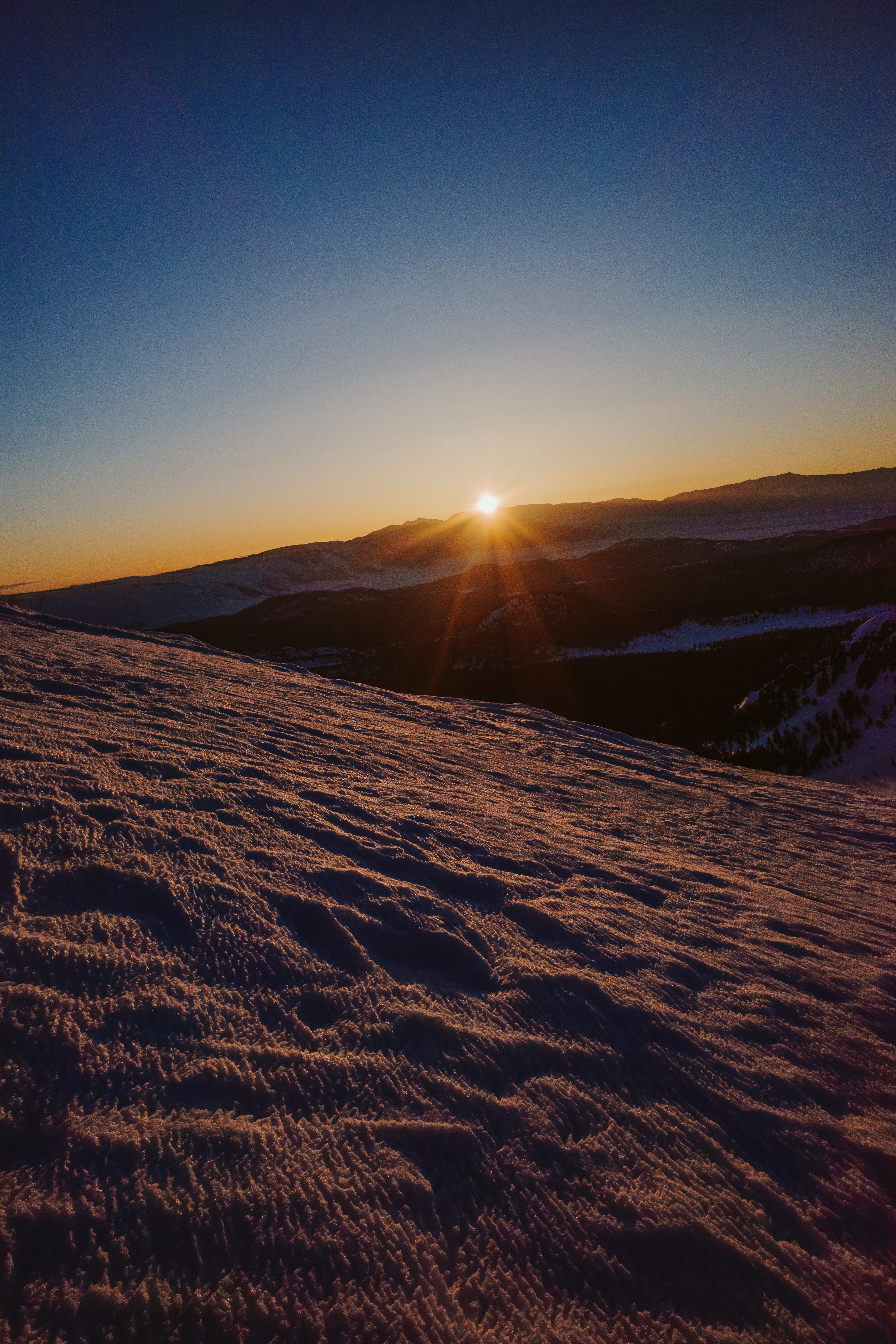
As the ridge grows increasingly exposed, the wind intensifies. The cold sets in, prompting us to grab the mitts. Glancing upward, we notice a faint dot gradually brightening as it steadily moves across the sky, its azimuth passing directly overhead before continuing toward the horizon. “Look, a satellite!” In just a few moments, another one appears, followed by yet another, and then another. An entire procession of Starlink satellites travel at a consistent speed in a perfectly straight line. Observing human intervention on such a planetary scale in this setting creates a truly hyper-real experience.
To the east, above the White Mountains, a faint glow starts to spread across the horizon. This sight is undoubtedly welcome. The silhouette of the coyote appears, maintaining pace with us, most likely eager for a morsel from a Snickers bar.
Up ahead, the ridge dips no more than a few hundred feet to a corniced saddle. Removing skins would be an inconvenience, as there are no turns to be had here. Instead, our group begins side-skinning downhill. After a couple minutes, Nick pivots and straight-lines it down the remaining half! I have never seen anyone move downhill fast on skins! The flat dawn light conceals the wind-sculpted sastrugi at the base of the saddle, causing Nick to go flying, toes locked and all. With broken glasses, blood, and a grin on his face, we are all slightly stunned and laughing.
Speed record? Likely!
The day’s first direct sunlight illuminates Ritter and Banner in the distance, then the ridge ahead as it continues its ascent. The temperature rises a few degrees, prompting the group to pause and take in the view, warmth, a few sips of water, and a snack. Nick seizes the opportunity to insert the remnants of his glasses into his goggles to keep everything intact. Meanwhile, Agnew Pass, situated to the east, gradually fills with sunlight.
When attempting to describe these moments, I find myself reaching for phrases like “unreal” or “another planet.” It’s ironic, considering they are often the most real and entirely unique to our home planet.
This ridge was once slated to become part of a mega-resort, connecting the Mammoth and June ski areas with a series of nearly 20 lifts. These plans were discussed for decades, until Congress designated the area as the Owens River Headwaters Wilderness under the Omnibus Public Land Management Act of 2009—a decision I’m grateful of. It’s a reminder of the interconnectedness of things. This drainage system, feeding the same Owens water supply that has long provided Los Angeles with water.
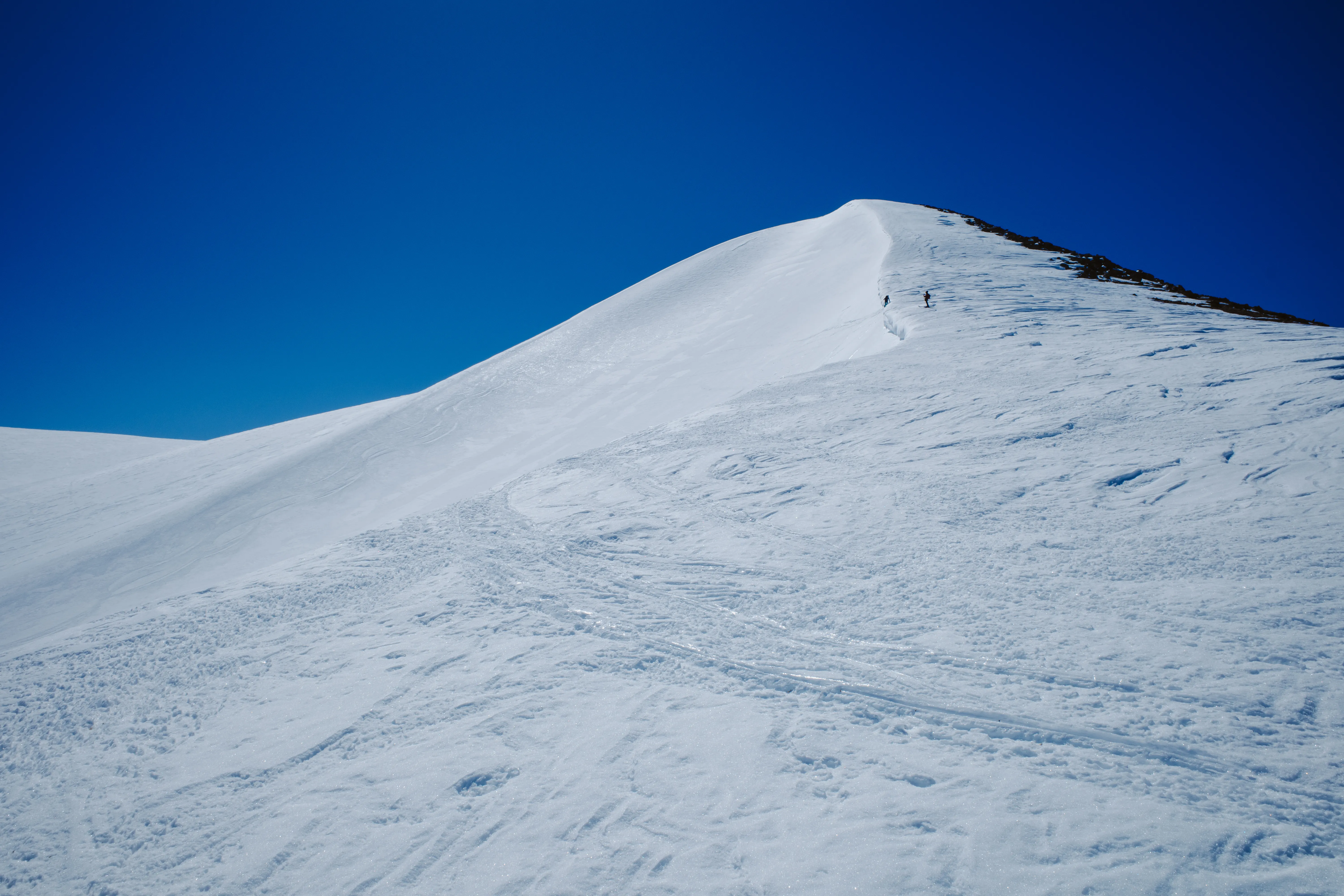
As we reach the top of the climb, our first view of “Two Teats” comes into focus. It’s easy to guess the general area referred to here. Yeah—we intend to navigate right between them. When looking back at the distance covered, it’s evident we’ve made good progress. We’re now more than halfway there.
Over the past week, there has been significant solar activity, as springtime tries breaking through. Bald patches of ground appear on the climb ahead, and surprisingly, for a moment, an actual dirt trail becomes visible—the first of the season. But for now, it’s very much still winter. As the incline steepens and the snow hardens, the ski crampons come on, just incase.
It ends up being mild, and before long the planks come off and the group starts booting up gravel. This provides a pleasant change of pace after months of sliding around.
Upon reaching the saddle between The Teats, our first view of San Joaquin Peak comes into sight. The sunlight, now noticeably stronger, gently invites us to take a break in this sheltered alcove, and we are eager to oblige.
With feet propped up, the group discusses various exit strategies. Numerous routes lie ahead, and given the cold temperatures and stable snow, we decide to pursue a more ambitious option.
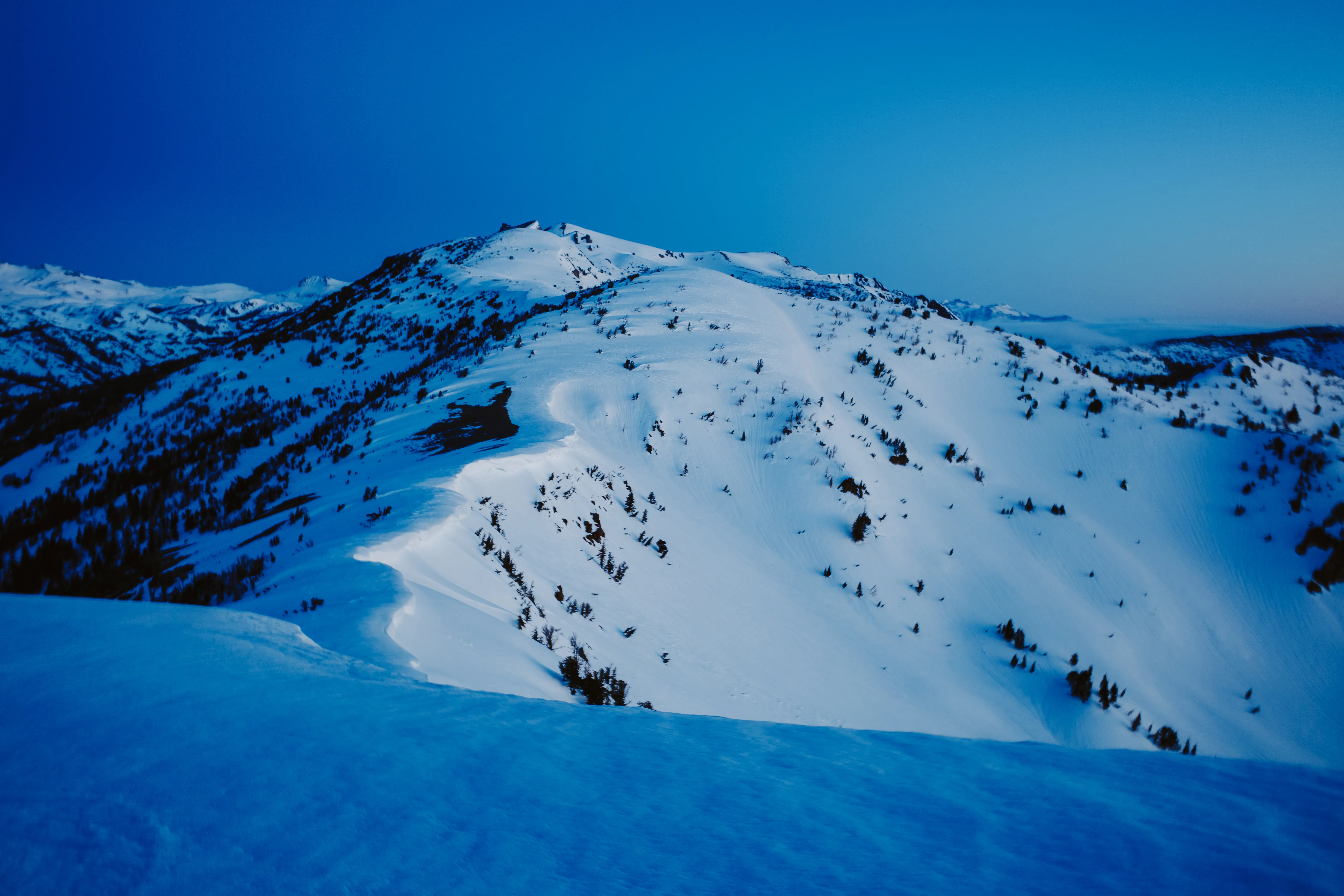
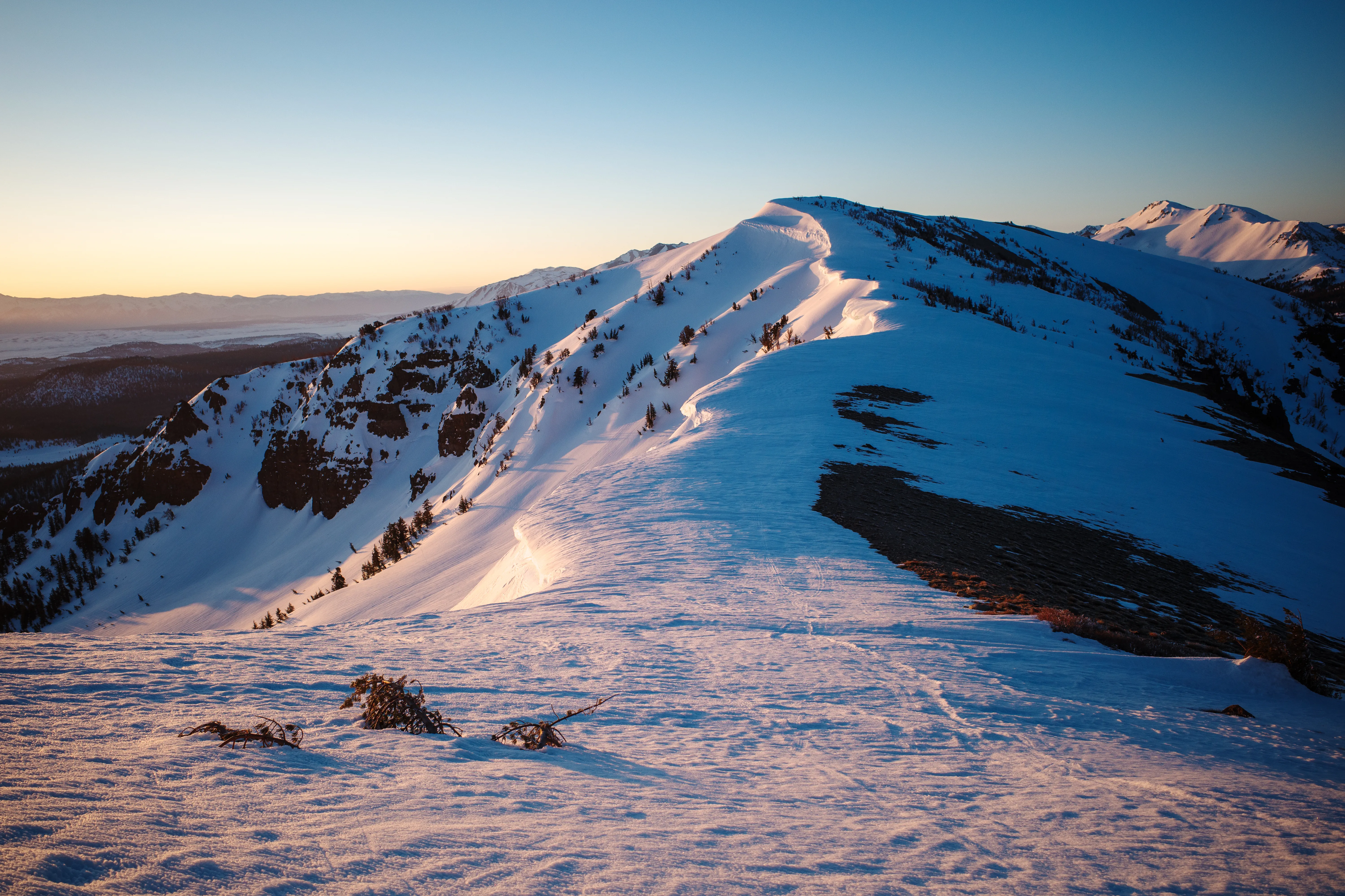
As you drive into June Lake along the 158, your gaze is immediately drawn to Carson Peak and settles directly on its north face, featuring a perfectly carved bowl—the very bowl we decide to ski. Having been a primary objective since moving to June, I am incredibly eager to drop in.
As we descend from The Teats, looking back reveals an impressive headwall. There are countless potential routes, and everyone agrees to return at a future date for further exploration. The final ascent to the summit begins, with some members of the group choosing to hike, while I decide to practice my kick-turns.
In no time, the summit is reached. This is my third visit within the past few weeks, and the view never loses its charm. We take it all in. With no real rush, we slowly remove our skins, transitioning between relaxation and preparation for a brief downhill traverse to Carson.
As the group traverses a bowl beneath San Joaquin, we ascend and cross a cornice to follow its lip toward a plateau leading to Carson. During the summer, I jogged along this same route towards Spooky Meadow after a big climb to the summit via Fern drainage. I remember thinking “whoa nelly” and imagining how incredible it would be to glide through here on skis. What took me 30 minutes to jog now takes only minutes to slide across. Winter travel has its perks.
Sufficient uphill terrain between our current location and the drop for Carson’s north bowl warrants skinning up. A large white hare darts across the alpine tundra—an incredible sight! This ascent feels more like a leisurely cruise, with the mind drifting on the gentle breeze.
Upon reaching the top of the bowl, a perfectly symmetrical view of the June Lake Loop emerges, with Carson dividing the two halves. “Wow… Wow…” From this vantage point, it’s impossible to see beyond the rollover and fully observe a route down the bowl. The snow is surprisingly firm, probably due to the strong wind from the previous evening and the subsequent low temperatures. Consequently, the group boots around, examining the area.
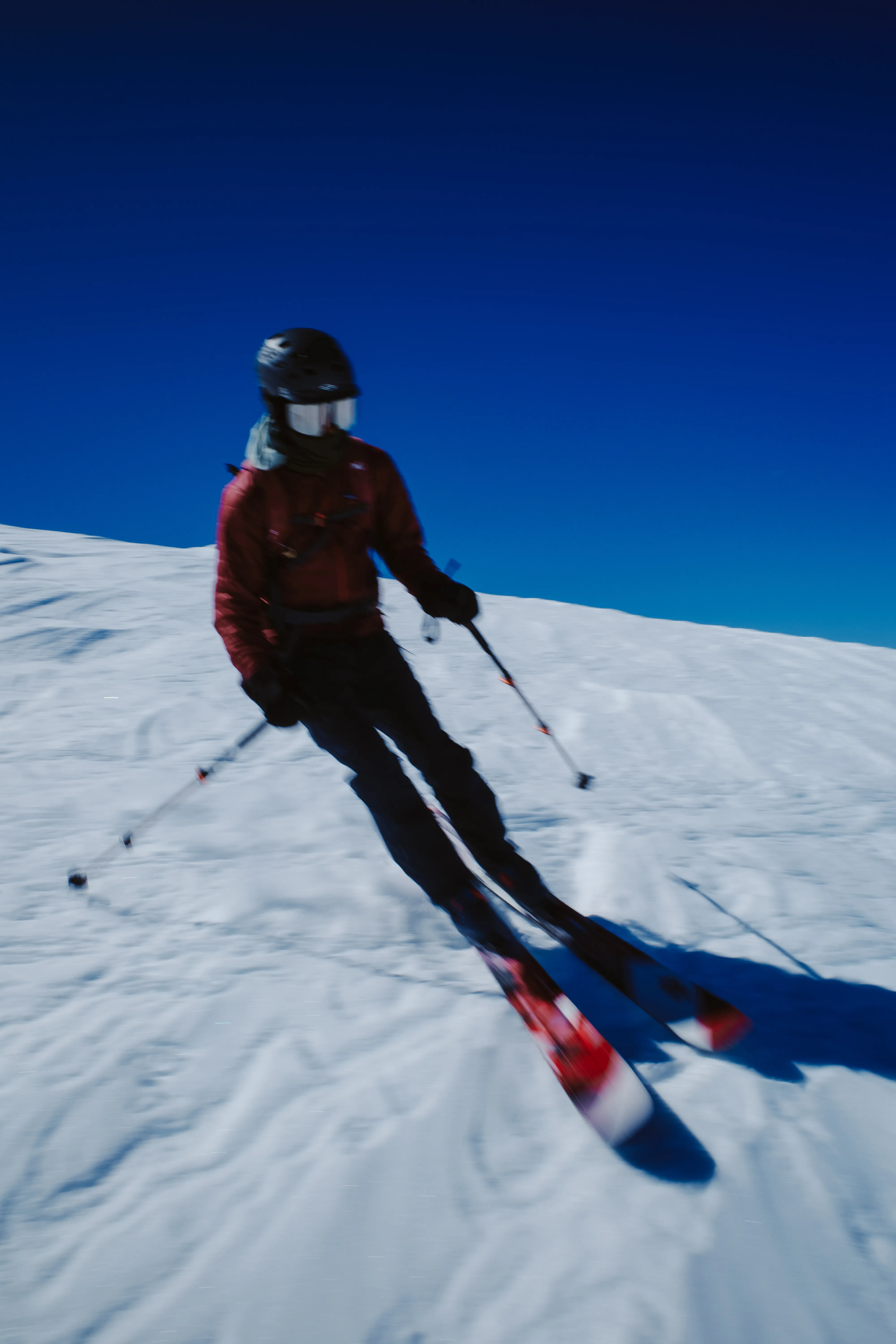
We agree to drop towards the right side of the bowl. After chatting with a friend who skied the line last week, we know that the exit is through some trees on the right. The bottom of the bowl cliffs out, and the firm snow means that falling is risky. Our plan is to link up with Devil’s Slide—a feature so filled in during this record snow year that it’s like a halfpipe with a 2000 foot descent.
After waiting for the better part of half an hour, it becomes apparent that the snow is not softening beyond its present condition. Nevertheless, it is edge-able, and we decide to drop.
Despite the firm conditions, skiing down the bowl is too good to pass up. Being here, skiing a line I’ve stared at so many times, fills me with immense joy and pride, even though it may not be the biggest or most exceptional by any metrics. “Here I am!”
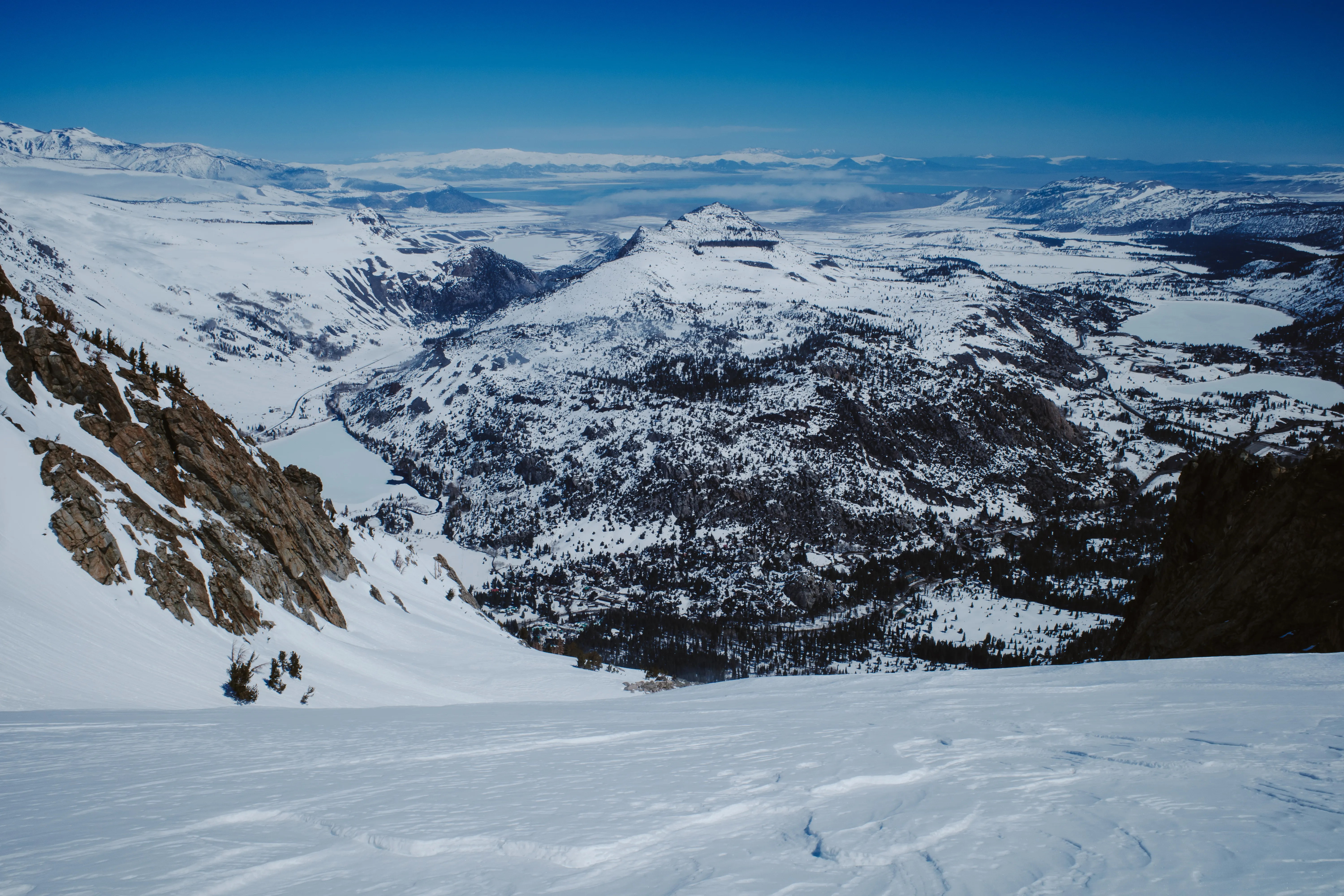
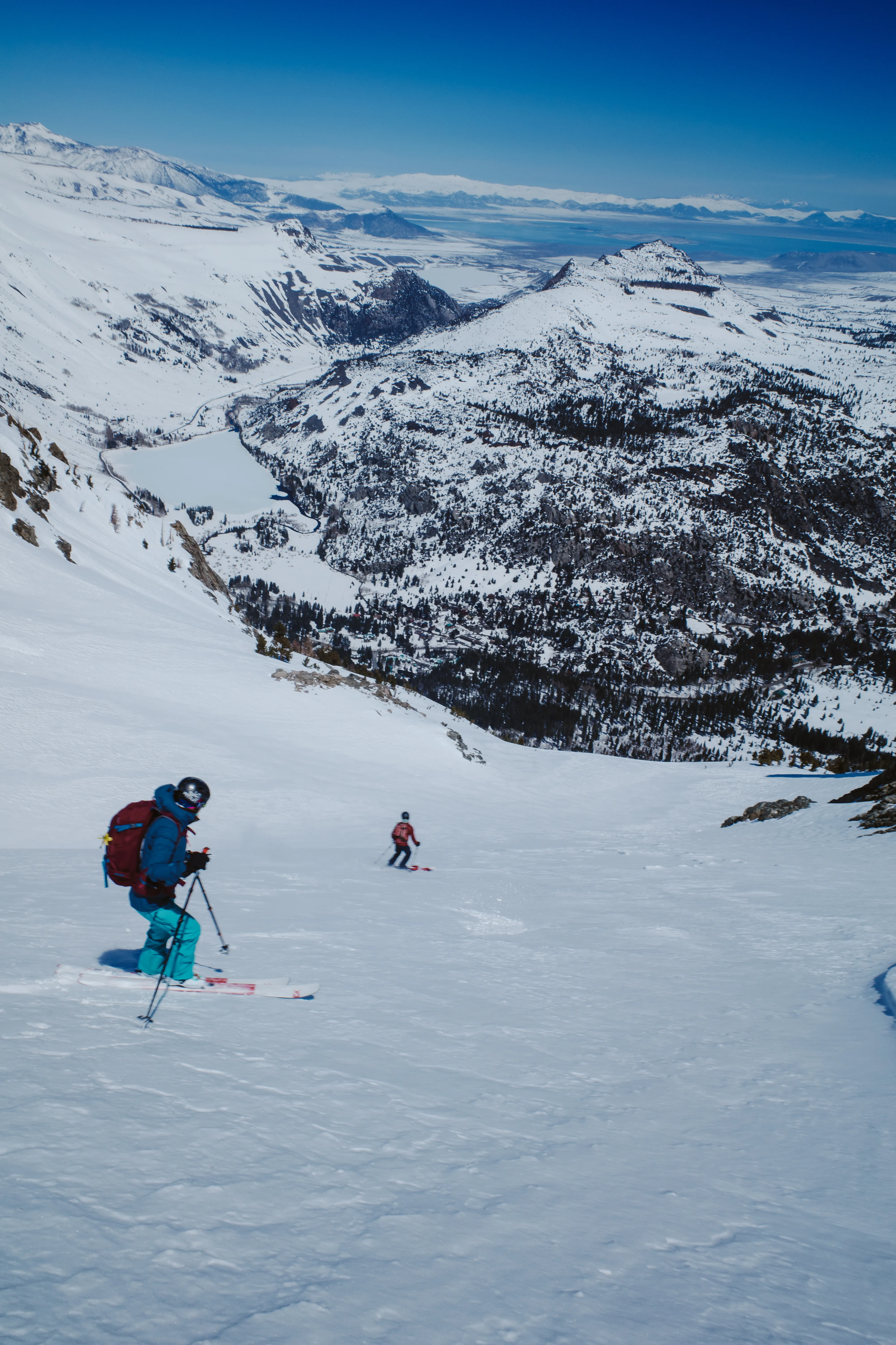
After reaching the bottom of the bowl and above the cliff exposure, we begin our traverse through the trees towards Fern Lake. We make a few corrections along the way since the group is initially higher than necessary, but before long we pick our way through the trees and rocks to arrive at the top of Devil’s Slide.
Skiing down the slide has become almost routine for me, as this is my third time here in the past few weeks. Still, the descent never gets old. The heat of the past few days has deposited debris from several loose wet slides throughout the descent that have now firmed up and made for somewhat technical skiing. Nevertheless, we ski with all smiles the entire way down.
Reaching the runout, the group ducks into a notch in the trees and zips the flats towards my car, having staged it there several hours earlier. A series of creeks run through this zone, and the snow bridges that existed only days earlier have now collapsed. We carefully pick our way up and over a berm for a brief walk back to the car.
It was a personally monumental day, and completing the long standing objective was satisfying. I have a sierra-sized amount of gratitude to Nick and Kim for letting me link up for the tour.
In the eastern Sierra, the places are second only to the people.
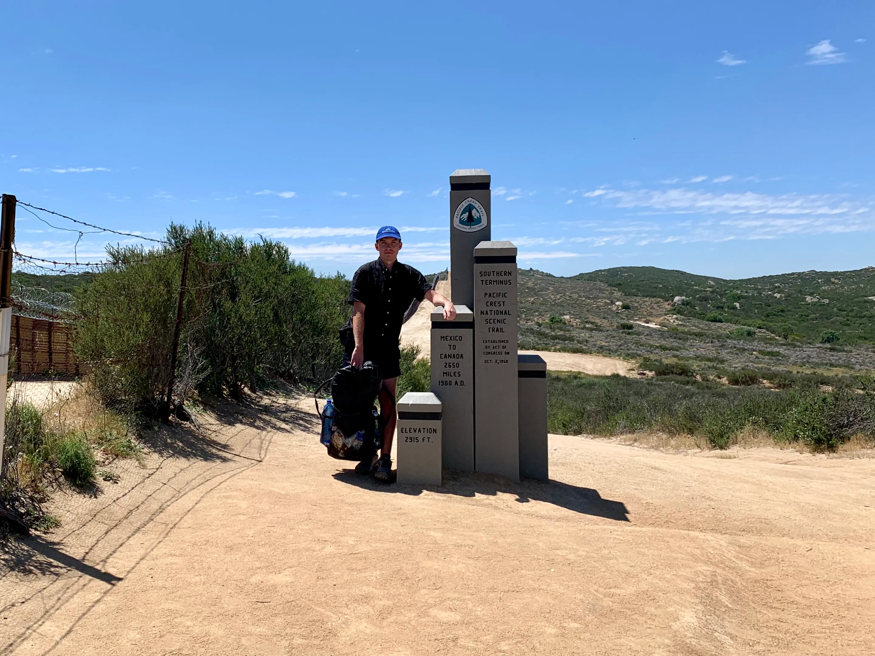
Mexico to Canada on foot. Roughly 2,650 miles, five months walking north: out of the desert, up over the high Sierra, down through Oregon and on into the Cascades. Wake, walk, eat, sleep, repeat. The trail narrows the whole day down to a single task, then a single step, and you keep taking it until there’s no more north left to walk.